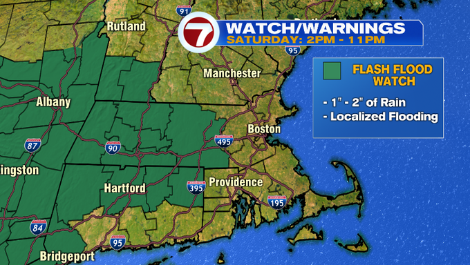
A Flash Flood Watch has been issued from 2PM to 11PM Saturday for areas west of 495, where 1 – 2″ of rainfall is possible with locally higher amounts where thunderstorms develop.
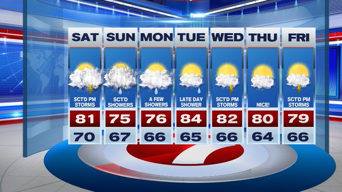
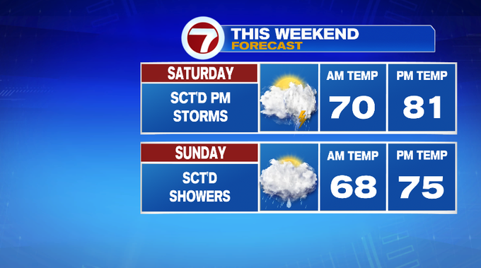
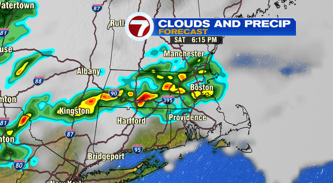
We started off our Saturday morning under a mix of sun and clouds and spotty showers. We will see a lull in the action on the radar into the early afternoon before the next round of scattered thunderstorms move in later this afternoon (closer to dinner time) and continues through tonight.
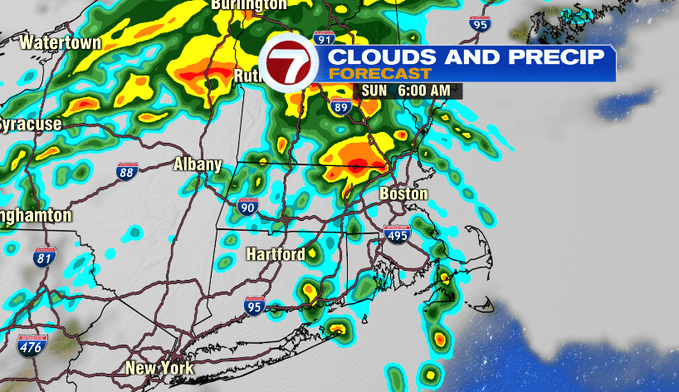
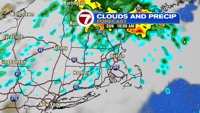
Scattered showers are still in the forecast for Sunday especially for central MA and southern NH. SE MA and the Cape and Islands will see a few showers early Sunday morning, otherwise lower rainfall totals are expected there.
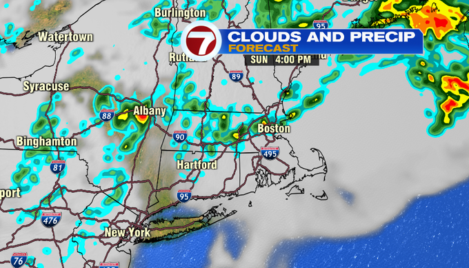
A few lingering showers associated with the system that is throwing the shower/storm threat at us this weekend are possible for Monday (mainly in the morning).
Tuesday is mainly dry with a late day shower chance. Wednesday brings scattered afternoon thunderstorms followed by a dry day Thursday.
Friday ends the week with another round of scattered afternoon thunderstorms.