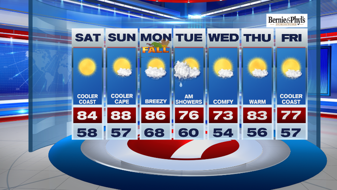
After a few days of fall-like temperatures, summery warmth has emerged for the last full weekend of summer. Fall officially begins on Monday morning at 3:50AM, so we have to enjoy the last bits of the summer season while we all can, right?
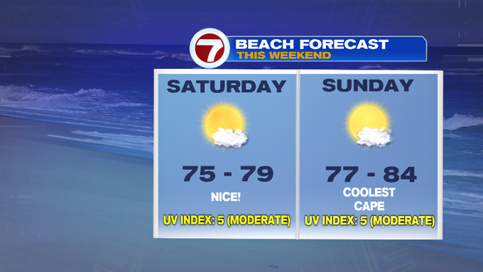
Thankfully, Mother Nature is on our side this weekend with highs stretching into the low 80s today, mid to upper 80s Sunday, 70s along the Cape and the Islands due to a southwesterly breeze by Sunday afternoon.

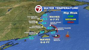
After noticing a weekend warm-up, you may be flocking to the local beaches. It will be a glorious beach day to dip your toes in the sand, but the rip current risk is high this afternoon for the Cape and Nantucket, moderate for the rest of the coast.

If you’re already ready for fall, it will still be a beautiful day for apple and/or pumpkin picking.

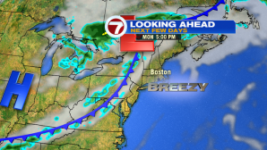
It’s still warm on Monday with highs into the mid 80s, but we do have an approaching cold front Monday evening. Ahead of this front, expect winds to pick up out of the southwest. Shower chances return Monday evening and continue into the overnight hours.

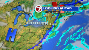
A few lingering showers are possible into early Tuesday, otherwise drier, comfortable and seasonable conditions return Tuesday and Wednesday, with highs into the low to mid 70s.
The rest of the week is quiet with highs around 80.
We’re still keeping an eye on the tropics. The remnants of Humberto is what is bringing us the dangerous rip currents at the local beaches today. Tropical Storm Jerry is passing well north of Puerto Rico and will continue to move northward and out to sea through the start of the next work week.

It is forecasted to gave strength as it passes over Bermuda late Tuesday into early Wednesday. Otherwise, the local impacts here are large breaking waves and rip currents along the coastal waters.