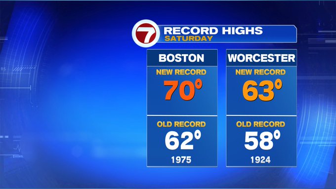
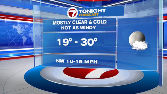
With temperatures well into the 60s to kick off our Sunday, we’ve already shattered the record high temperature for Boston and Worcester. This incredible and impressive warm-up for January will be on it’s way out as early as this evening as the winter chill returns tonight.
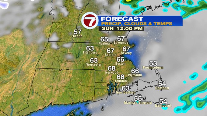
As for your forecast for your Sunday outdoor plans, temperatures topping out in the upper 60s (maybe a few spots reach 70 like yesterday) by midday under mainly sun-filled skies. Yes, we started off with rain showers, but these rain showers will depart by late morning (as early as 11am) along with most of the cloud cover.
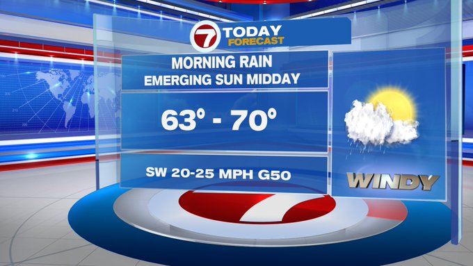
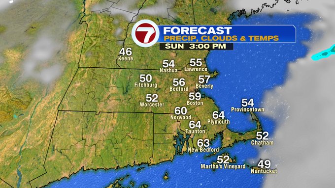
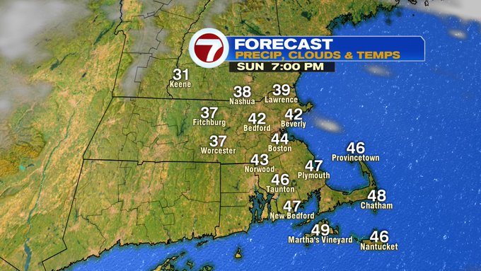
Later this afternoon, temperatures will start to slip back into the upper 50s as early as 3pm, 40s around sunset, and then tumbling through the overnight under mostly clear skies.
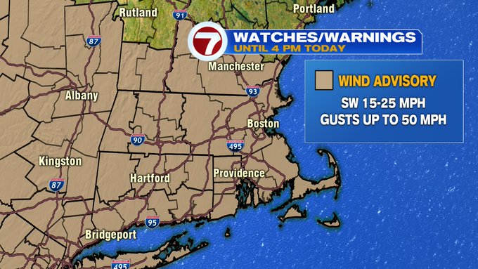
The good news is that the wind will start to diminish later this evening. A Wind Advisory remains in effect through 4PM this afternoon for gusts up to 50 MPH.

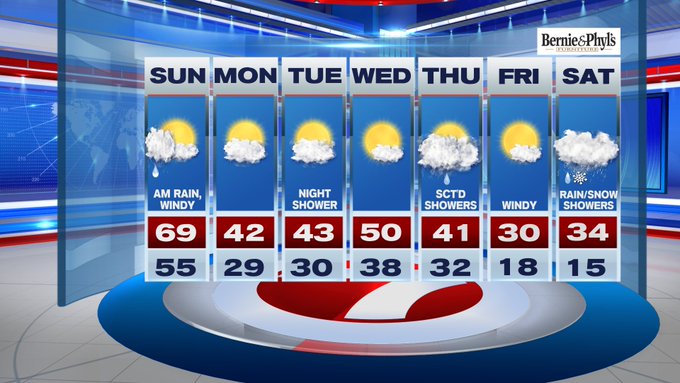
Temperatures Monday morning start off around 20° for the higher elevations, central MA and areas north and west, to around 30° at the coast.
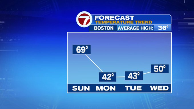
With high temperatures Monday afternoon only rebound into the upper 30s to low 40s under partly to mostly cloudy skies.

Tuesday will be similar to Monday with increasing cloud cover and highs into the low 40s. There is a chance for a few showers in the evening.
Back to 50° Wednesday before temperatures plummet for the end of the week.
Highs on Friday, below the freezing mark with gusty winds. Meanwhile, next weekend brings a chance for a wintry mix to snow showers Saturday, so we will certainly keep an eye on that system as we get closer.