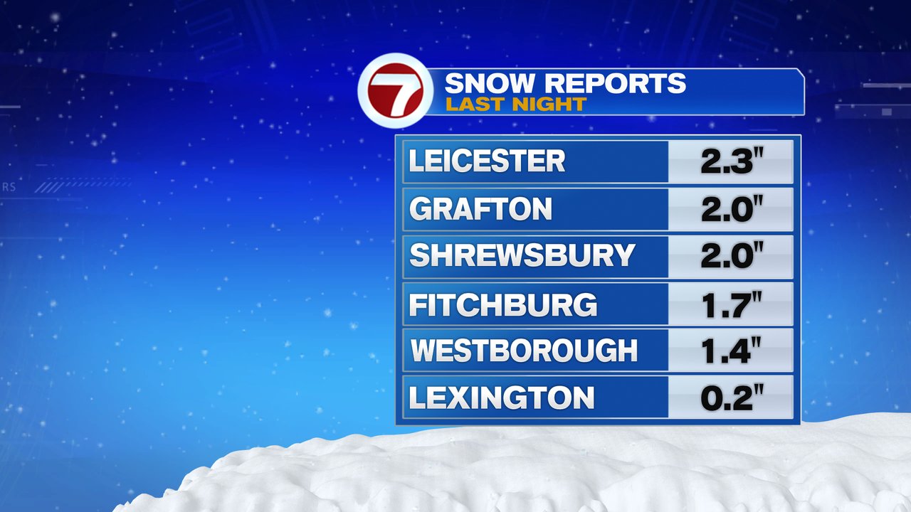
The first flakes of the season flew last night as inland locations, near and northwest of 495, manage to pick up an inch or two of some wet snow!
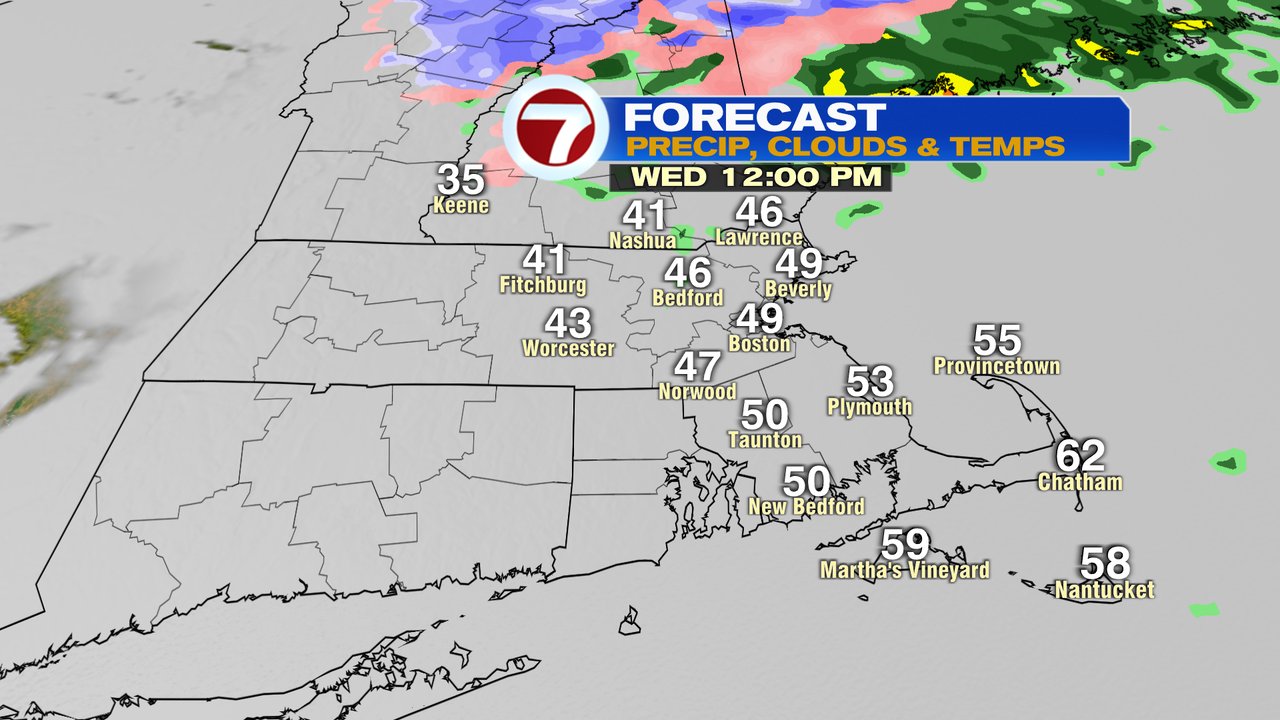
The snow did change over to rain overnight, and any snow on the patio furniture, cars, or grass, is now waterlogged and melting down quickly. Temps have risen above freezing for much of the region, in fact, we’re near 50 across coastal Mass.
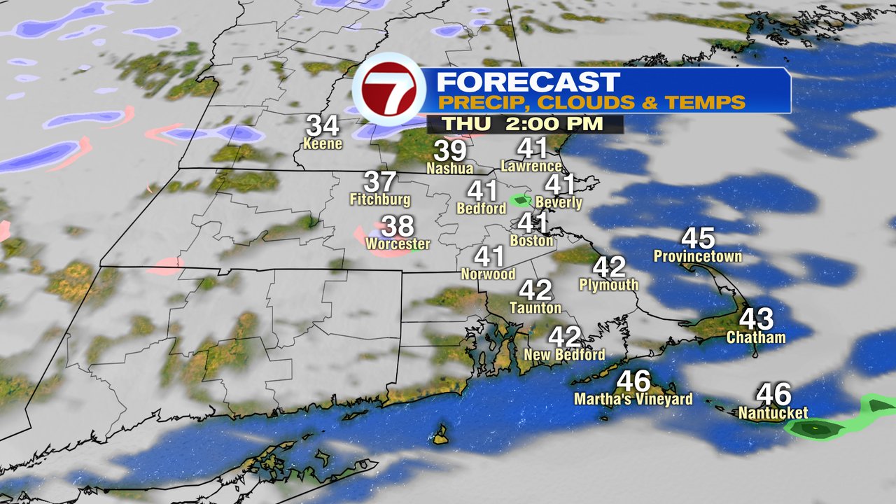
The temps will max out midday in the low to mid 50s near Boston, near 40 in the Worcester Hills and in the low 60s across the Cape… quite mild there. Rain and drizzle tapers off midday with some breaks in the overcast late in the day as we dry out for the evening commute.

Chilly air returns for the rest of the week and through the weekend with a spot flurry or sprinkle possible tomorrow and again Sunday.