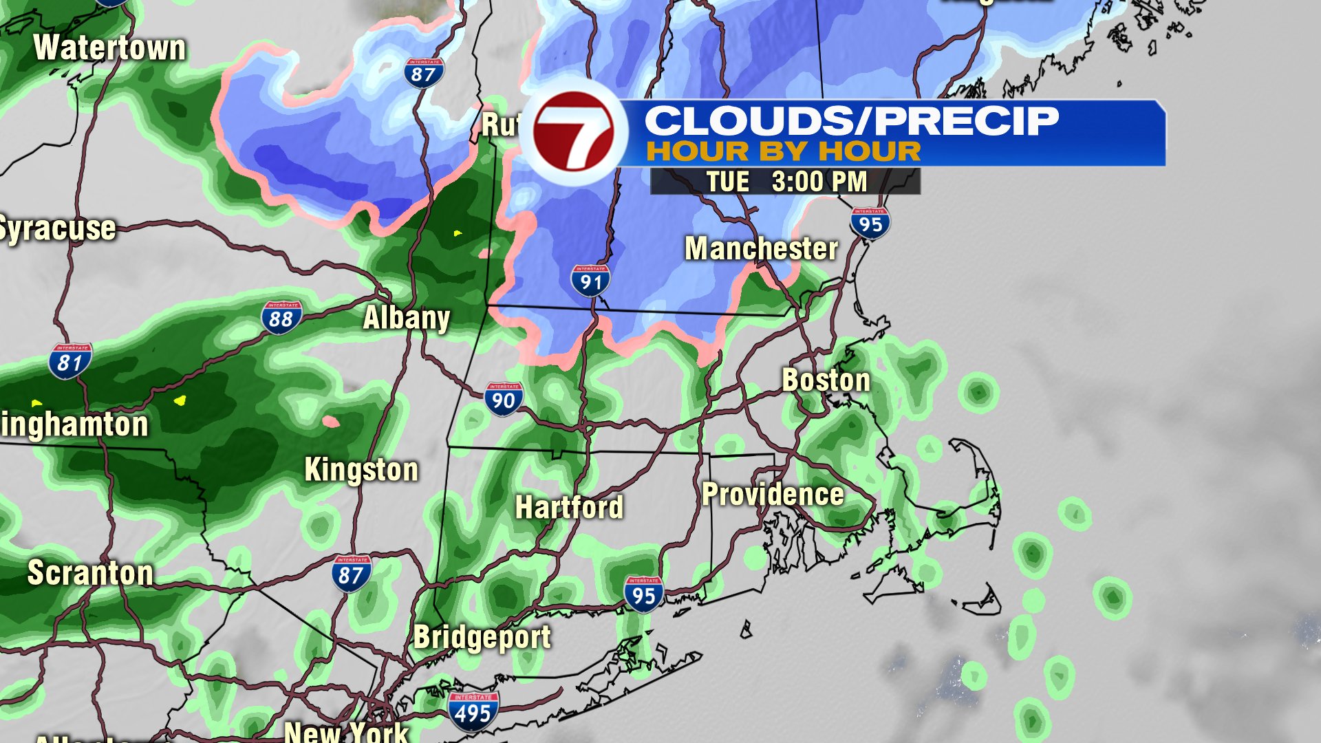
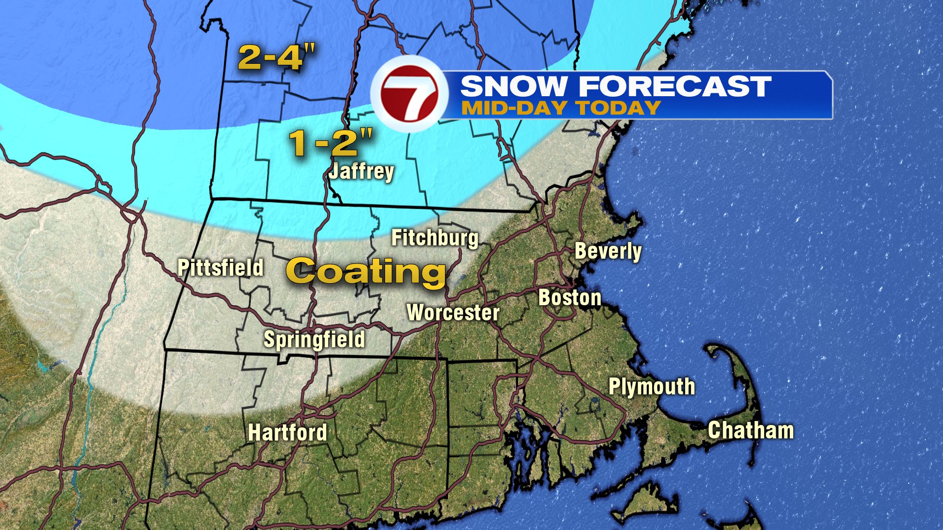
After a beauty of a day yesterday, we’re back to tracking some wet weather as showers arrive early this afternoon and continue through the evening commute. Initially, it’s cold enough that across southern New Hampshire and northern Worcester County, we’ll start off with some wet snow. However, even there, that snow goes to rain as wet weather settles in for many for the evening commute.

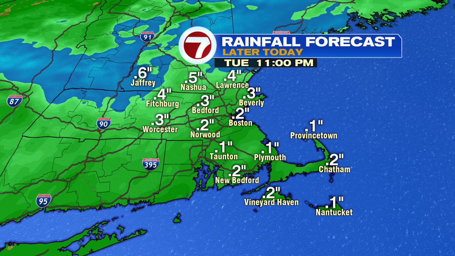
Rain wraps up late this evening with rain totals running around a quarter of an inch. A bit less to the south, a bit more to the north.
Temps tomorrow stay near 40 degrees for a high, seasonable for the time of year, but the wind starts to crank, gusting 30-40mph. That wind is followed by a shot of cold air for Thursday and Friday before temps moderate to near 45 Saturday and close to 50 Sunday.


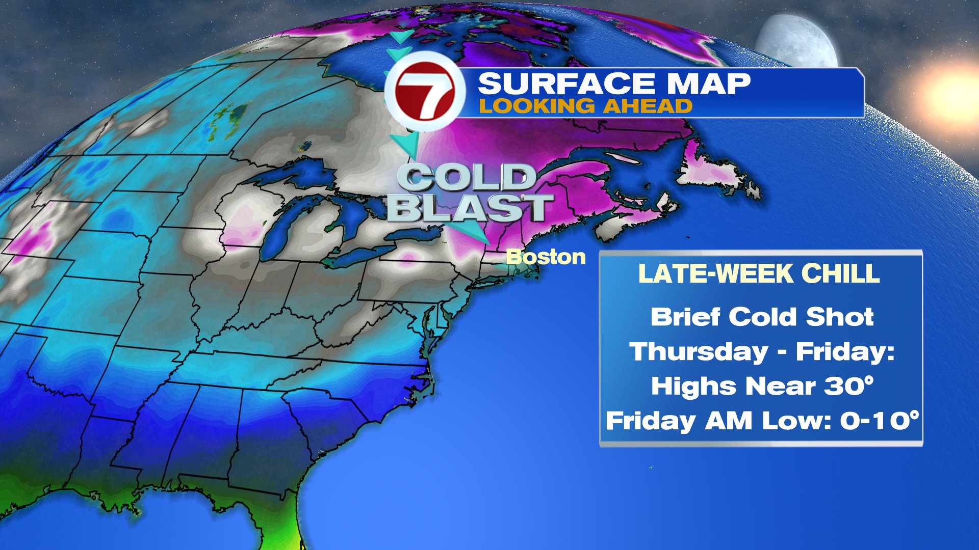
Plenty of snow is across northern New England, so ski conditions hold up well this school vacation week. It’ll turn cold and windy tomorrow, but the wind lessens by Thursday and the cold starts to ease heading into the weekend. Locally, good snow making weather kicks back in Wednesday night – Saturday morning.
