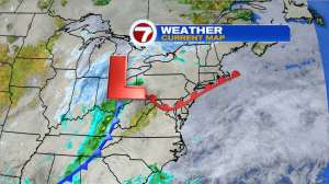
We’ve been on a rather tranquil stretch of late and overall that pattern rolls on but we do have about 5-6 hours of some wet-n-wild weather late tonight and early Thursday morning. On the surface map tonight we see Low Pressure out near Pittsburgh…
…and once again, this storm has no cold air to play with…
So that takes the winter component out of this storm. Sorry snow lovers…

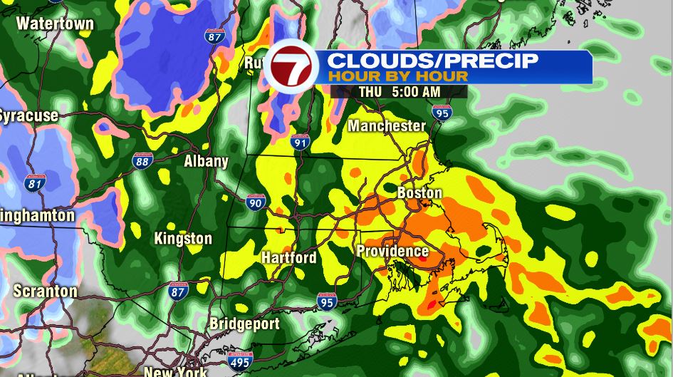
..maybe next winter. That means we track raindrops for your Thursday morning commute. Unfortunately, the heaviest rain falls during the entire commute. Check out the future radar at 5am…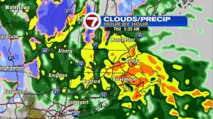
….good luck using Waze to get around that!! Thankfully, we get out of the soaking rains by mid to late morning. Future radar should appear like this around 10am Thursday…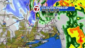
Rain out! Sunshine in! That storm will be a wind-maker for a few days as it parks itself to our north early tomorrow afternoon…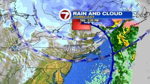
Wind will be an issue along the North Shore Thursday morning, gusting over 40mph from 4-9am out of the southeast….and then for everyone for the remainder of the day between 25-40mph from the southwest.
At first, that wind is not cold but with time the wind will drag colder air into southern New England for Friday and the upcoming weekend.
The last two days of meteorological winter will be colder than normal…especially Saturday the 29th. Speaking of, know why we have leap year? The Earth travels around the sun every 365 days (Happy New Year!)..well technically, it’s 365.24 days….and every 4 years that 0.24 days adds up to a day….hence..the extra day added onto the calendar!

Have a great Thursday !
~JR