I think I used the same title just a few weeks ago, so today’s blog is “Reprise” or Part 2.
Another beauty out there today coming off of a fantastic weekend! Temperatures over the weekend near 60 degrees in Boston and even warmer away from the coastline.
Same story today. Temperatures soared into the 60s inland with full on sunshine. Coastline towns held into the 50s but even that is above average and with the bright blue skies hard to find a complaint today.
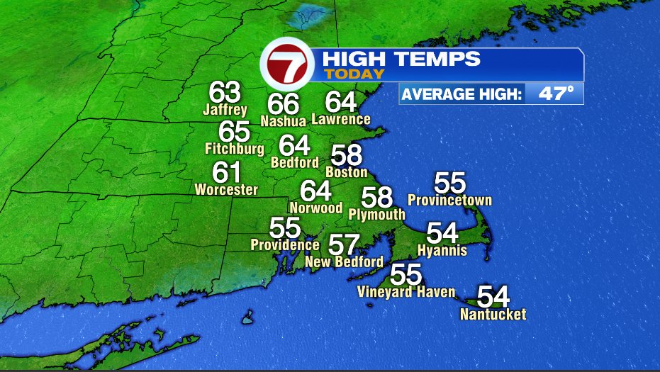
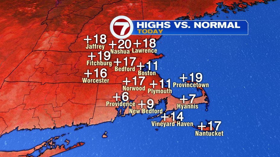
Highs today across the region climbing somewhere 10 to 20 degrees above average!
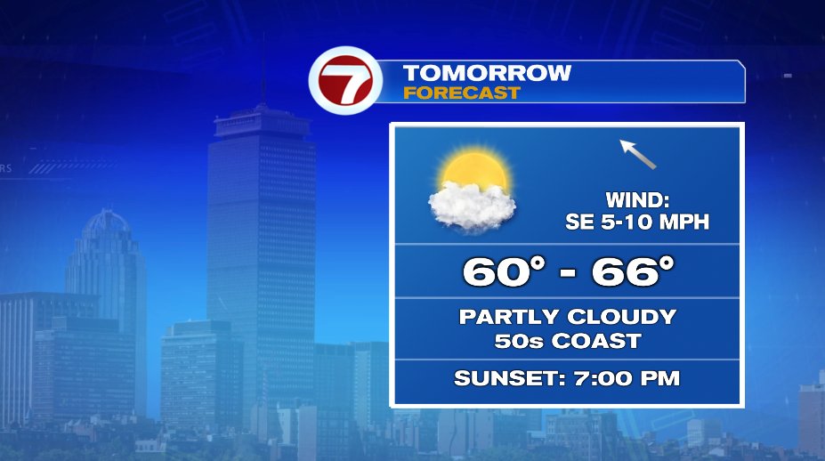
And we’ll do it again tomorrow! Also of note, tomorrow is Boston’s first 7pm sunset since September 11th of 2020!
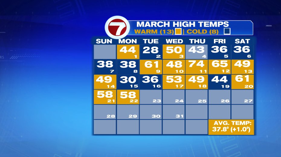
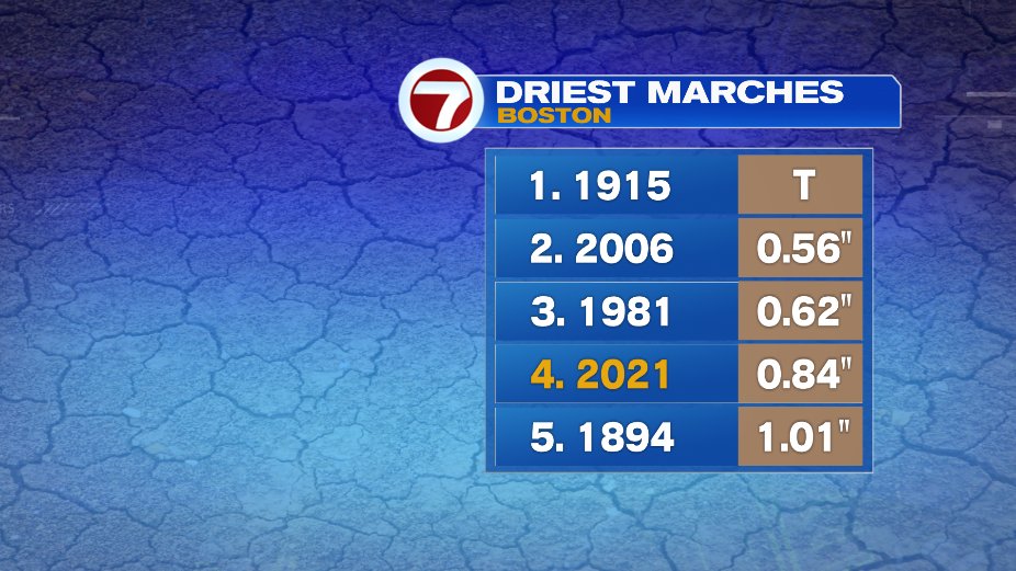
So we haven’t been lacking in the sun and warmth department lately but we sure have been lacking in the rain department. The rain we’ve picked up so far this month has us placed 4th in driest Marches on record for Boston. Granted we still have a week or more left in the month, but still… it’s been dry.
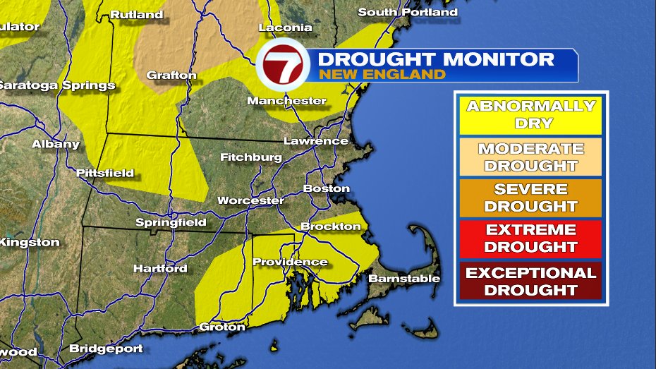
The drought monitor shows that as well. Pockets of abnormally dry conditions are starting to pop up in New England. One thing to note is it takes some time to pull data together, analyze, and release a map so this does not include the inch of rain many of us had last week Thursday.
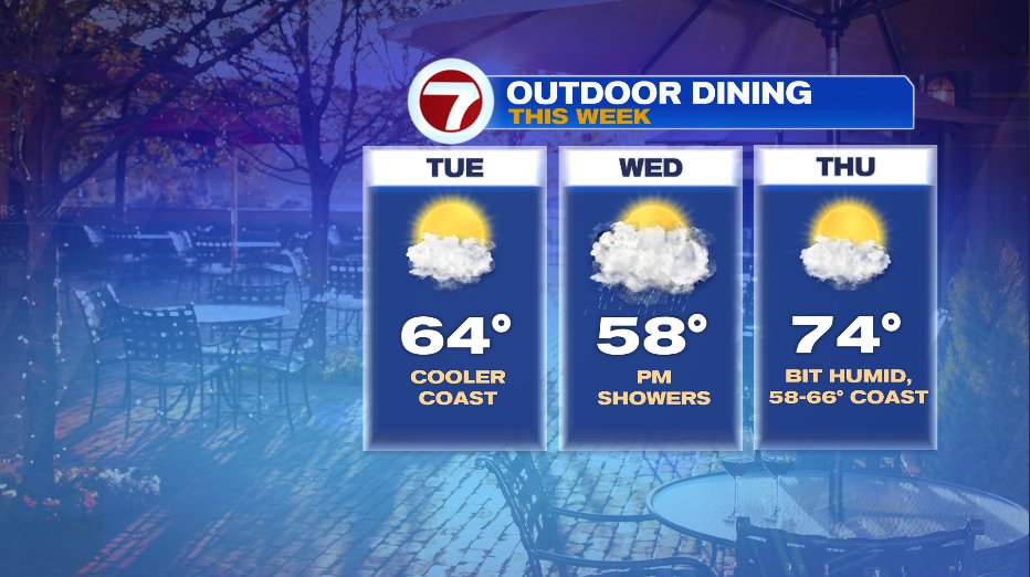
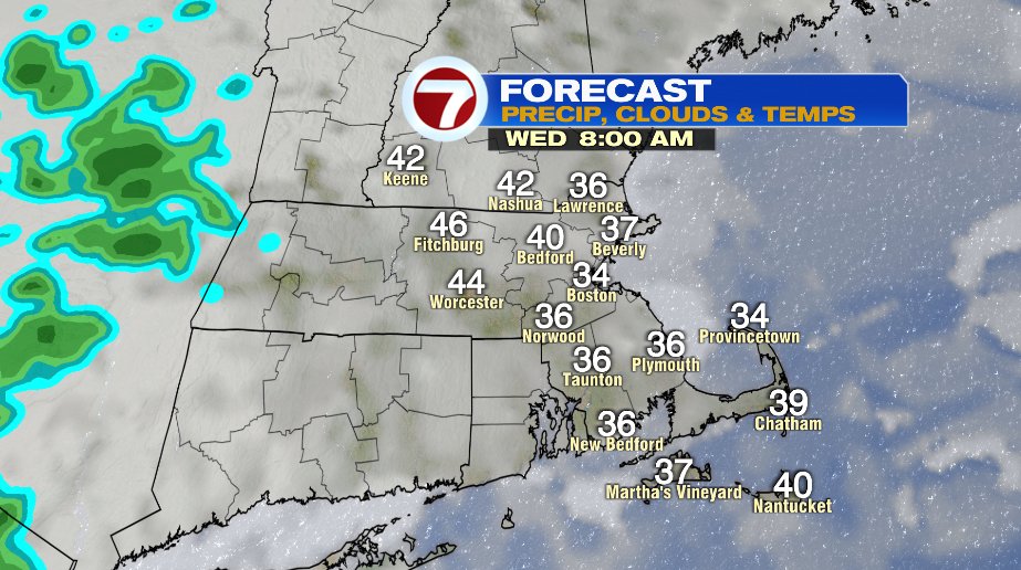
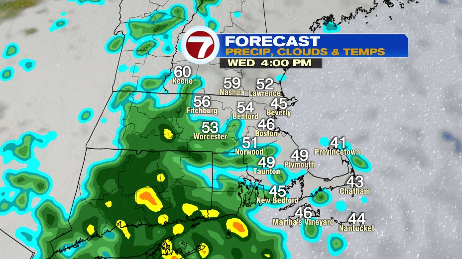
But we can still use more. And there’s more on the way. Wednesday will bring us showers in the afternoon and evening.
And of course outdoor dining begins this week so the weather is perfect for that. Aside from the Wednesday afternoon showers, Tuesday and Thursday will be great days to eat outside! In fact Thursday inland spots will soar to the 70s, 60s on the coastline…. and you may even notice a hint of humidity. It won’t be a humid day by summer standards but coming off of winter’s dryness you may notice it creeping back in on Thursday.