We all woke up to a winter wonderland this morning, and a SNOW DAY for the kids – seeing as how the snow fell on a Saturday. Finally, some better timing for a visit from Old Man Winter. Hopefully you were able to enjoy the snow, rather than cursing it as you were trudging through the traffic to do some “week before” shopping. Snow totals were generally between 3-6″, with a few reports closer to 7″ in northern Worcester County. Worcester picked up 6″ and Boston picked up 4.3″. And there were happy kids and pets all across the land!
https://twitter.com/ProfCj/status/810232310754922496
Now that the snow is done, we watch for ice this evening. The cold is hanging on along the I-95 corridor and points N & W. 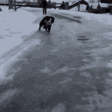
Into the wee hours of Sunday, temps will climb; upper 30s, 40s, even into the 50s tomorrow. These numbers are probably a bit aggressive, but you get the idea; we’re in for rain, rather than snow for Sunday as most of us top out in the 50s around mid-day.

Unfortunately, it’s not a balmy winter day that we can enjoy – as we’re in for wet weather. Note: that’s WET weather we’re in for, rather than WHITE. This is mild rain and even a breeze that moves through for Sunday – and the warmest it’s been since the first two days of December. Into tomorrow afternoon though, temperatures go back down… and by early evening (Sunday) we’re back below freezing N & W of Boston… which means whatever is still wet, in a puddle, slushy, etc. will FREEZE overnight Sunday into Monday morning. While Monday is a DRY day, lows will be in the teens and highs will be in the 20s. Both Monday commutes have the potential to be icy. Please use caution!
We stay dry through the first half of the week and we wait until Thursday for another round of precip. Again though, this looks more likely to happen in the evening/overnight hours Thursday and will likely be rain, rather than snow. We’ll keep an eye on it. The other BIG QUESTION that everyone is asking: “Are we in for a white Christmas?” My answer is “not likely.” It appears that temps next weekend will be too mild for any snow – but we may be in for some Christmas rain. Again, stay tuned.