Seasonable cold and sunny again today with temps running near 40. Tomorrow, we’ll increase the clouds in the afternoon with temps in the 40s. We’ll stay dry during the daylight hours, so both today and tomorrow look good to get some holiday errands done. That changes by Friday.
Tomorrow night, any brief mix inland turns to rain, and that rain becomes widespread overnight as temperatures start to go up. Winds increase by Friday morning too as a very stormy day begins.
As a powerhouse storm bombs out across the Great Lakes, blizzard conditions will halt travel out there. For us, we’re on the warmer side of the storm, but with that area of low pressure to our west becoming very strong, it’ll help drive a very strong southerly wind up the East Coast, into Southern New England. Temps surge to 50-60 on that southerly wind, but that wind will be powerful Friday, gusting 45-65mph, strongest at the coast.
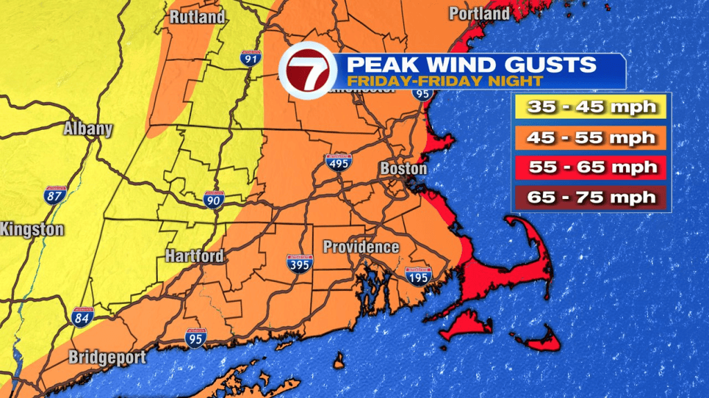
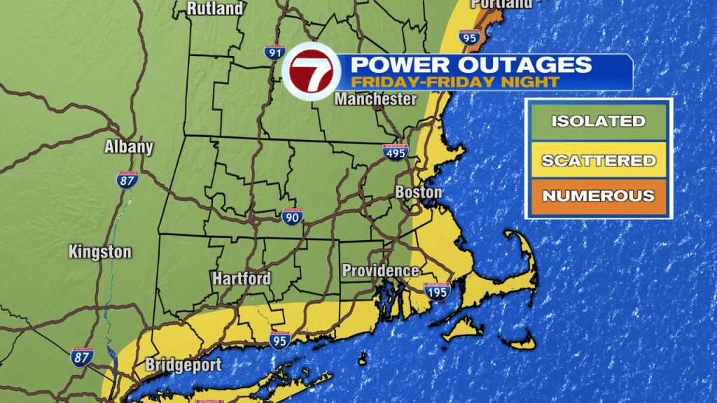
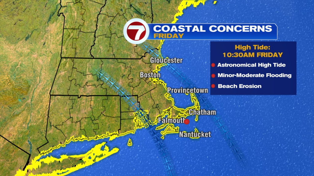
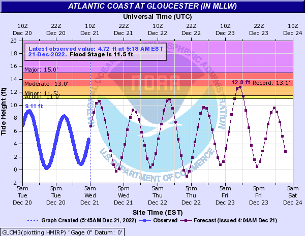
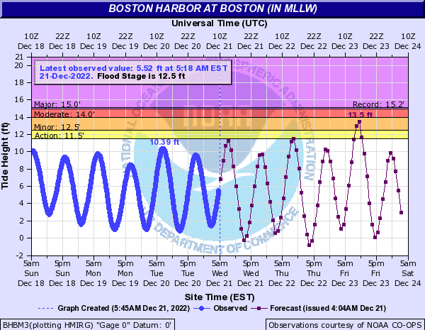
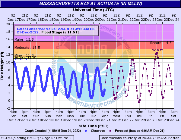
At that level, isolated to scattered power outages are possible. In addition, the Friday morning high tide around 10:30am is astronomically very high, so minor to pockets of moderate coastal flooding is possible, especially along south to southeast facing coastal communities like the North Shore to Gloucester Harbor. Expect 1-2″ of rain as well.
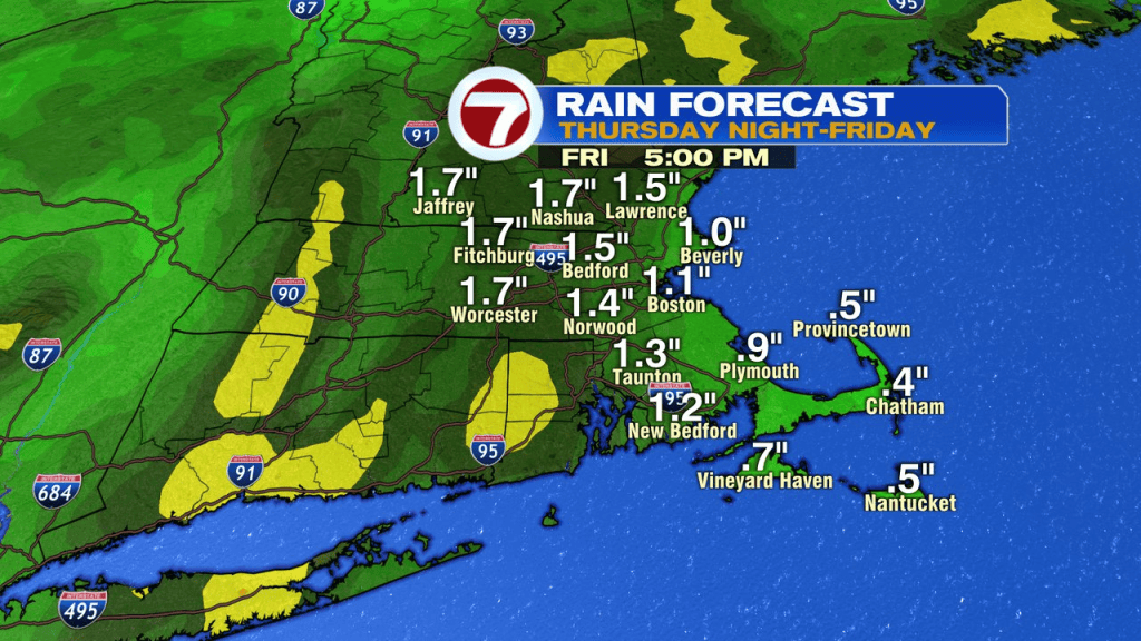
The rain ends by 3-4pm Friday, then the temps start their free-fall. Big puddles freeze up, but if we can catch a few hours of dry air and wind (4-7pm), then that’ll help the roads, driveways, sidewalks dry out before the freeze up. Again, aside from standing water/puddles.
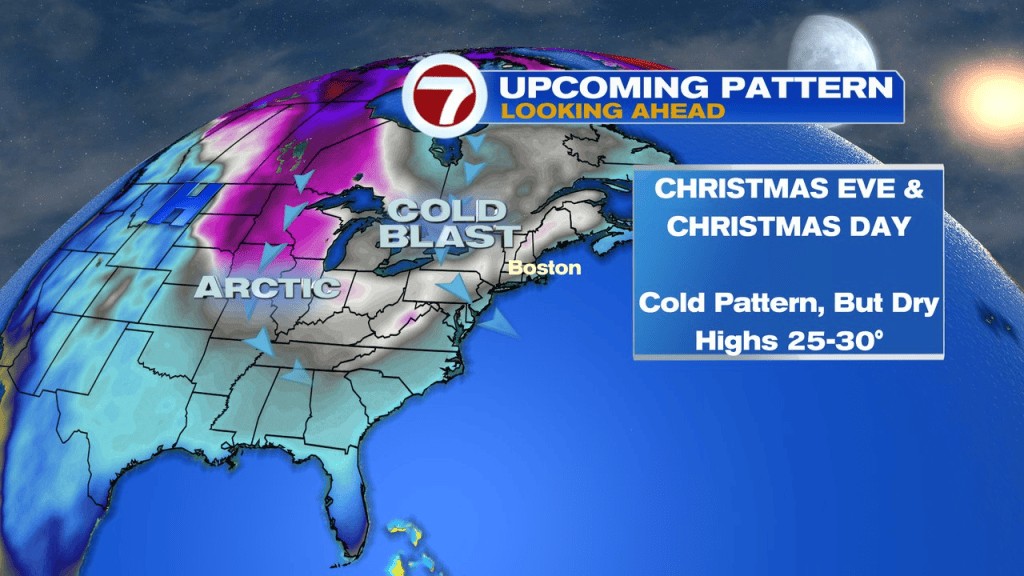
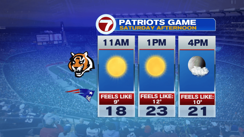
Once the cold air comes crashing in, it has some staying power through the weekend as highs hold in the 20s Saturday and Sunday. Wind chills run near 10 on Saturday too! A few festive flakes will fly Christmas Eve for the Cape and Islands thanks to some ocean-effect flurries/snow shower.