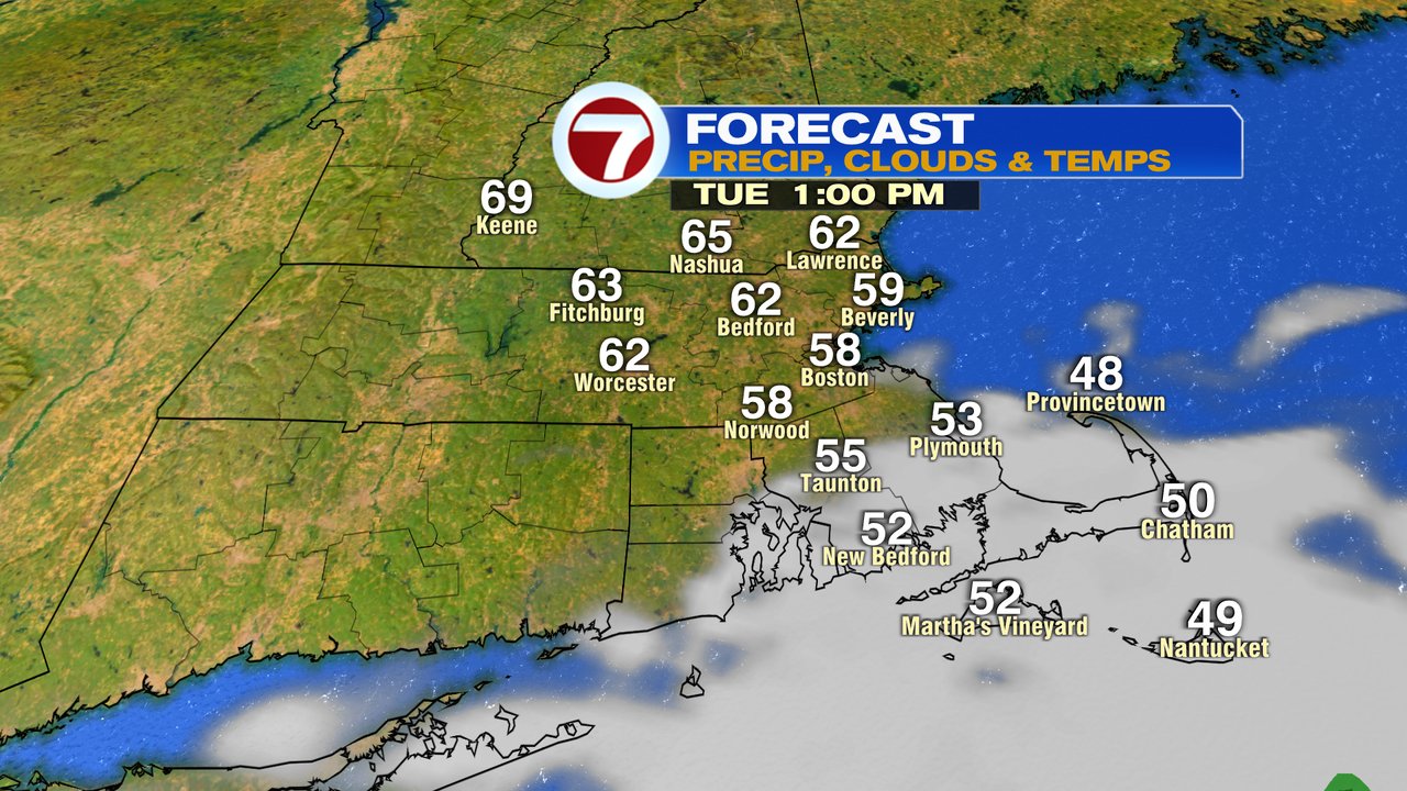
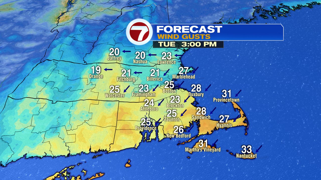
Another day of dry skies and gusty winds went into the books yesterday, and today, we’ll do it all over again. Winds may not be quite as strong, but still gusty, 25-35mph, strongest across the Cape. With the wind out of the northeast, temps will be again coolest at the coast. Highs range from 55 to 65 across the region under a mostly sunny sky, aside for some clouds across far Southeast Mass from time to time.
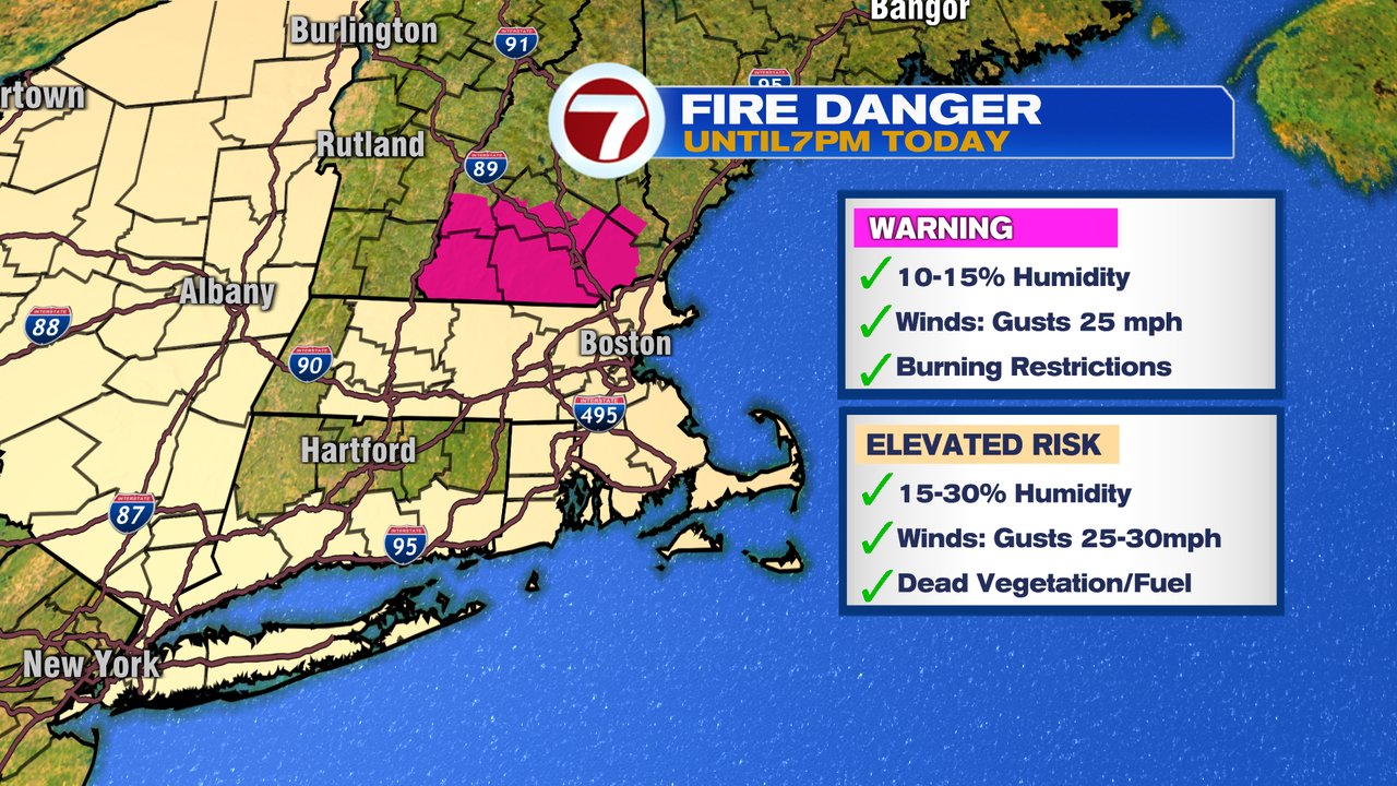
With gusty winds and very low humidity, the risk for fire to spread quickly is there if a brush or grass fire gets going.
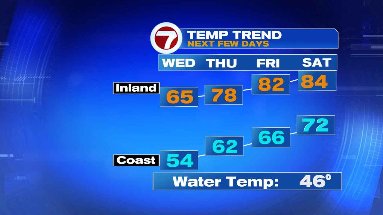
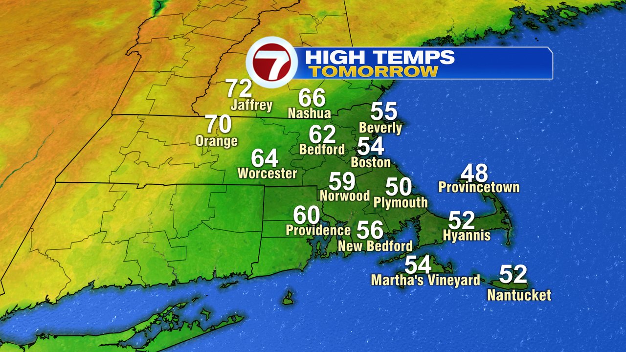
Wednesday will feature more clouds across eastern Mass, and even some patchy drizzle near the coast. Farther inland, it’ll be brighter and much warmer as temps run 65-70 across Central Mass, but only 50-55 at the coast. Wind gusts run 20-25mph, so a bit breezy, but not as windy as the past few days.
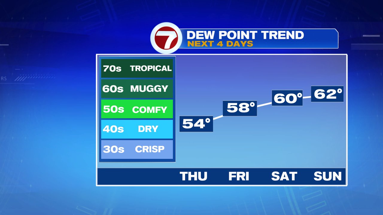
Much warmer weather moves in Thursday and lingers right through the weekend. Away from the coast, 70s and 80s will be common for several days. At the coast, temps run in the 60s to near 70, coolest along the south coast and Cape Ann. Shower chances are limited with just a few isolated showers this weekend, with the highest chance Sunday. There will likely be some low clouds/fog along the south coast in the mornings Friday – Sunday as some higher humidity moves in. Dew points jump into the low 60s this weekend, and with highs in the 80s, it’ll certainly feel summery outside.