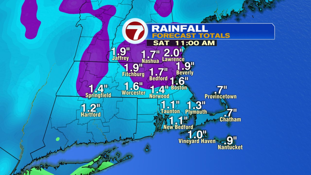
A nasty start to our Friday as gusty winds and soaking rains greet us on the way out to door to head to school or head to work. What you see, is pretty much what you get through the day as a windswept rain is the them of the day. Rain totals run 1-2″ through tonight. Winds gust 30-50mph, strongest along the coast, especially across the Cape and Islands.
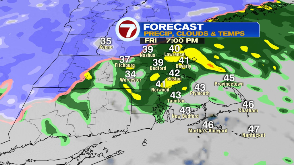
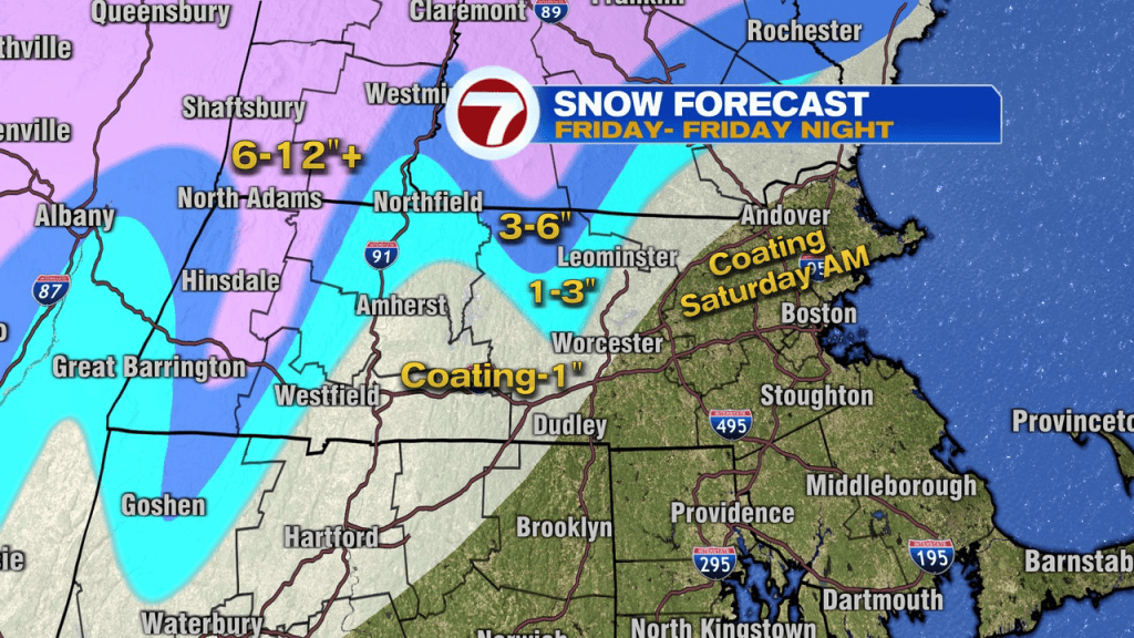
In northern Worcester County, the heavy, wet snow will be a story as the pasty snow piles up in areas like Winchendon, Ashburnham, points north, into New Hampshire. As colder air starts to move back southeast overnight, Fitchburg and Leominster go back to some snow, the even some snow falls across eastern Mass, mainly north of the Pike, early tomorrow morning. While I don’t expect much inside 495, tomorrow mornings burst of snow may through down some slushy coatings. In the meantime, plowable snows will be likely in the northern Worcester Hills and Ski Country up north will catch near/over a foot for many.
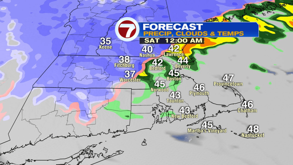
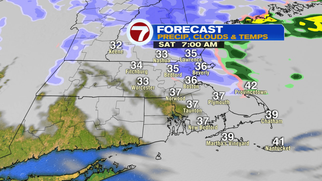
Any early rain/snow tomorrow is wrapped up with by midday and it’ll be dry from then, right through next Wednesday. Good to knock off some of those Holiday errands.
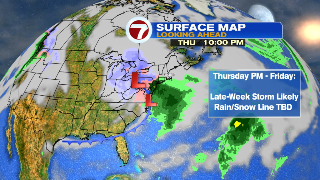
Next storm up… late next week. Thursday PM-Friday timeframe. Rain/snow lines and more deets TBD. Just something to keep an eye on.