7Weather- Rain moves out around midnight tonight, and then wind picks up after 2 AM.
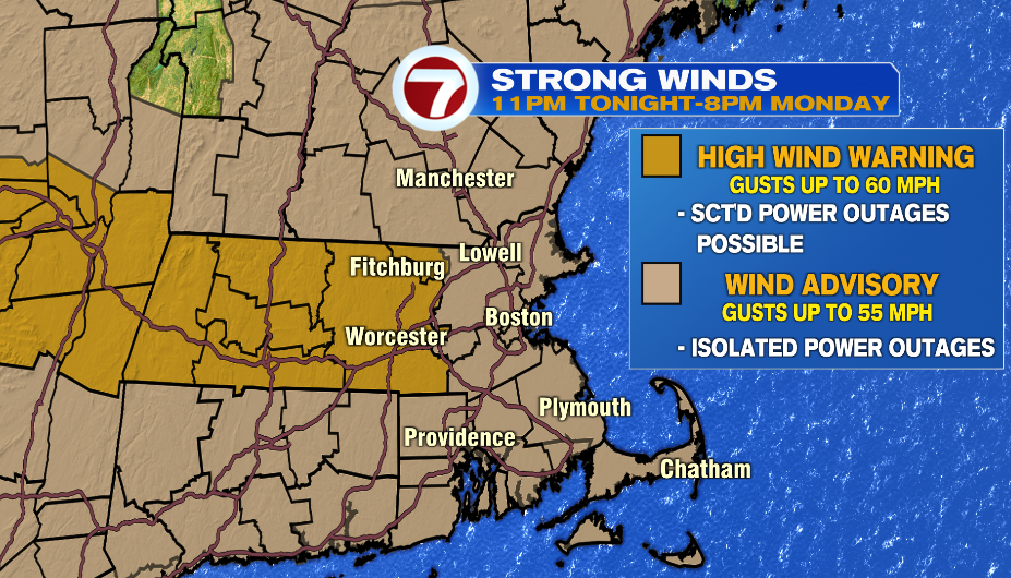
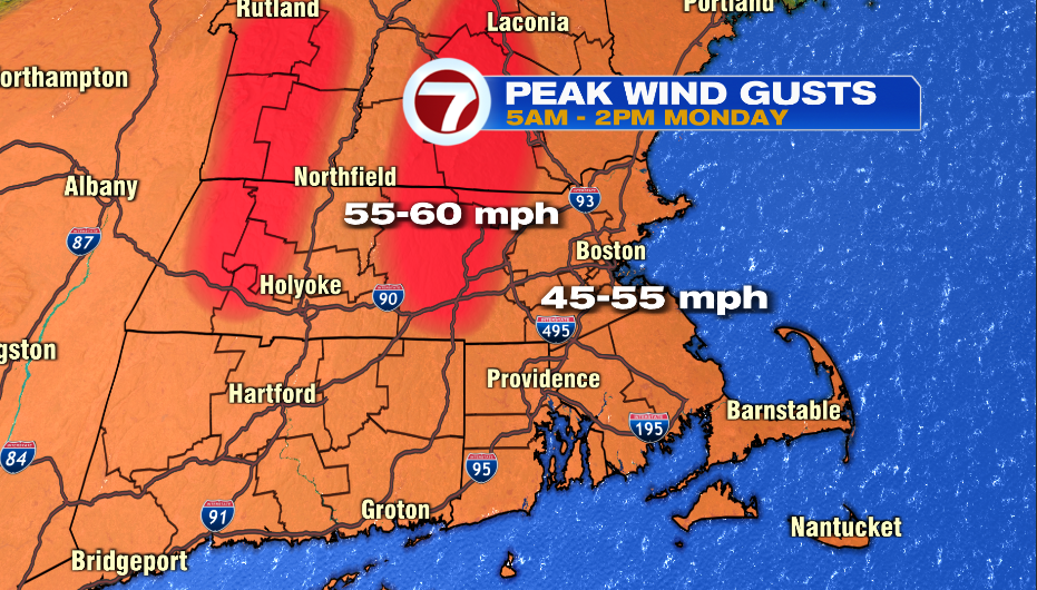
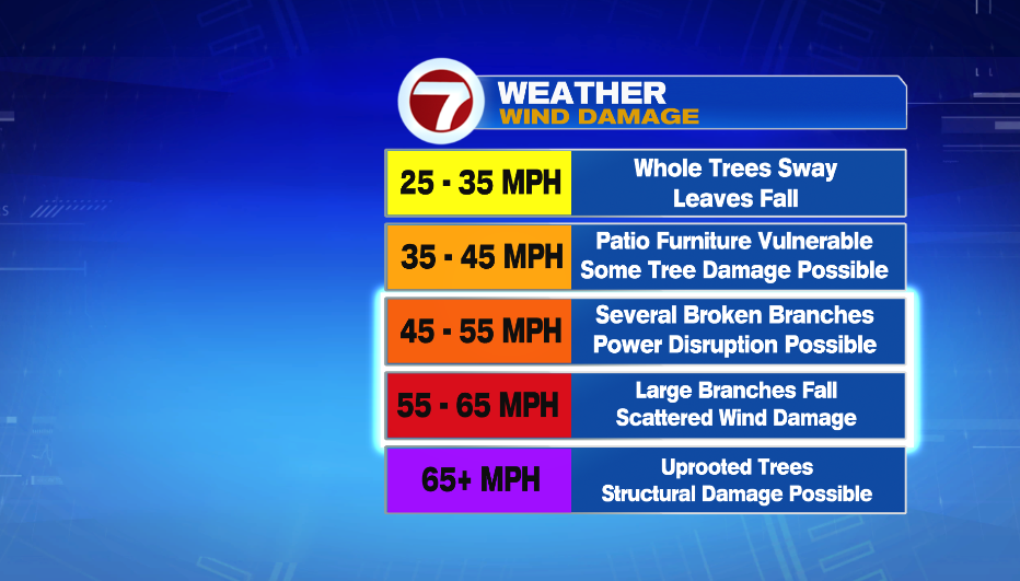
A High Wind Warning is in effect for Worcester County and NW Middlesex County from 2 AM – 4 PM Monday for gusts up tp 60 mph. This is enough bring down big tree branches, causing scattered wind damage, and power disruption.
A Wind Advisory is in effect for everyone inside of I-495 for gusts between 45-55 mph. This could lead to several broken branches in your city/town, which could lead to isolated power outages.
The time frame for the windiest conditions for everyone is from 5 AM – 2 PM Monday. Winds begin to die down after 2-3 PM Monday, and just a light breeze will be around in the evening.
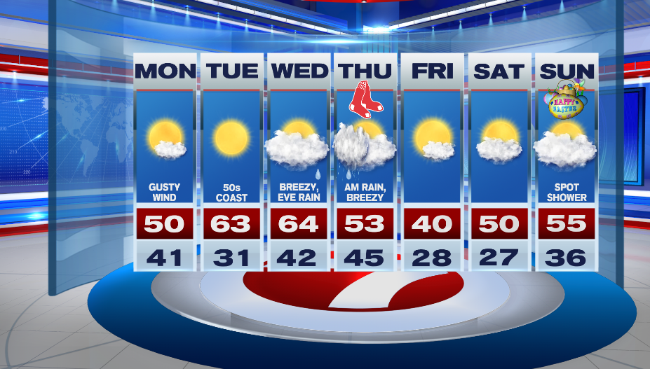
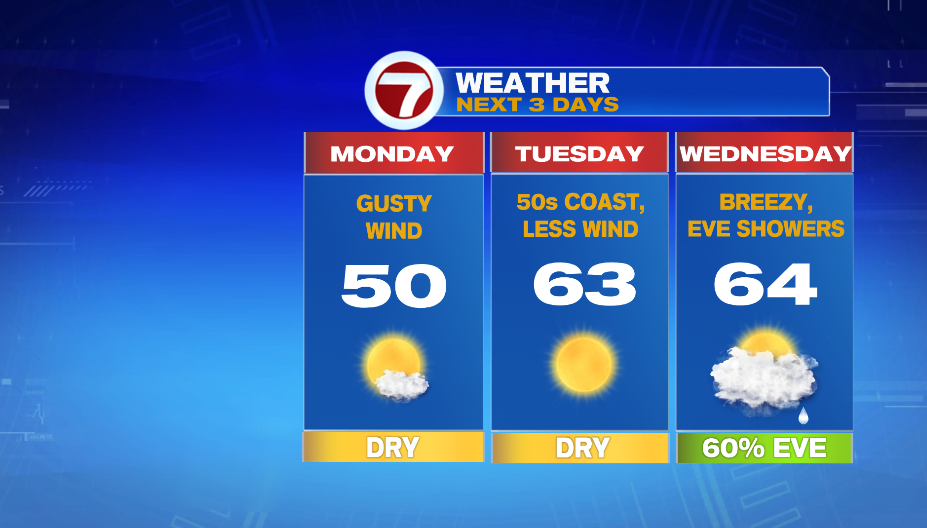
We will likely have some cleaning up to do after the windy conditions, and Tuesday looks to have calm weather for that. Highs reach into the low 60s inland, and into the 50s at the coast.
Showers move in around sunset on Wednesday, so most of the daylight hours are dry. Highs are in the mid 60s, and we will have a breezy southwest wind.
A cold front will be pushing out rain the morning for Opening Day on Thursday, so it looks like showers will mainly be around in the morning.
Temperatures reach into the low 50s around lunch time, and then they start to drop from there as cooler air moves in. It will be breezy, but not nearly as windy as is will be on Monday.