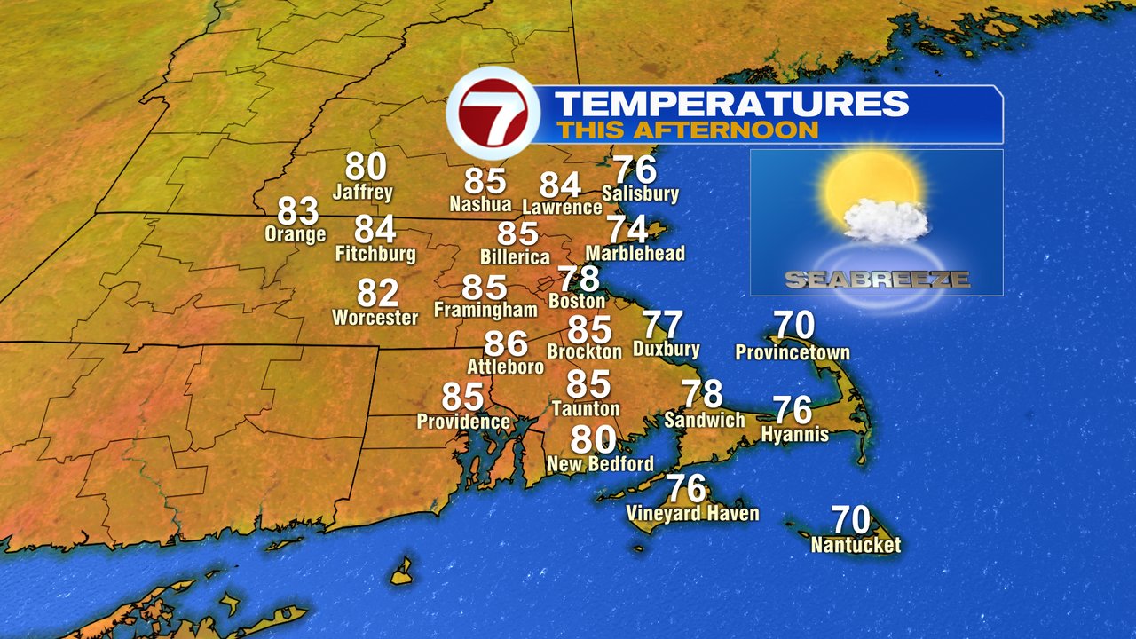
After a few storms lit up the skies last night night near/north of Boston, the weather has cleared out quite nicely this morning as bright skies and low humidity return for a 3rd day in a row… we’ll call it a weather winning streak. Temps this afternoon push near 85 inland and hold around 75-80 at the coast with light sea breezes kicking in.
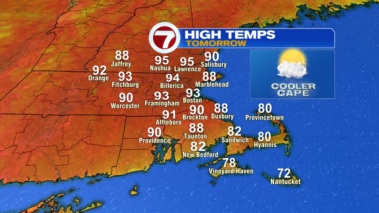
No storms are expected tonight as temps and humidity remains comfortable this evening. Low fall back into the 60s for many. Tomorrow, it’s all about heat as temps take off, cracking the 90 degree mark for much of Southern New England, away from the south coast. With a southwest strong enough to hold back any sea breeze, even Boston will topple the 90 mark, with a high around 93.
Although the heat will make it uncomfortable outside, the humidity isn’t all that high as dew points stay in the 50s. Those dew points jump up Friday night into Saturday though, to near 70.

With high humidity in place and a cold front approaching, expect scattered showers and storms on Saturday. While it’ll be unsettled at times, it won’t be an all day rain, just a day to keep an eye on the radar as storms will be in and out. A few storms during the afternoon/early evening could contain damaging wind gusts and some hail if we get enough breaks of sun to warm us into the mid 80s out ahead of the front. Sunday looks good with lowering humidity and The Fourth looks mainly dry with just a slight chance of a passing storm. Sunday and Monday, temps run in the mid 80s.
