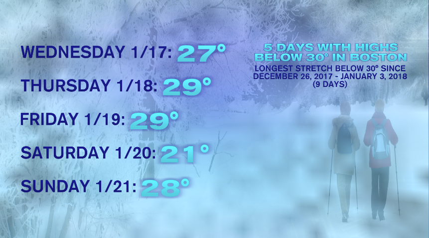
The weekend chill is behind us as temperatures clawed their way back up to the 30s this afternoon. Today’s high in the 30s ends our streak of days with highs stuck in the 20s. Boston strung together five days, beginning last Wednesday (the 17th) through yesterday (the 21st). This stretch of five days is the longest stretch of highs not reaching 30° since the winter of 2017-2018! In that winter, Boston strung together nine days without reaching 30° beginning December 26th and lasting through January 3rd!
With the cold air behind us, we now turn our attention to a warmer, and more active, pattern setting up over the next several days. Temperatures tomorrow will be close to average, if not a few degrees above, so it’s more of a typical January chill. You’ll notice more clouds tomorrow, and those are ahead of (mostly) snow showers arriving tomorrow evening. I say mostly because when the precipitation first starts, it may briefly mix on the coastline, but eventually will flip over to all snow for everyone.
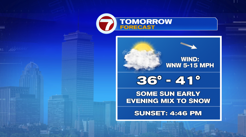
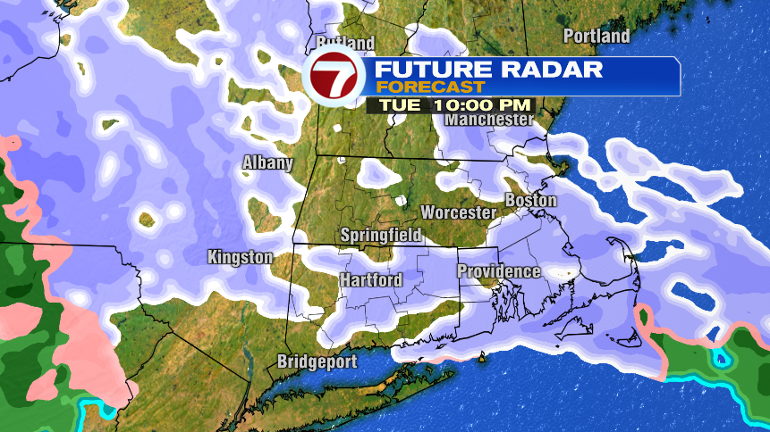
The snow doesn’t arrive until the evening tomorrow, so much of the day is dry. Your commute in the morning will be just fine, and even by the evening commute, while light snow may break out, roads should remain just wet for the evening commute. The snow will continue lightly for several hours into Wednesday morning. Wednesday is a bit warmer so as the snow tapers off Wednesday morning, it will become a mix of rain and snow showers. Those look to be confined to the morning hours and drier skies (not clearer skies) for Wednesday afternoon and evening as the clouds linger.


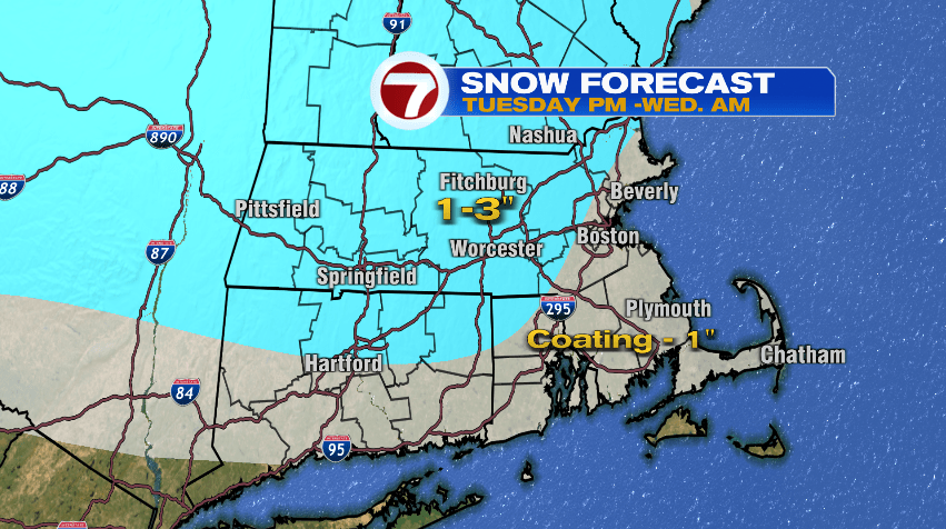
It’s not a blockbuster storm in any stretch, but enough to freshen up the snow that’s already on the ground. Most of us will end up with just an inch or two. But it opens the door for a parade of storms that will move through over the next several days. With warmer temperatures, most of this active stretch will be rain, but there will be times when it does try to mix with snow.
Take a second to digest the graphic below, it shows how much of the day will be impacted (the percent) and how it will fall (the color). I’ll also break it down underneath the picture.

TUESDSAY: Much of Tuesday is dry, like we talked about earlier. Snow showers will start to break out around the evening commute/dinner time and continue as mostly snow Tuesday night into Wednesday morning. As the evening goes on, the snow will get steadier to get to those accumulation numbers above.
WEDNESDAY: By Wednesday we start to work in warmer air so the snow becomes a mix of rain and snow showers. It’s showery versus steady and likely just the morning and drying out in the afternoon and evening (hence the lower height of the bar).
THURSDAY: Wednesday night another storm moves in and with warmer air, this one is all rain. And once it arrives overnight Wednesday, it will rain through much of the day on Thursday and Thursday night.
FRIDAY: Again, notice the lower bar by Friday. The green indicating it will stay as rain but impact less of your day. It will likely rain Friday morning, then dry out for the second part of the day with dry weather lingering through Saturday.
If we continued this graphic for a few more days, we’d track another storm Saturday night, through Sunday, and wrapping up early Monday morning. As temperatures slide back off, that one looks a little messier… but more details to come on that one.