Happy Friday! We got off to a wet start, and while we had a break much of the afternoon, we could see some spotty showers and thunderstorms during and after the evening commute. This weekend we’ll have plenty of dry time.
From now through 9/10 p.m. we’ll be watching spotty showers and thunderstorms to drop in from the northwest toward the southeast.
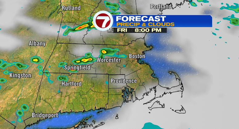
There could be an isolated severe storm, especially over northern Massachusetts and southern New Hampshire. Even then, the chance is pretty slight for a severe thunderstorm with gusty winds and large hail. Again, the storms will be pretty spotty. Otherwise, the humidity is here to stay with temperatures this evening cooling from the 70s into the 60s.
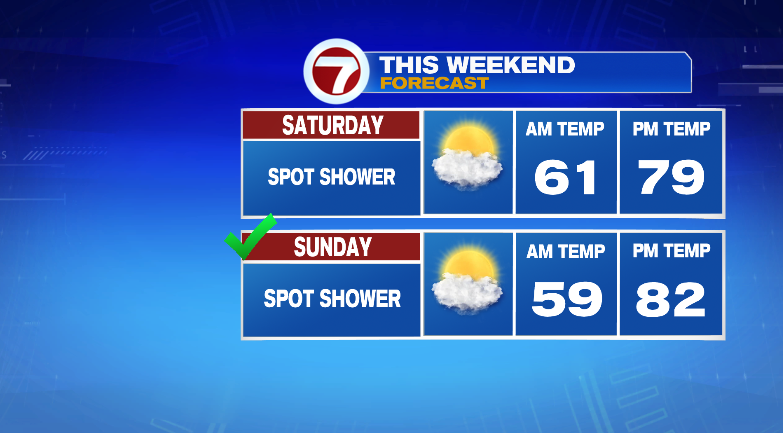
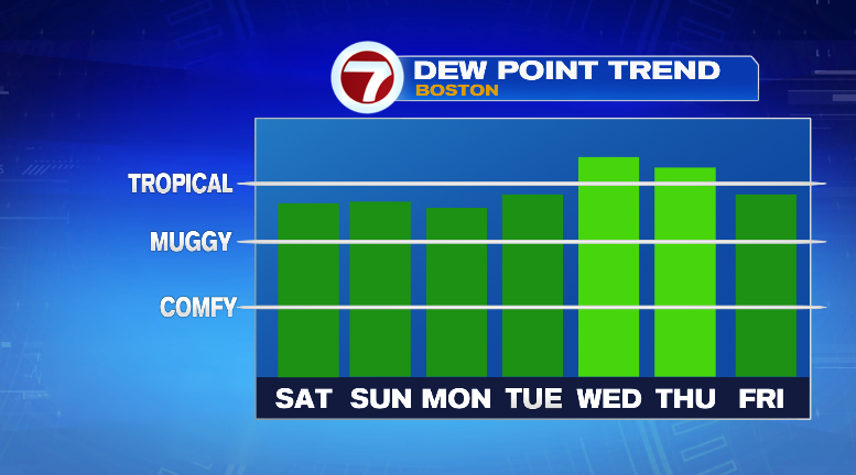
Overnight into Saturday morning we’ll get down to the low 60s. Saturday will be humid and warm with highs in the upper 70s with dew points in the 60s. We can’t rule out a spot shower but generally the day looks dry.

Sunday morning we’ll wake up near 60 degrees with warmer highs in the low 80s. It’ll be humid still and partly sunny. There’s another very slim chance for a spot shower.

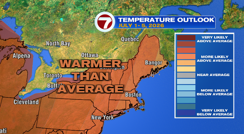
We start heating up even more on Monday. We start the day in the 60s with highs in the mid 80s. It’ll be sunny and humid still. Tuesday we jump to the upper 80s with a chance for showers. Wednesday: mid 80s with isolated thunderstorms. The REAL heat is on Thursday! We jump into the mid to upper 90s, and with oppressive levels of humidity, that’ll feel like it’s over 100 degrees in the afternoon. There’s more chances for isolated thunderstorms Thursday, too.
Friday is trending drier but just as hot and humid. Stay tuned!