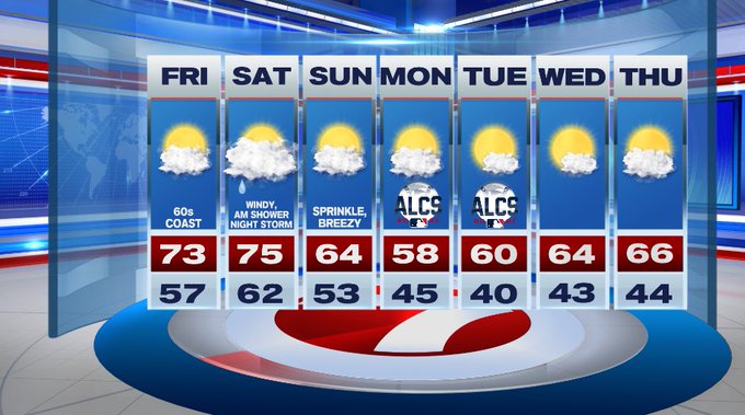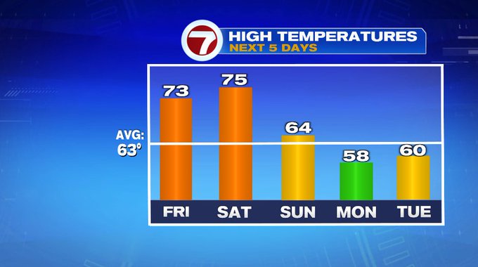
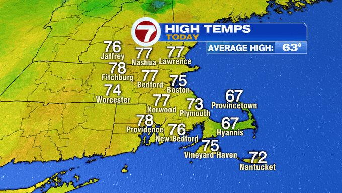
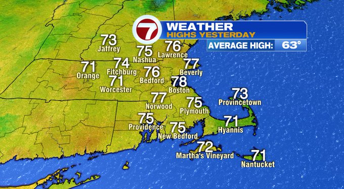
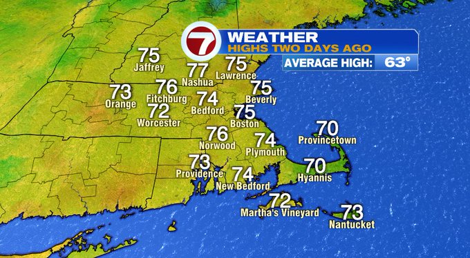
The warm weather we’ve received since Tuesday will stick around for tomorrow and Saturday. Today we saw highs stretch into the mid 70s.
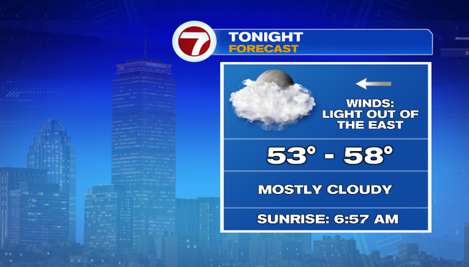
Tonight, temperatures only slip into the 50s under mostly cloudy skies.
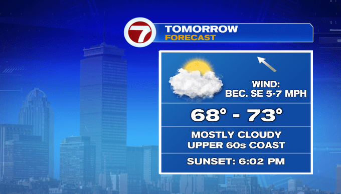
Friday brings another day in the 70s mainly away from the coast where temperatures will likely be in the upper 60s. The clouds stick around with some peek of sun through the day.
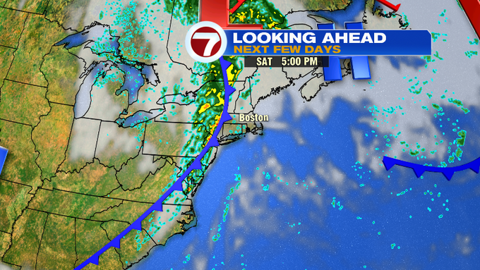
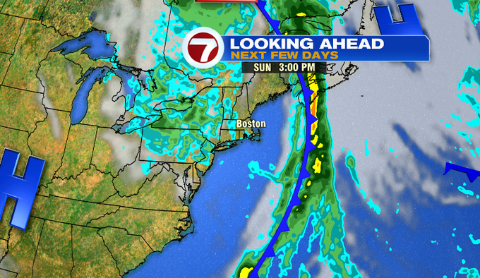
Mainly cloudy skies persist into the weekend. Saturday brings highs into the low to mid 70s ahead of a cold front that approaches after sunset. This cold front is the leading edge of seasonable air and also the showers and thunderstorms that will be pushing into southern New England Saturday night.
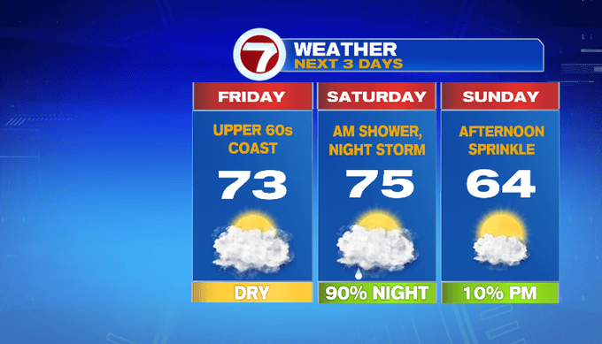
By Sunday, a lingering shower is possible in the early morning hours and then we have a chance for an afternoon sprinkle too, otherwise it will be partly cloudy and much closer to normal with highs in the low 60s.
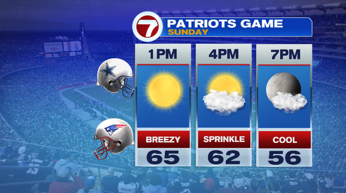
Speaking of Sunday, for the Pats game at Gillette, there could be a passing sprinkle around kickoff, otherwise it will be partly cloudy.
Looking ahead to the following work week, Monday and Tuesday for the ALCS games at Fenway, it will be cooler under partly cloudy skies (we’ll have a better understanding of the forecast once the times are announced for both games). Dry conditions persist into the middle of the next week as high pressure returns.