If you’ve been enjoying the 70°+ weather than you are going to like the forecast through the middle of the week.
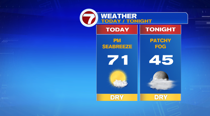
Today, we’re tracking those highs stretching to the low 70s inland, near 70 at the coast due to a seabreeze that sets up by the afternoon.

This evening, temperatures dip into the upper 60s by sunset (which is before 4:30pm this evening), and then we’ll see overnight lows sliding back into the 40s to low 50s. Patchy fog cannot be ruled out tonight into early tomorrow morning.
Speaking of tomorrow, Monday features highs into the low 70s under mostly sunny skies with Boston possibly tying the record high of 74° set back in 1945.
Tuesday is also sunny with highs into the low 70s, but the winds will pick up out of the southwest, making it a breezy afternoon.
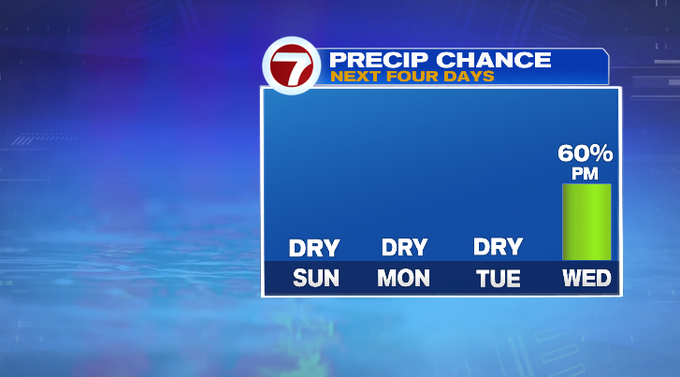
Wednesday will also be breezy ahead of our next chance for rain linked to a cold front to our west that swings in late Wednesday. Showers are expected to move in late afternoon and will linger into early Thursday.
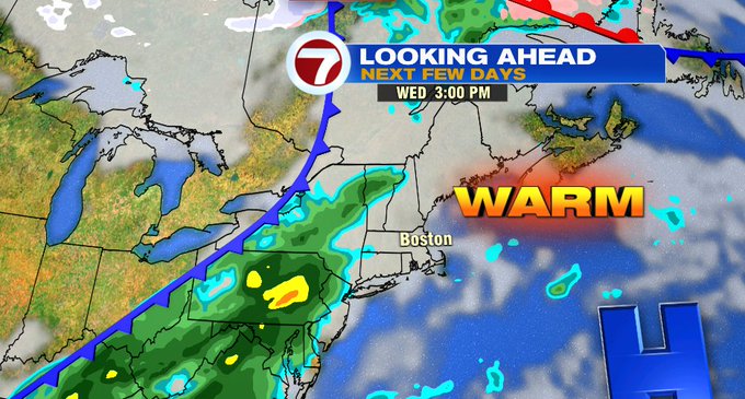
Behind the cold front, temperatures will gradually return to near normal. Thursday remains mild with highs into the mid 60s. It’s Friday and Saturday that highs will be in the 50s, which is average for this time of year.

The 70-degree stretch of days could be one for the record books with the number of 70+ days for the month of November. As of right now, 1975 has the most number of 70+ days in November at 5. If we reach 70 through this upcoming Wednesday, that would be 7 days at 70 degrees or higher.
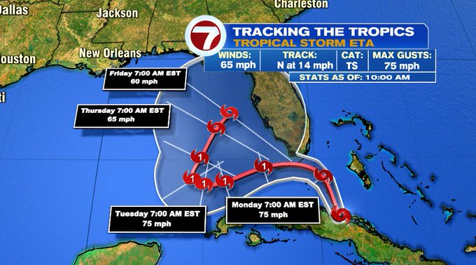
Speaking of record-breaking, the 2020 Atlantic Hurricane Season continues as Tropical Storm Eta nears Southern Florida. It is expected to strengthen to a Cat. 1 Hurricane early Monday as it nears the Florida Keys and will continue to meander in the Gulf of Mexico along the SW coast of Florida through the end of the week, posing as a significant flood threat much of the state.