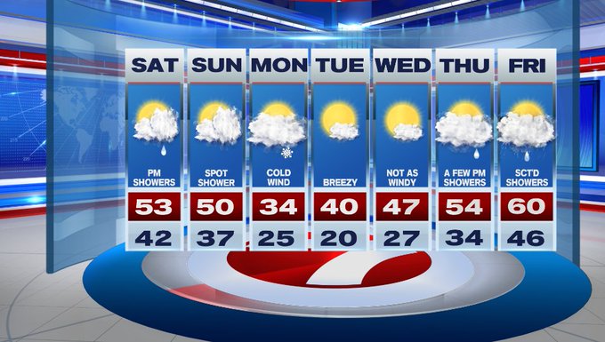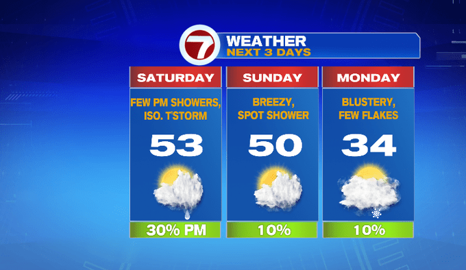
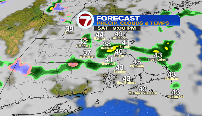
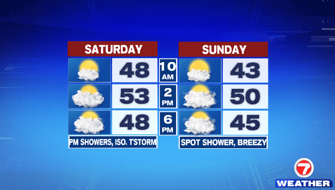
We’re starting off with sunshine on this Saturday, but we’ll see increasing clouds this afternoon as a few showers start to pop up. A few of these showers could contain thunder, but the thunderstorm threat should hold off until closer to dinner time.
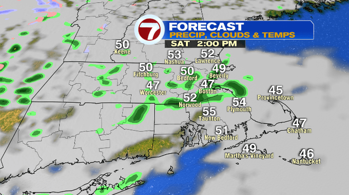
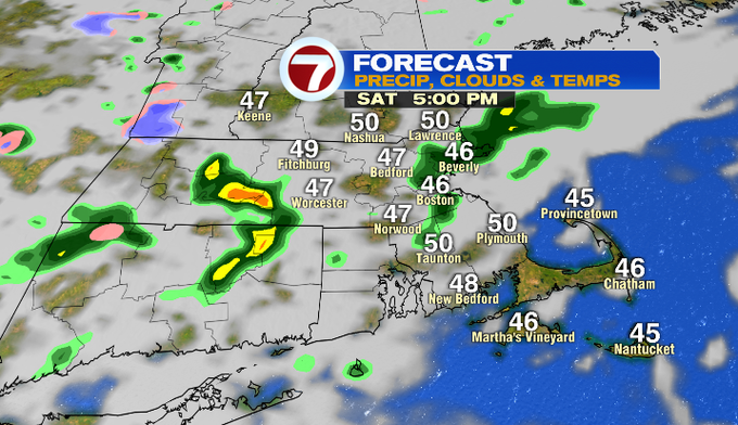

We can’t rule out that thunderstorm risk, alongside the potential for hail or graupel (soft hail, looks like dippin’ dots) due to very cold air aloft.
The showers should diminish in coverage by 10pm as colder air starts to push in and we’ll see a gradual clearing of the skies overnight.
Similar to this morning, we start off with sunshine Sunday as clouds build in for the afternoon. Sunday will be breezy with a spot shower, but the rain chance tomorrow is not as widespread as today.
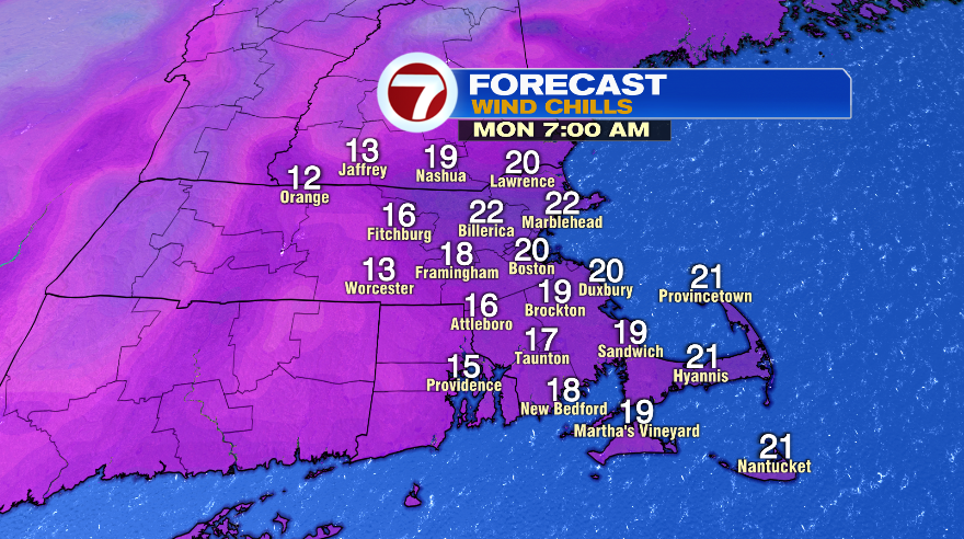
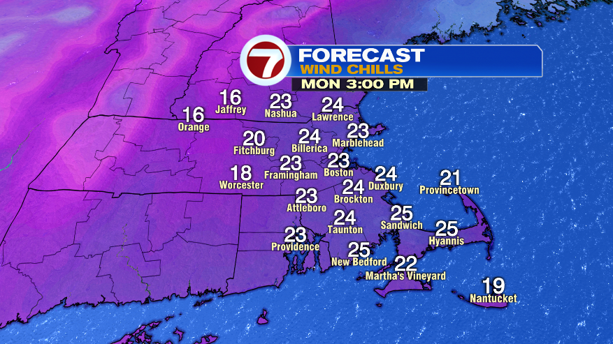
Much colder air pushes in from Canada to kick off the work week. Monday features highs in the 30s, which will be coupled up with blustery winds, dipping wind chills into the 20s for much of the day. Don’t be surprised or shocked if you run into a passing flurry.
The coldest morning will be Tuesday with overnight lows diving into the upper teens to low 20s. It will still be breezy Tuesday, but at least we’ll see highs around 40 as the sunshine returns.
Through the end of the week, we’ll see temperatures climb. Wednesday is dry and seasonable with highs in the upper 40s. 50s return Thursday along with rain showers in the afternoon and evening. The rain chances continue into Friday with highs nearing 60.