Yesterday, we saw widespread light rain, especially along and south of the Pike, at least putting a small dent in the rain deficit for the month (with still nearly 2″ below normal for Boston and Worcester).
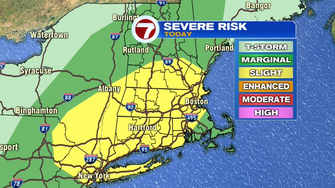
This afternoon, we’ll see a few spotty thunderstorms popping up. These will contain heavier downpours, some gusty winds, and hail cannot be ruled out, making the threat for strong to severe storms possible. The Storm Prediction Center has put most of southern New England in the Slight Risk category for severe thunderstorms this afternoon and evening (3PM – 9PM).

The South Coast, far SE MA and the Cape and Islands are not included in the Slight Risk.
Let’s talk timing. A few spotty rain showers into the early afternoon along and north of the MA/NH stateline. The thunderstorm threat picks up between 2 to 3PM and lingers by dinner time.


By 8PM, more scattered thunderstorms develop for central MA and southern NH before starting to break apart moving eastward and out to sea.

Scattered showers are with us Monday, Tuesday and Wednesday, but we’re not tracking washouts.

We end the week on a sunny note just in time for the 4th of July weekend.