We saw a few strong storms late last night in Western MA, with a few storms sliding into north central MA earlier this morning. We’re dry through midday then, we’ll see a few storms bubble up this afternoon ahead of a cold front to our northwest.
This means to be weather aware for your outdoor plans because some of these storms could contain gusty winds, torrential rain and hail.

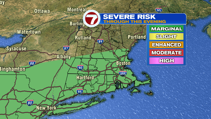
The Storm Prediction Center has included all of our viewing area in a marginal risk for severe storms this afternoon (yes, that’s the lowest risk, but that also means that severe weather is possible).

The storms will be spotty through the afternoon and early evening and with sunny breaks in between, temperatures and humidity will be high. Highs today stretch to near 90°.


Tonight, temperatures only slip into the mid to upper 60s to low 70s under mainly cloudy skies and a few lingering showers.

Friday will bring more sunshine north, while clouds will linger longer farther south. Plus, a spot shower cannot be ruled out along the South Coast and the Cape and Islands.


The weekend brings highs into the mid to upper 80s, with Saturday being the better half with slightly less humidity while Sunday brings a chance for a few showers/storms. The heat returns Monday ahead of a threat for some scattered showers and storms that could be on the outer rain bands associated with Tropical Storm Isaias.

We will continue to monitor the strength and track of that storm through the next few days. As of right now, the impacts to southern New England remain uncertain.
