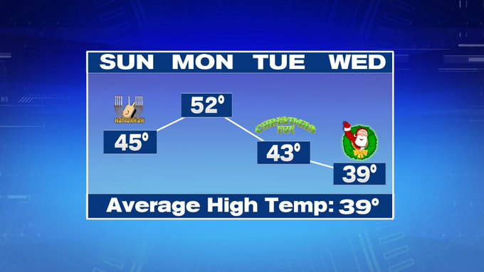
Winter officially begins at 11:19pm Saturday night, and the irony is that we are tracking a warm-up for the first full day of winter on Sunday. Highs will stretch into the low to mid 40s Sunday afternoon under partly cloudy skies.


Tonight, temperatures will not be nearly as cold as last night with lows into the upper teens to mid to upper 20s at the coast.
Monday features an even bigger warm-up with the return of the 50s for highs under mostly sunny skies.

Christmas Eve features highs closer to normal, into the low 40s and Christmas Day will feature seasonable high temperatures in the upper 30s under partly cloudy skies.

Thursday remains dry too, so that mild and dry stretch will be sticking around through MOST of the 7-day. Friday night features our next best chance for snow showers, with a few lingering flurries into early next Saturday. So, overall, the holiday travel forecast across southern New England is looking great.
