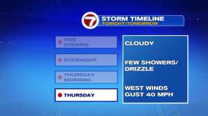
We have a potent coastal storm that will be producing soaking rain as well as damaging gusts to the area over the next 24 hours. Below is the latest timeline, hazards, and forecast as of Wednesday evening’s commute:
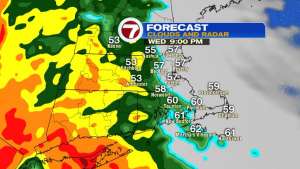
Let’s start off with how strong the wind gusts will be. As the low pressure system strengthens right over southern New England, the winds will be shifting over the course of the Thursday, although the rain shifts out, the wind remains strong, especially for the immediate coastline. You may have heard the term “Bombogenesis” with some of storms over the years, but it looks like this low will do that- strengthening 24mb (or even more than that) over the next 24 hours.
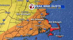
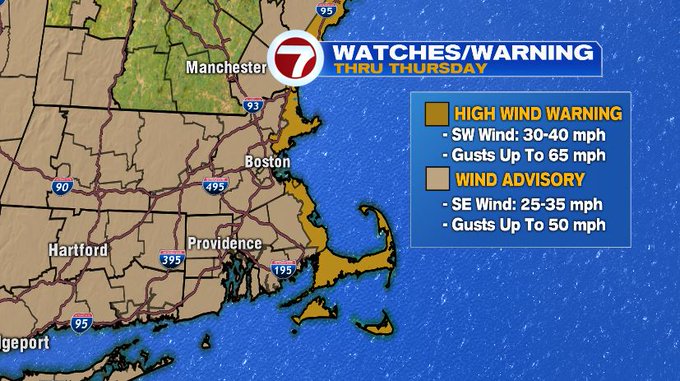
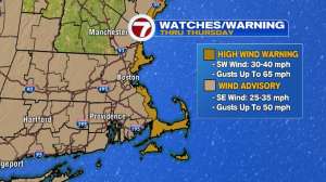
As this strong system strengthens, the wind will also become stronger with gusts between 50-65 mph possible for the coastline, which has translated to a High Wind Warning from the NH seacoast, to Cape Ann, to the South Shore, Cape and Islands, otherwise a Wind Advisory has been issued for the rest of the Bay State and areas just inland of the NH seacoast. The Warning and Advisory goes through Thursday evening.
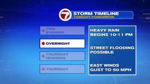
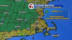
We also have a Flood Watch for Worcester Co., western MA, southern VT, SE NH, and northern CT. This is due to the fact that some spots could get up upwards of 3″ of rain within a 6 hour window. Plus, we have some fully-leaved trees (that could shed most of their leaves and some twigs with the ongoing wind event) which in turn could clog up some of the storm drains, so poor drainage flooding will likely be an issue.
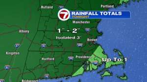
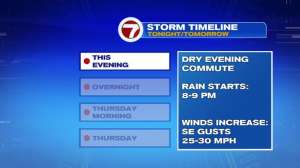
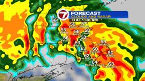
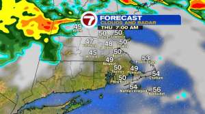
As for the timing of the rain, the heaviest pockets will be overnight and into 2am Thursday, with the bulk of the rain exiting to our north by 6am Thursday. The gusty to damaging winds will still be an issue even as the rain exits, but the wind direction will be out of the south to southwest by Thursday late morning and into the afternoon on the backside of the storm.
We end the week on a nicer and less windy note. It will still be breezy, but at least we see the return to sunshine. The good news is that we see the sunshine continuing into the weekend with seasonable conditions just in time for the Head of the Charles Regatta. An onshore breeze will keep temperatures slightly cooler at the coast.
Next week features a dry start before another round of showers are expected into midweek.
