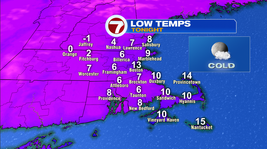
Today was cold, but it’s only a taste of what’s to come for the weekend. Highs today struggled to make the lower 20s, but with the wind, it felt like the single digits through most of the afternoon. With clear skies, we have a cold night on the way for tonight with most cities and towns falling into the single digits by tomorrow morning.

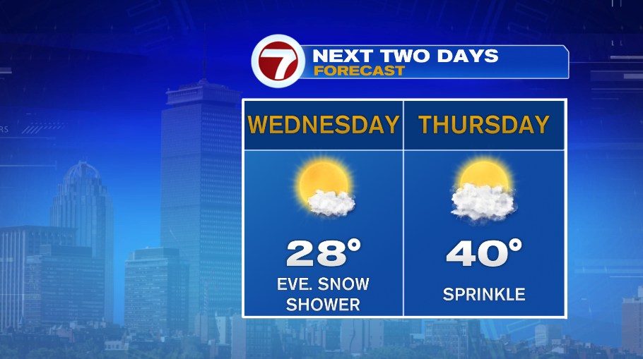
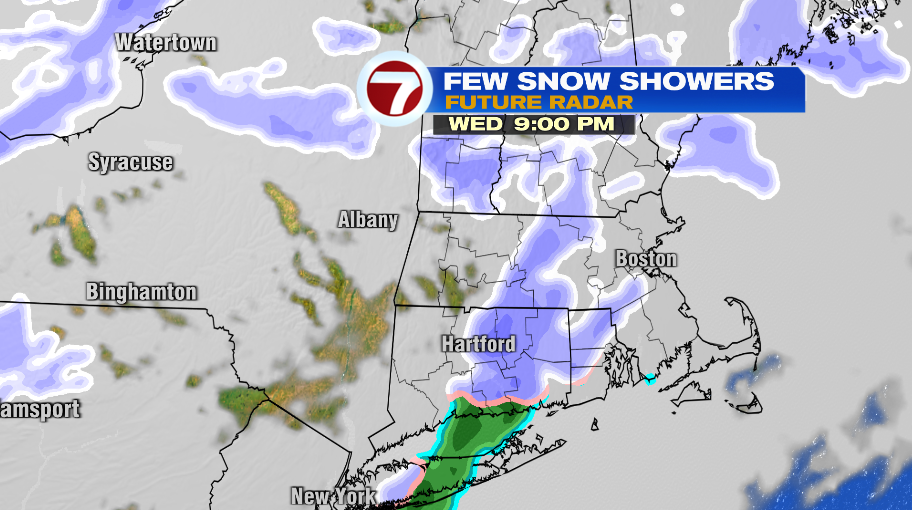
We’ll have slight temperature improvement the next two days, but it’s all relative, it’s not another January thaw with temperatures in the 50s. Tomorrow is one of those days where temperatures will continue to rise in the evening and overnight. I have 28° for tomorrow, which is probably a “high temperature” while the sun is up. There’s a warm front that will pass through later in the evening, after sunset, which will pull our numbers to the lower 30s overnight. As the warm front passes tomorrow evening, it will touch off a few snow showers. Closer to midnight, as temperatures rise closer to freezing, the snow showers could transition to a few rain showers, especially across our southern spots. Either way, the precipitation is gone by Thursday morning. Thursday ends up being a pretty nice day with a partly cloudy sky and temperatures near 40°.
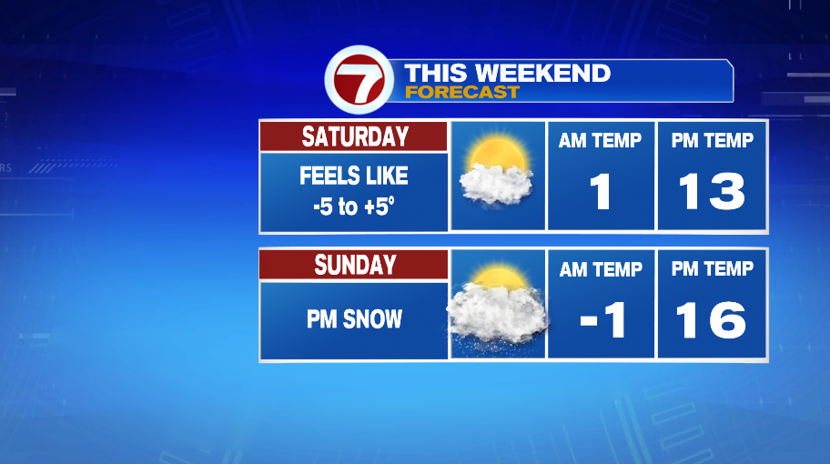
Then the bottom falls out. Temperatures will plummet through Friday as another arctic front moves through. As it does, it will pick up the wind and produce a couple of snow showers. Highs Friday will be in the 20s, followed by the weekend when high temperatures will be stuck in the teens.
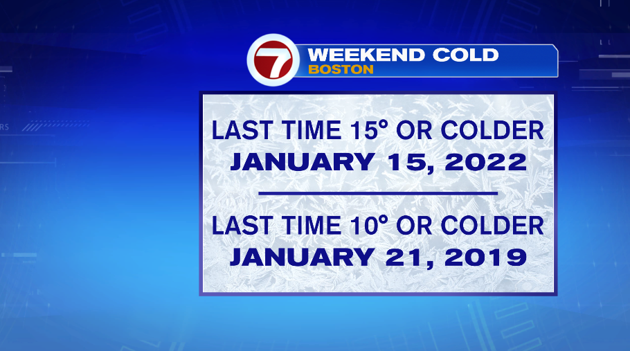
This is rare cold that’s on the way. The last time Boston had a high temperatures that was 15° or colder was January 2022. The last time that Boston had a high temperature that was 10° or colder was January 2019!
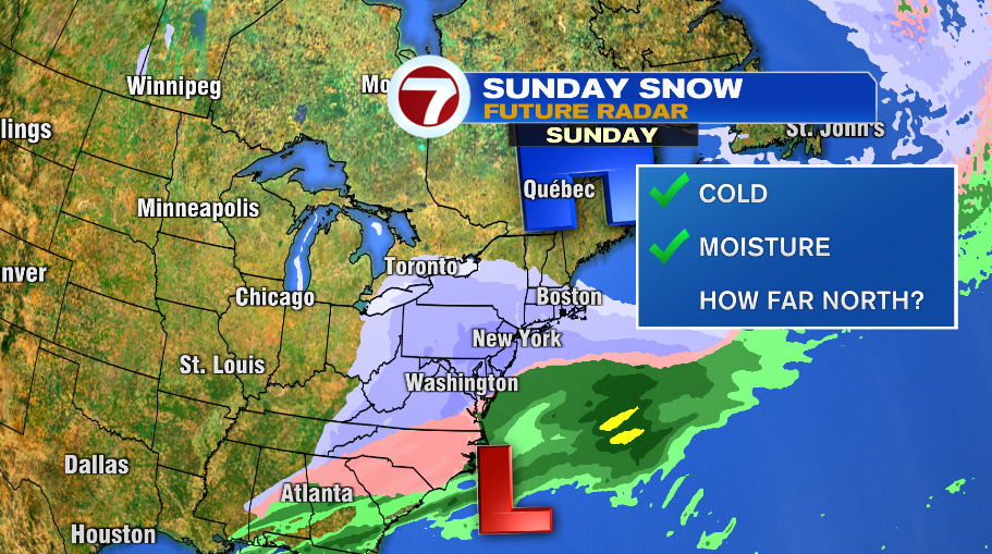
Sunday will also bring the chance for snow back to the forecast. We have the factors in play for a snowstorm SOMEWHERE ON THE EAST COAST. That does not mean New England or Boston. Right now, it looks like the Mid Atlantic will be taking the brunt of that. But we have the cold from the weekend and we have the storm to provide the moisture. That big, cold area of high pressure will do it’s best to hold that storm away. That said, I do think we’ll see snow on Sunday evening into Monday morning, but how much is the question. Right now it’s looking like the potential of a few inches of snow. It’s a storm to monitor because it certainly would have the potential to be more if that storm track changes. Stay tuned!