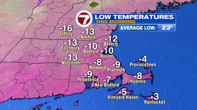
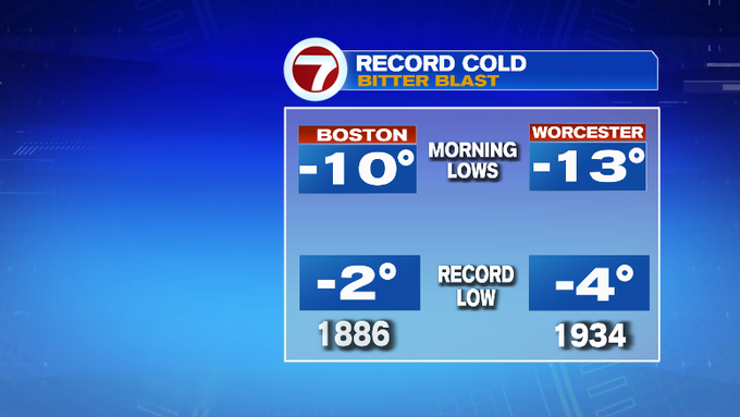
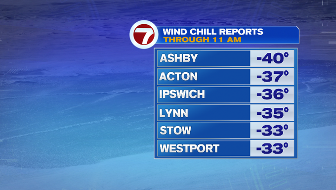
7Weather- How’s everyone holding up with the cold? Boston dropped to -10 overnight! This is the coldest air in 66 years. On January 15, 1957, the temperature dropped to -12°, and that was with 6″ of snow on the ground. Overnight, temperatures across the area dropped below freezing too, to near -15 for some. Those are just the actual air temperatures. When you factor in the gusty NW wind (you no doubt heard it), it felt like -30 to -40. Brutal cold.
Ocean-effect snow flurries fell into the morning across the Lower Cape. Provincetown reported light snow for a few hours. Interesting when you see the temperature contrast helping to initiate those showers, as low as -4 in Provincetown while the ocean water is mild in the low 40s.
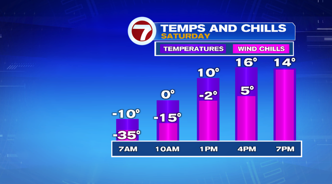
It’ll still be cold today, but it’ll be an improvement. The overall trend is that temperatures will go from negative readings to the double digits and teens by the afternoon. It’s more the wind chill readings you want to pay attention to. This morning it’s still gusty. By the afternoon/evening, there will be less wind and thus less wind chill. It’ll feel closer to what the temperature actually reads. And yes still cold. This is very dry air so we’ll see plenty of sun before more clouds move in later today.
Overnight, low temperatures will be in the teens. Dewpoints will start to come up overnight, but you might still want to have your humidifiers going. When you start your Sunday, temperatures will be in the 20s.
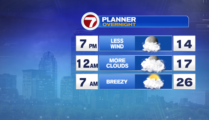
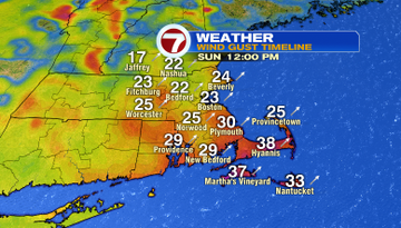
Two very different days this weekend! -30 to -40 wind chills to 40s for actual temperatures tomorrow. A warm front will lift through along with a SW breeze to boost temperatures. It’ll still be breezy to gusty at times, but not as strong as last night.
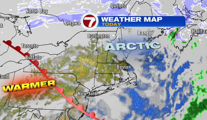
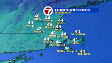
Looking ahead to the week. No more Arctic air! It’s mild. Mid to upper 40s with maybe some towns squeezing out some 50s. Unsettled with some rain showers late in the week.
-Meteorologist Melanie Black