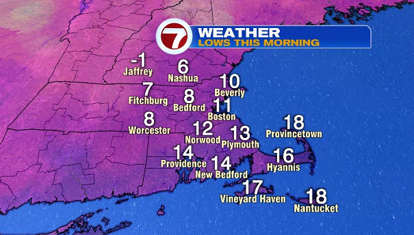
It was yet another cold start earlier this morning with lows into the single digits.
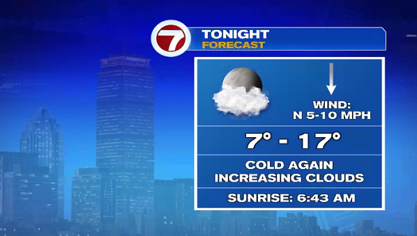
We’ll see another cold night tonight, but not quite as cold as earlier this morning, but a few towns inland will likely see single digit lows again.
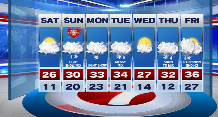
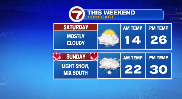
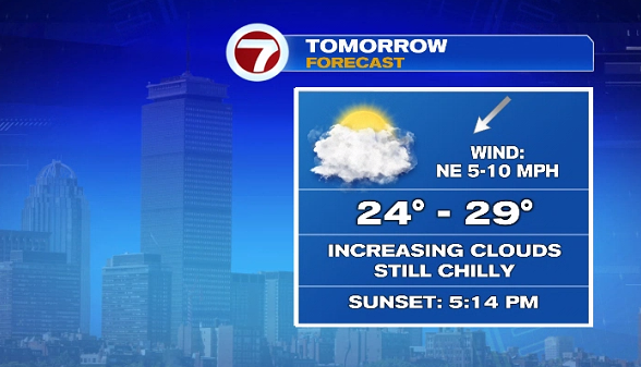
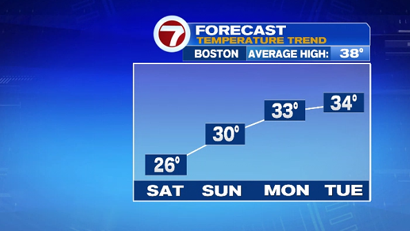
We’ll see increasing clouds Saturday with highs into the mid 20s (over 10-degrees below normal), alongside a NE breeze that will make for wind chills into the upper teens for much of the afternoon (similar to what we felt Friday afternoon).
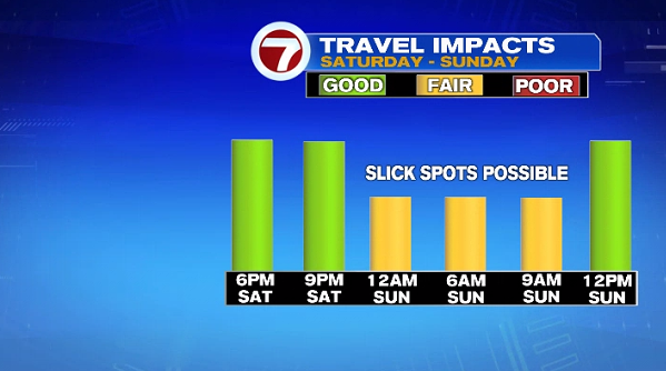
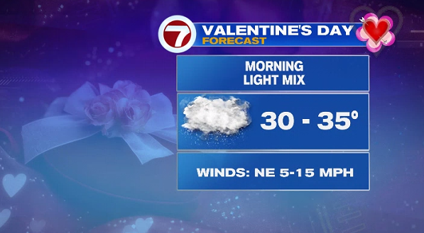
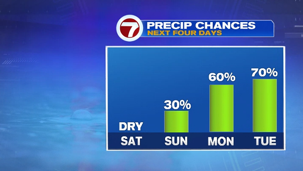
Late Saturday night into Sunday morning, a system to our south will bring light snow showers to the region, changing to some wintry mix Sunday morning for areas south and east of the Pike, making for some slick travel.
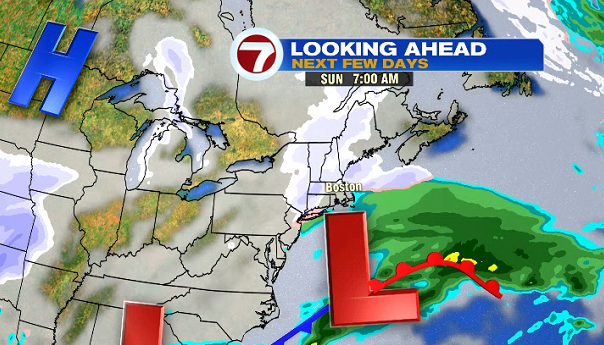
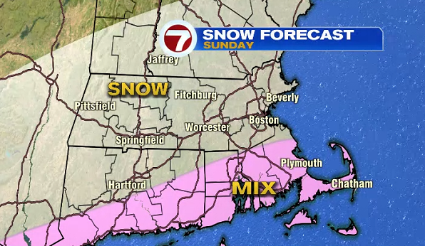
With temperatures above freezing for portions of SE MA, the Cape and Islands, that is where wintry mix will likely fall Sunday morning. Valentine’s Day is not a complete washout, but it will be overcast with the snow/mix shower threat for the first half of the day.
Sunday kicks off an active pattern for southern New England into the next week. Monday brings a chance for light snow showers.
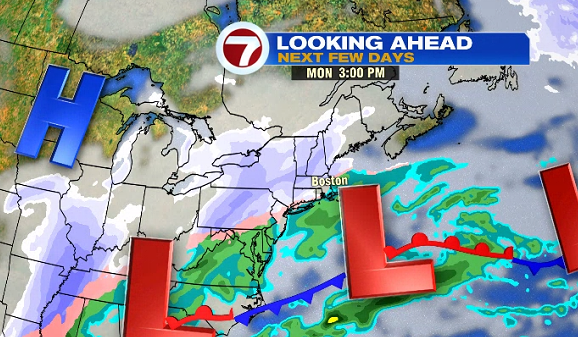
Tuesday poses to be the messiest over the next week with a dose of rain, snow and ice as high temperatures hover just above the freezing mark.
Wednesday is the only day featuring dry conditions for the upcoming work week with Thursday bringing another dose of snow showers that flip over to a wintry mix. These showers will linger into early Friday morning.