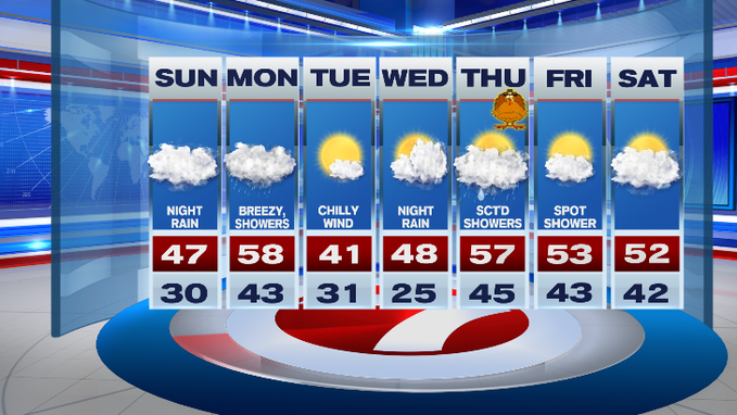
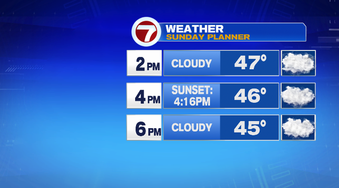
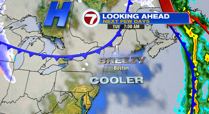
Today will be nearly 20-degrees lower than yesterday’s high temperatures. This afternoon, highs will only stretch into the mid to upper 40s across the region with an isolated 50-degree high (mainly south). The cooler air is also greeted with cloudy skies that loom over the region for our Sunday.
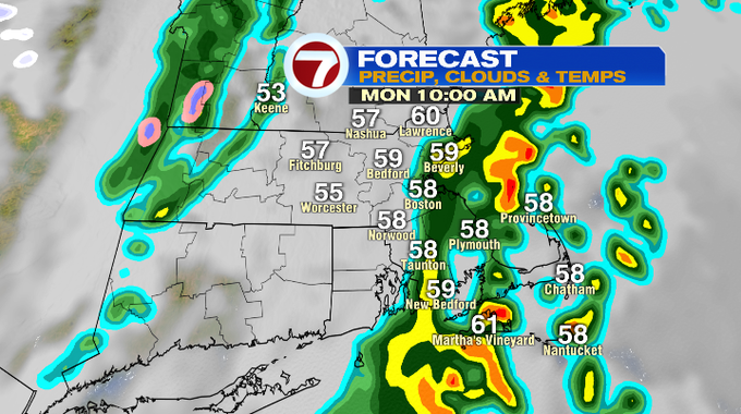
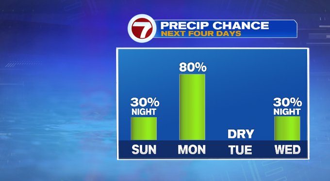
Tonight, as early as 10PM, a few spotty showers will pop-up ahead of widespread showers through Monday morning. Embedded downpours (along with some isolated thunder) are possible as a warm front lifts north into southern New England.
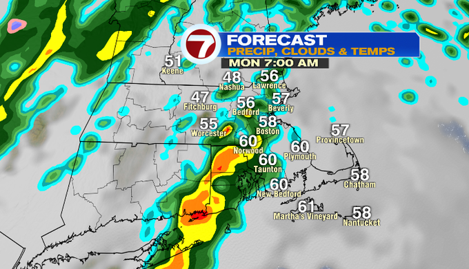
With that warm front, we’re also tracking a warm-up with high temperatures into the upper 50s.
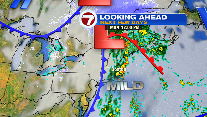
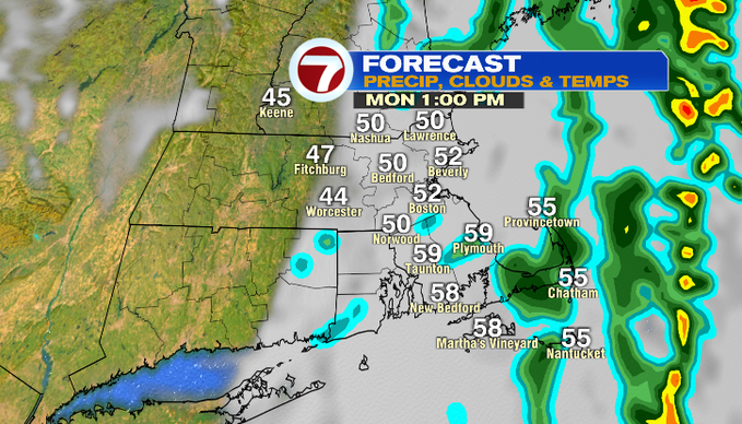
The warm front is followed by a cold front which will push out the rain by mid-afternoon, and most of the clouds by sunset (so there is some sliver of hope for some sun by sunset at 4:15PM).
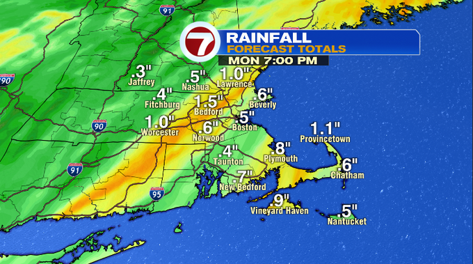
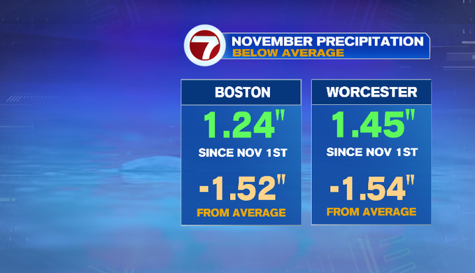
We’re looking at widespread 0.5″ to an 1.0″ of rainfall through Monday, which is much needed since we’re over an 1.5″ below normal for the month for Boston and Worcester.
With the clearing of the skies Monday evening, temperatures will fall back into the low 30s, and Tuesday’s highs will struggle to make it into the low 40s with a chilly northwest wind, but at least we’re tracking the sunshine.
Wednesday brings in more clouds with our next system knocking on our doorstep by Wednesday night. That system brings scattered showers for our Thanksgiving Day, but it does not look to be a complete washout. Although we see showers on the holiday, we’ll also see a warm-up with highs into the upper 50s.
For the end of the 7-day, highs will be in the low 50s with a spot shower Friday, mainly cloudy Saturday.