With a fresh snow pack and a gradual clearing of the skies tonight, temperatures will dip into the teens late tonight into early Saturday morning. Before we dive into the forecast for the weekend, let’s recap the snow storm that brought the first significant snowfall of the season.
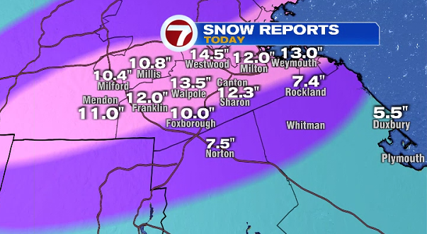
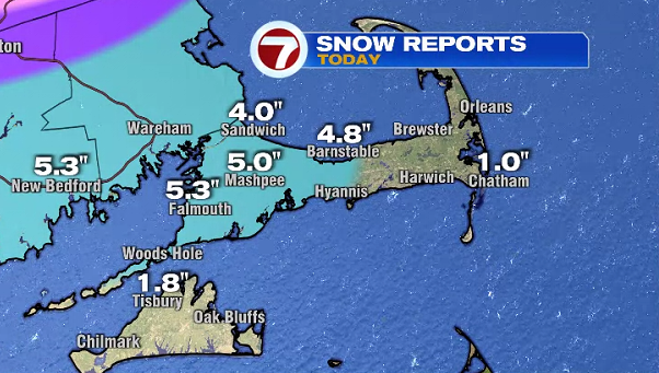
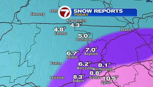
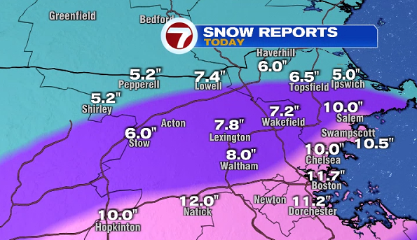
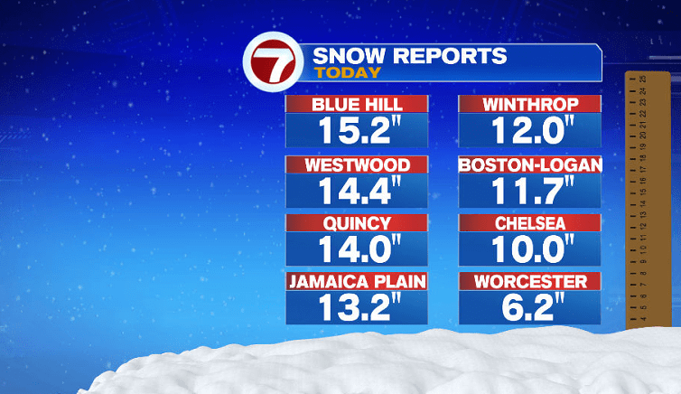
Several towns saw snow totals over a foot, with the jackpot area just south and west of Boston. One of the highest totals was from Blue Hill at 15.2″. Boston was just shy of reaching a foot, with a snowfall total of 11.7″
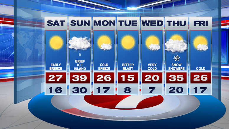
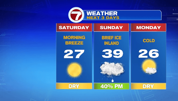
Tonight, temperatures will dip into the teens as the winds pick up and the skies continue to clear. Wind chills will dip into the single digits around daybreak Saturday morning.
If you’re heading out to sled or shovel tomorrow, be sure to bundle up because wind chills will be in the teens for much of the afternoon.
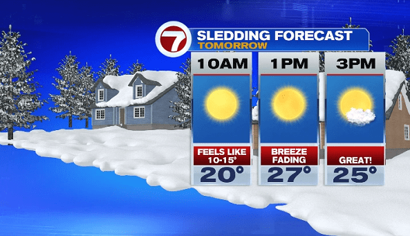
Highs tomorrow will be in the upper 20s with the return of sun-filled skies.
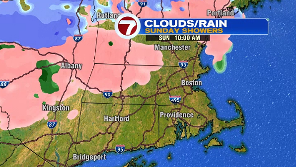
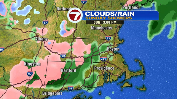
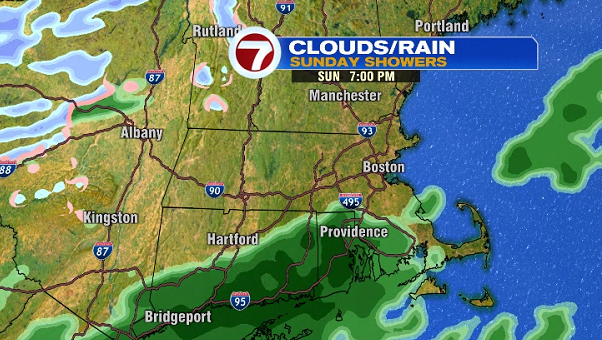
Shower chances return Sunday. With temperatures hovering around the freezing mark, we could see some freezing drizzle for southern NH and for the Rt. 2 Corridor, so we could see some slick spots. Otherwise, we’ll see some scattered rain showers Sunday through the afternoon.
The sunshine returns Monday with highs into the mid-20s, followed by a bitter blast Tuesday and Wednesday with highs into the teens to around 20°. Snow showers slide in for Thursday followed by a sunny end to the work week.