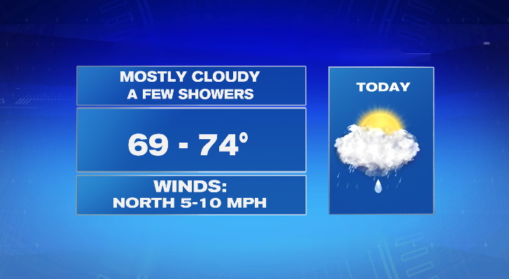
Go figure. Another gloomy, damp, and cool day in July on tap for today. Temperatures will top out about 10 degrees below average with mostly cloudy skies and on-and-off showers.
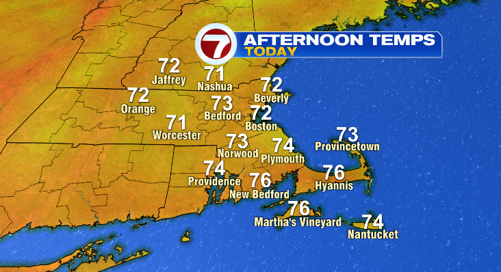
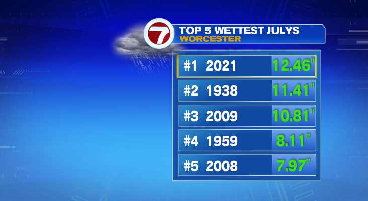
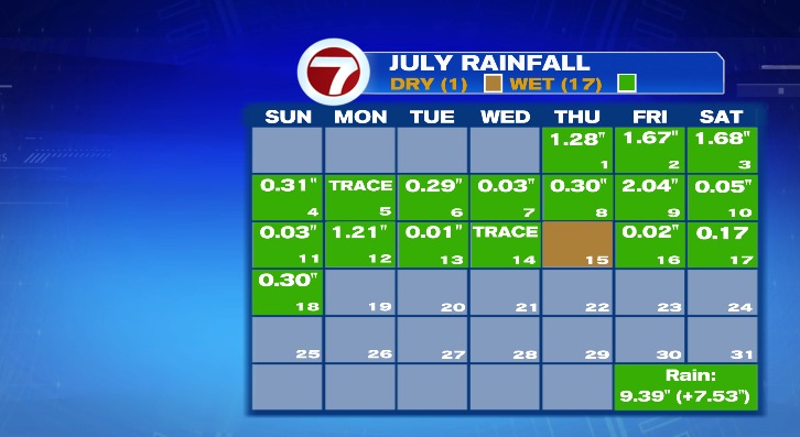
There’s good news and bad news with the rain. The bad news is we just don’t need another drop. The good news is what we do see will be light and spotty. Best chance at anything heavy will be in SE Massachusetts where things haven’t been quite as wet and are more capable of handling a bit heavier rain. This past weekend was another day with INCHES of rain in Worcester County and back to the Berkshires. In fact, Worcester has now secured the top spot for wettest July on record. What makes this even more incredible is #2-5 take into account all 31 days! We’re in the top spot with 1/3 of the month left to go.
In Boston, we’ve had rain every day except one this month. And it’s certainly possible we fill most (if not all) of the boxes this week with green squares. We have spot showers in the forecast today, tomorrow is mostly dry and hot but can’t rule out a pop up storm in the afternoon/evening. The best chance of rain this week is likely on Wednesday.
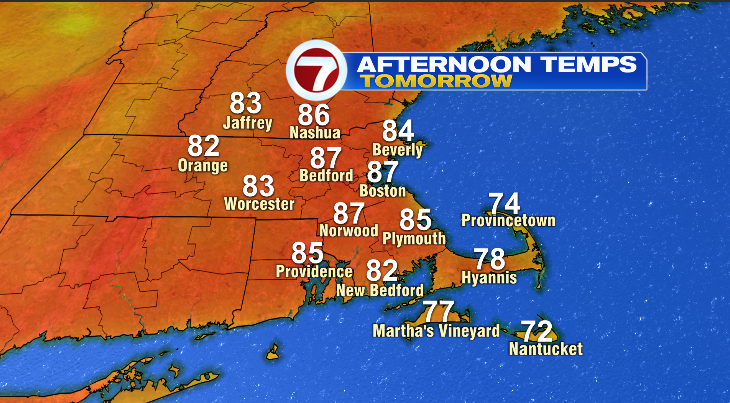
Despite that pop up storm chance tomorrow, it will be a very July-like day… finally! We’re looking at sunshine and warmth with highs well into the 80s!