7Weather- Wednesday is a nice, spring day, and then rain arrives to end the week.
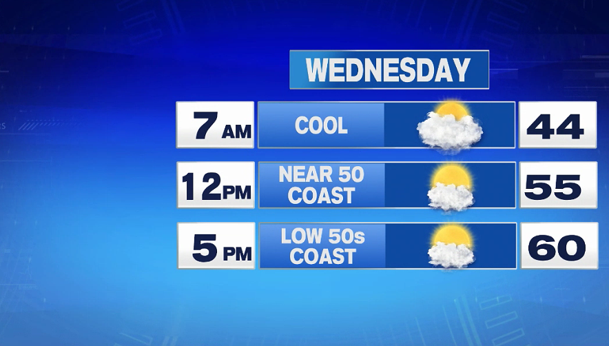
It will be a cool and cloudy start to the day tomorrow with temperatures in the 40s in the morning. The sun comes out by lunch time, allowing us to jump into the mid 50s inland, but the coast will be a bit cooler with an onshore wind. Highs make it into the low 60s inland, and into the low 50s along the coast.
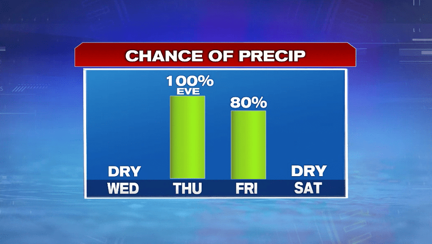
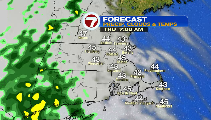
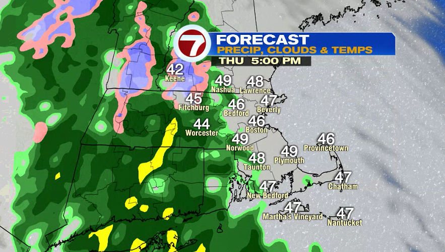
Thursday starts dry and cool in the 40s. We’re stuck under the clouds all day, and we highs eventually make it into the low and mid 50s. Showers start to move in before sunset. The evening commute will likely have a few, light showers, and then the steady rain arrives after sunset.
Rain will be steady Thursday night into early Friday morning. Higher elevations in Worcester County and parts of southern New Hampshire could see rain flip to snow for a couple to few hours Thursday night. There could be a slushy 1-2″ on unpaved surfaces in these areas. That snow will get sloppy and messy as we switch back to rain. There shouldn’t be too much impact on travel Friday morning, but you’ll want to give yourself extra time if you’re in northern Worcester County.
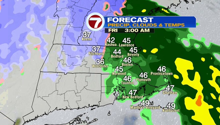
By Friday morning, it’s more about a few puddles that will be around from the rain overnight. We won’t get an overwhelming amount of rain, so flooding is not a concern. This will be beneficial rain for southern New England.
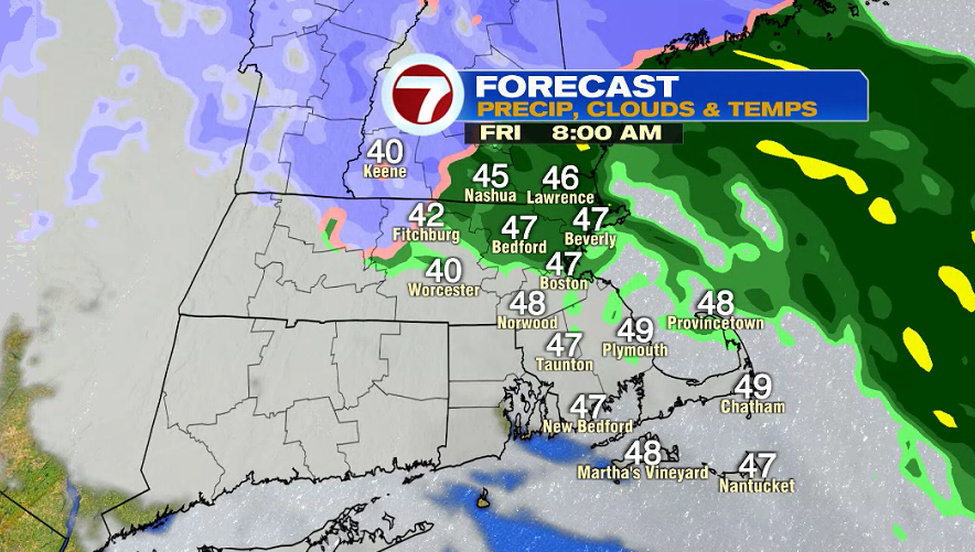
Expect a windy Friday with on and off showers in the morning. By the afternoon, it looks like we’re just left with light showers and patchy drizzle. Highs only make it into the mid 40s.
In total we will get anywhere from 0.75″-1.50″ of precipitation Thursday evening – Friday.
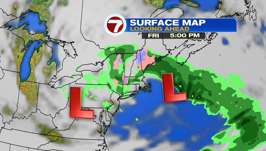
Lots of clouds are around on Saturday, and it remains windy in the morning. Highs reach into the low 50s. Sunday is the better day of the weekend with partly sunny skies and temperatures in the 50s.
