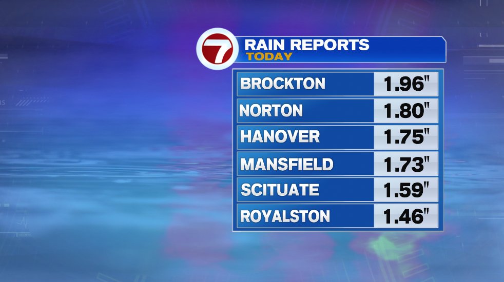
We had a soaking day today with heavy rain at times. Many towns picked up over an inch of rain with some even approaching two inches! The rain reports below are from 2pm so totals when the rain finally winds down will be higher than what you see here.
The rain we had today was along a cold front and it’s a potent one. You will feel the drastic drop in temperatures tomorrow as a blast of temperatures comparable to late October and early November move into southern New England. On top of the cooler temperatures, the wind will put an added bite in the air. Winds tomorrow could gust up to 35 mph at times.

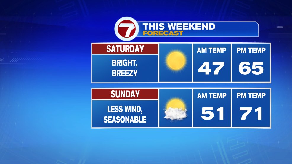
It will stick with us for the weekend as well but it won’t be quite as dramatic. Saturday is actually a fantastic fall day with tons of sunshine and temperatures in the mid 60s. We’ll keep the breeze on Saturday though it won’t be as bad as Friday. Sunday also looks great with increasing clouds and perhaps a shower but not until after sunset so day time hours will be dry. The breeze will also back down on Sunday.
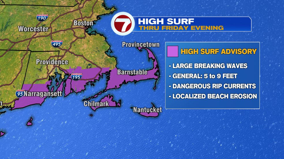
Not that this weekend is a beach weekend with temperatures in the 60s but if you live on the water or plan for a quick beach walk, water conditions will be pretty poor Friday and into Saturday. With Hurricane Fiona passing offshore it will churn of the waves and send that rough surf into southern New England. Large breaking waves of 5-10 feet are expected with dangerous rip currents and even localized beach erosion.