Fall temperatures have returned for the second half of the weekend after a cold front pushes off the coast. That cold front brought some rain showers to the region late last night and has cleared the region for our Sunday morning.
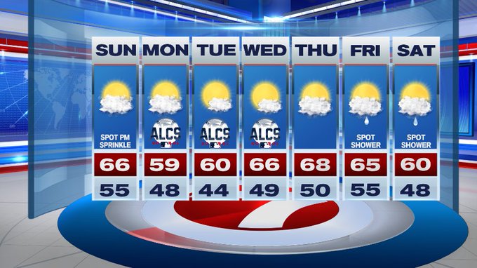
Later this afternoon, we’ll see a few more clouds building in and we can’t rule out a spot sprinkle with some of these clouds, otherwise it will be dry with highs in the mid to upper 60s, which is closer to seasonable compared to yesterday.
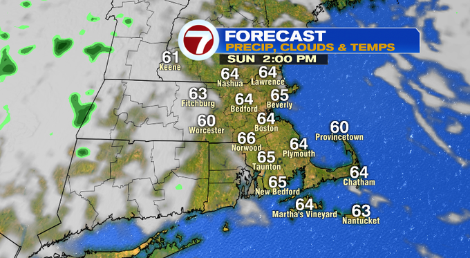
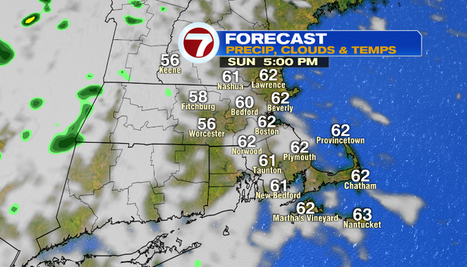
Tonight, we’ll be mostly cloudy with lows dipping in to the upper 40s for central MA and southern NH, low 50s closer to the coast.
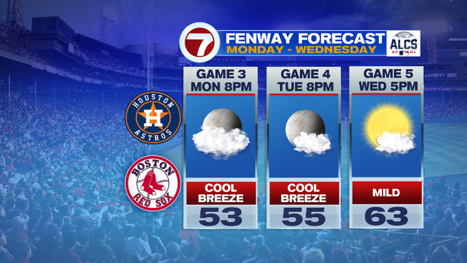
Similar to today, Monday features some sun to start and then clouds fill in again in the afternoon, however high temperatures will be a touch cooler, in the upper 50s! If you’re heading to Game 3 of the ALCS at Fenway, you’ll need the jacket as temperatures at first pitch will be in the low 50s and likely falling back into the upper 40s by the last out.
Tuesday is breezy with highs around 60° under mostly sunny skies.
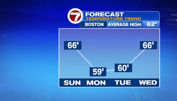
Dry conditions continue through the middle of the week as high pressure keeps us quiet. We’ll see a slight warm-up Wednesday and Thursday with highs into the upper 60s. A spot shower chance returns Friday and Saturday.