It definitely feels like fall when you step out the door early this morning. Most towns fell down near 50° this morning with a few dipping into the upper 40s! This fall like morning will lead to a fall like afternoon. Dew points are down in the 40s, giving us that crisp feel to the air. Humidity will stay low today, temperatures will climb to the lower 70s and we’ll see a ton of sunshine!

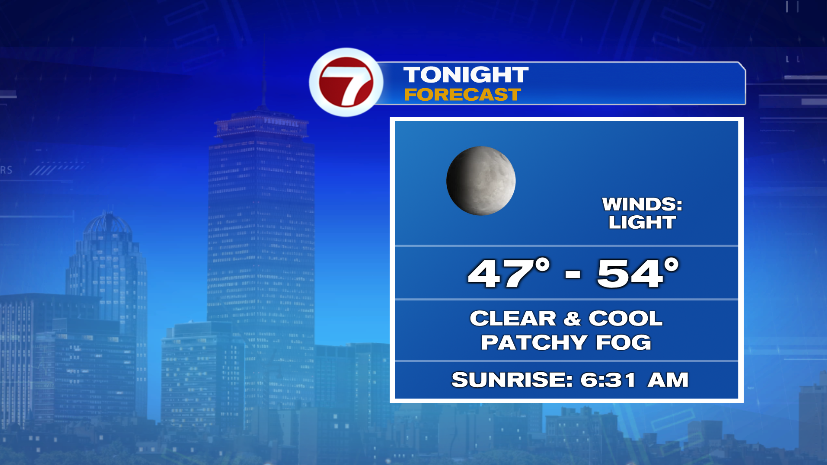
Tonight will be another fall like night. Clear skies will lead to temperatures falling to near 50 once again. Like this morning, there could be some patchy fog, but this morning that fog is VERY localized and not dense.
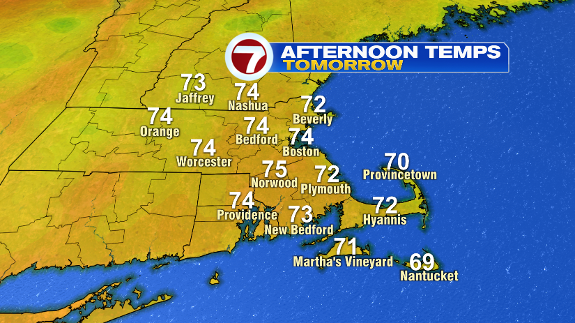
That will be followed up by another beauty of a day tomorrow. Today will be hard to beat, and is probably the pick of the entire week, but Tuesday’s great too! Partly cloudy skies and a touch warmer for Tuesday but humidity will remain nice and low.
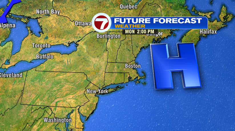
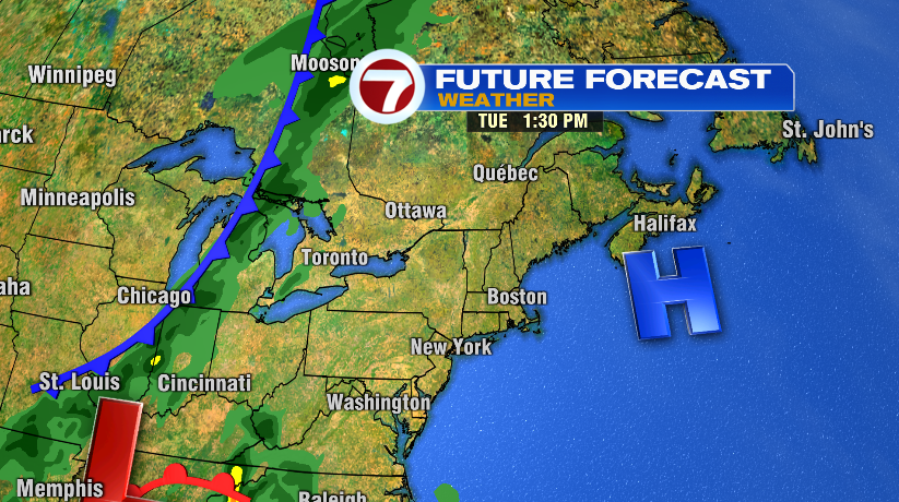
This is all thanks to a large area of high pressure sitting over head and that will keep skies clear, temperatures in check, and humidity low for the next few days. As that high slides out that will lead to rain chances increasing by the end of the week. Right now Wednesday’s rain chance is nothing more than a light spot shower, so we’ll have to watch Thursday and Friday for a few showers and storms returning.
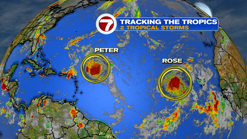
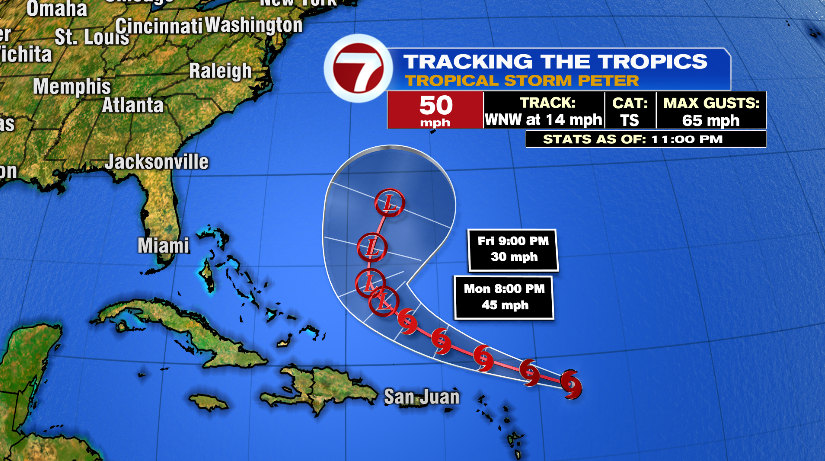
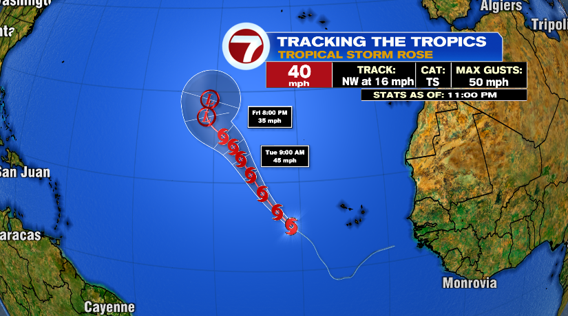
The tropics remain active as well. Two new systems forming over the weekend in the Atlantic will stay in the Atlantic. Both Tropical Storm Peter and Rose will stay out to see and not impact the United States — though Bermuda will need to watch Peter.