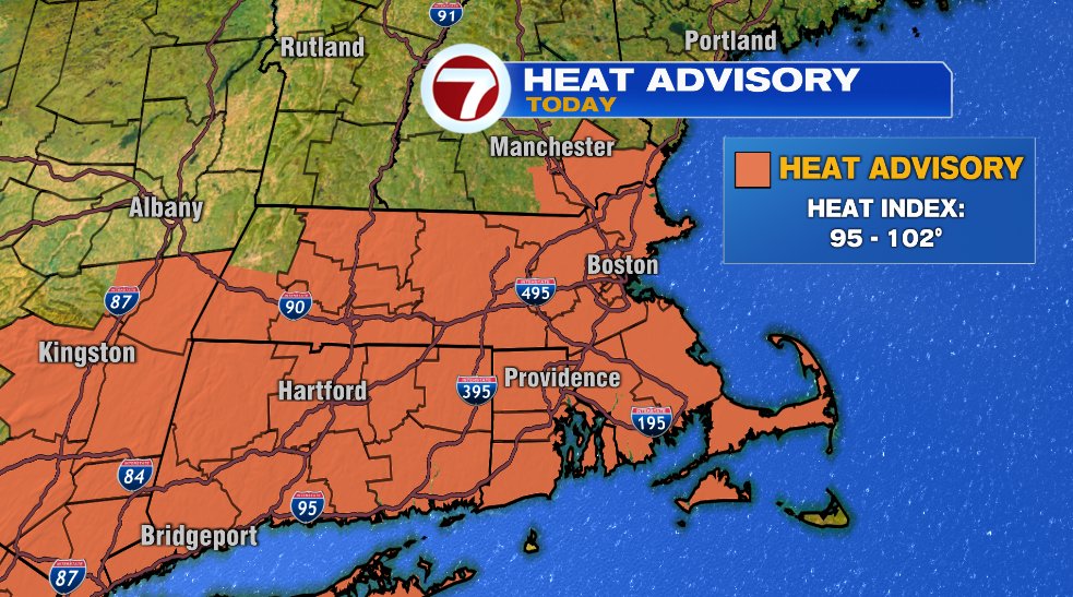
It’s been a long time coming but the extreme heat is finally coming to an end after today. That said, it’s still hot and humid today which will make feels like temperatures return to 100° so the heat advisory rolls on for one more day.
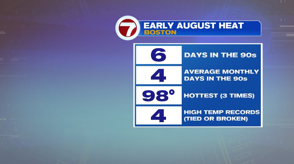
Yesterday Boston set a record for the daily high temperature, hitting 98°.

The first eight days of August (about to be nine) have been incredibly hot. In the first eight days, we’ve hit 90° six times! Today will be seven. In an average August we hit 90° four times ALL MONTH! Boston has hit 98° four times this month which was good to either break or tie four high temperature records. This all ends after today.
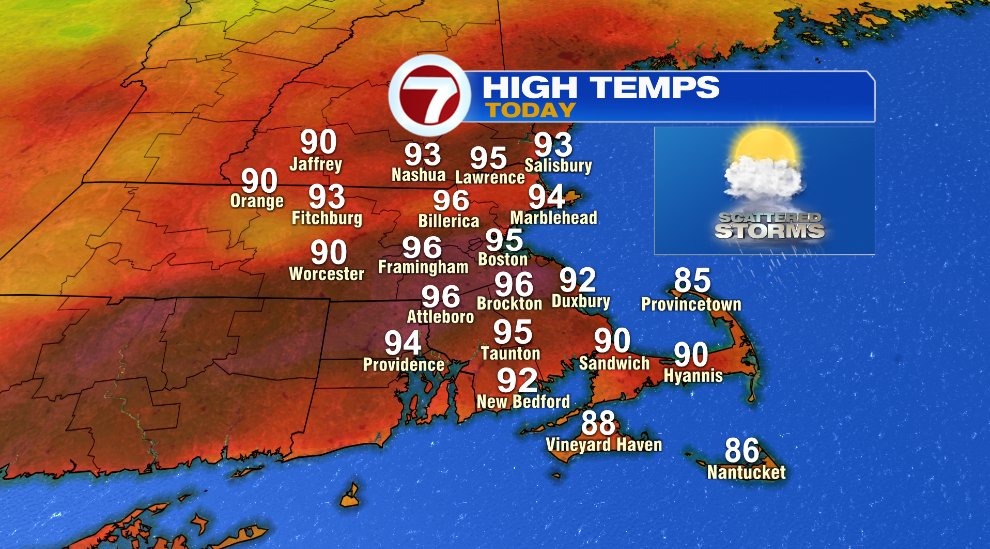
We’ll get another 90 degree day today with numbers soaring to the middle 90s before storms arrive this afternoon and evening.

As the cold front slides into the heat and humidity, it’ll spark a few scattered storms this afternoon and evening. Like most of the storms we’ve seen in the past week, they will be isolated/scattered and not everyone will see rain, but those that do see a storm pop up, it’ll have the potential to be strong or severe with all the “juice” in the atmosphere. Initially the storms will be isolated (early afternoon) and become more scattered by early evening.


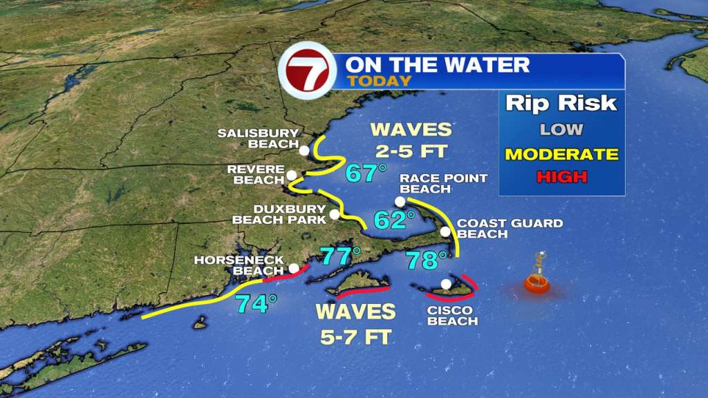
With the heat today it’ll be a good beach day but be cognizant of a few things. First, the risk of a few storms through the afternoon and evening. Lightning is always dangerous whether a storm is severe or not. Second, water conditions are not ideal — especially on south facing beaches. There, there’s a moderate risk of rip currents and surf is pretty rough. Seas will be 5-7 feet today.
The heat breaks for Wednesday but the humidity will take a little longer to exit. The humidity will slowly exit on Friday but just in time to set up a near perfect weekend.