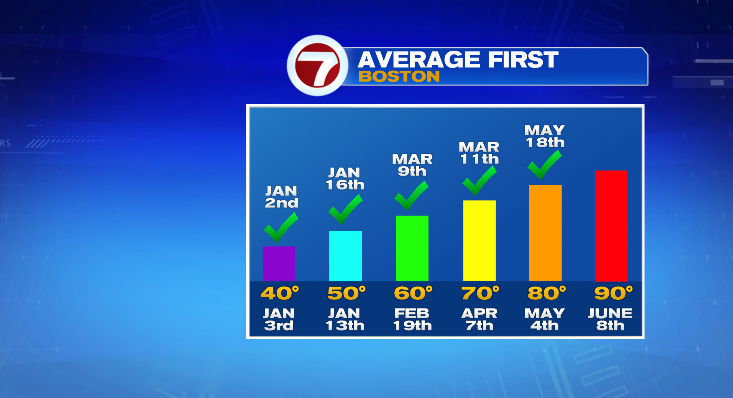
Well we waited about 2 weeks past the average first 80° day in Boston but we finally did it!
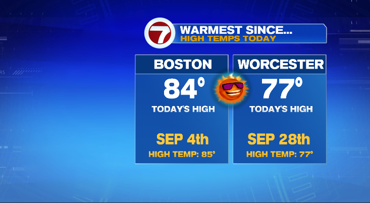
Today’s high of 84° in Boston was our warmest day since September 4, 2020 when our high was 85°. Unfortunately for those of us in Worcester, we’re still waiting for that illusive 80° high temperature. Either way, today was a fantastic day. The high there was 77° which also makes it the warmest day since September of last year.
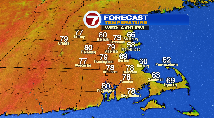
Highs all across the area today hit the 70s and 80s. Beautiful stuff.

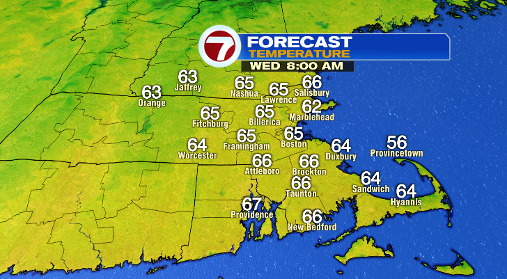
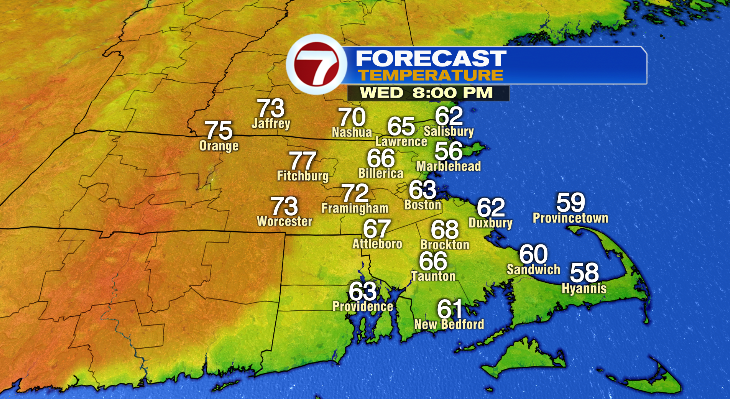
So will we do it again tomorrow? Well, that depends where you’re reading this from. Inland spots (Worcester I’m looking at you), you have another shot at 80° tomorrow! Unfortunately for those on the coast, an east wind will keep our highs in the low 70s, with most of the day spent in the 60s tomorrow. But we’ll still have the sunshine and temperatures will still be above average.

That east wind will gradually push the cool air west through the day. We’ll all start out in the 60s and warm uniformly for a few hours. By 11am or so, we may have a brief jump to the 70s on the coast, but that will quickly drop to the 60s. And those 60s will keep advancing west through the afternoon and evening.

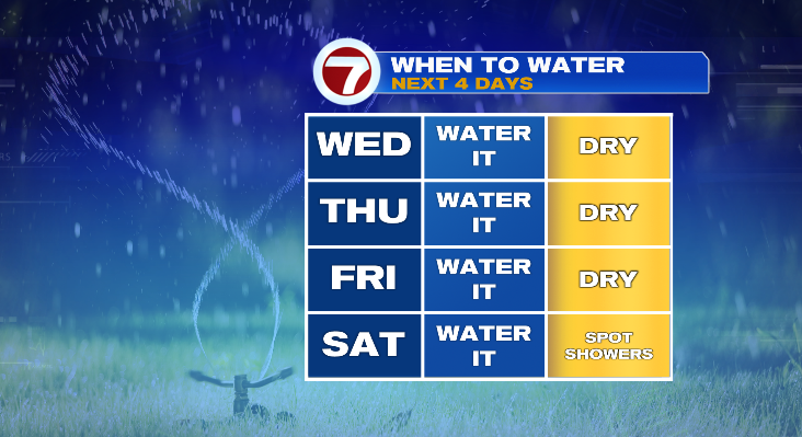
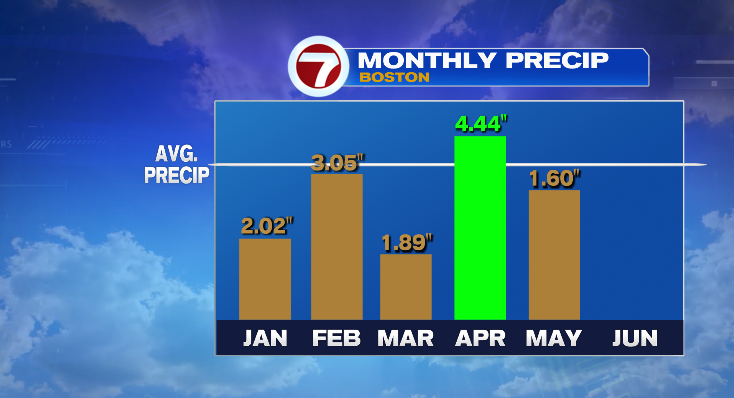
There’s no shortage of warm air in the forecast but there is a shortage of rain. With the sunshine and warm air the ground is baking and drying out fast. In fact, despite the soggy start to the month of May, we’ve now fallen below average on the monthly tally. So while early this month we were chipping away and the early year deficit, now we have to make up for May’s own deficit.
So if you planted grass or flowers get those garden hoses and watering cans filled and ready. No real rain chances in the forecast until a few showers Saturday. Even then, you’ll probably still want to water on Saturday.