We’ve had some showers today, but today is only the start of a rainy stretch before a total switch-up in our pattern!
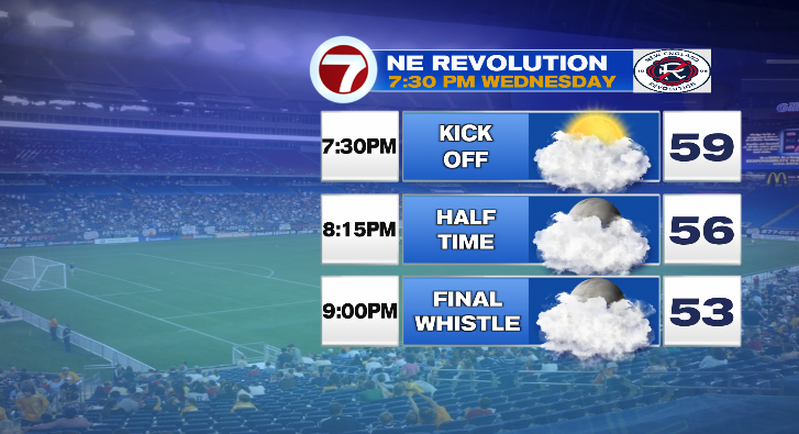
Let’s start with the rain the next few days. The rest of our Wednesday will be mostly cloudy and cool. Temperatures this afternoon were slightly below average, and it will be a touch cool throughout the evening. Keep that in mind if you’re headed to the Sox game or the Revs game this evening– it’ll be dry, but feel cool between the breeze and temperatures falling through the 50s.
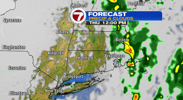
Temperatures as we head into tonight will be in the upper 40s– right on the money for this time of year. That’s how we’ll wake up on Thursday morning, along with continued cloud cover and, eventually, more showers.

We’ll see a few showers, mist & drizzle early in the morning, but heavier rain will move west to east as we head through the mid/late morning and into the afternoon.

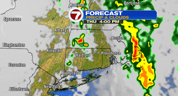
We could also hear a few rumbles of thunder with this round of rain as well, particularly in the mid afternoon. Areas with the heaviest rain/downpours are looking at 1-2″ of rain by the end of the day. Highs will be in the low 60s.
We’ll see a few remaining showers on Friday, and clouds will hang around throughout the day. It’ll be a cool, somewhat raw-feeling spring day with temperatures only in the mid 50s– roughly 10 degrees below average for this time of year. However, this is where the dreary, cool pattern ends and the warm weather begins!
High pressure starts to build as we head into the weekend. This will keep us largely dry, barring a potential shower or two Sunday (limited potential there). Highs will be in the 70s on Saturday, and the upper 70s and low 80s on Sunday! But wait– there’s more!
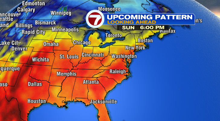
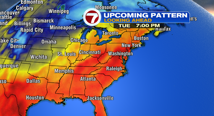
While we may see a brief “cool down” on Monday as temperatures fall back to the 70s, we bounce back with an even warmer, in fact downright hot day on Tuesday with highs in the mid to upper 80s possible. Talk about a taste of summer!