Have outdoor plans this evening? The summer feel to the day will linger through sunset this evening, with temperatures by 7PM still in the mid to upper 80s inland, low 80s at the coast, 70s SE MA, 60s along the Cape, so it ultimately depends on location. Low level clouds and some patchy fog will develop over the South Coast and the Cape and Islands later this evening, too, and continue to linger through the overnight.

Overnight, temperatures will slip back into the mid to upper 60s and you’ll still notice how the humidity lingers, too.

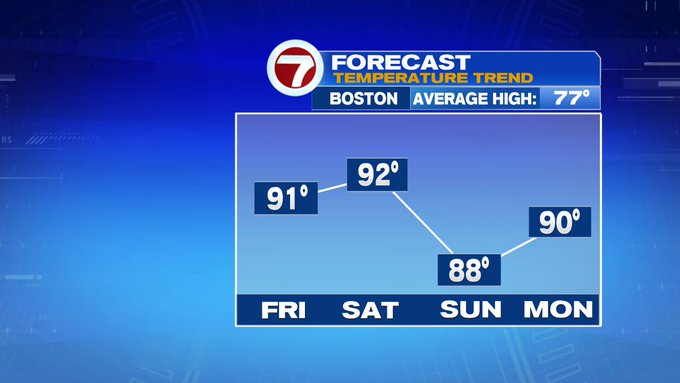
Tomorrow is Friday (I know, it’s been a long week). Friday brings the heat and humidity, with highs into the low 90s inland (phew!), mid to upper 80s for Boston and the South Shore, with the coolest temperatures felt along the Cape and Islands (if you’re looking for the relief from the heat, the Cape and the Islands are the places to be).

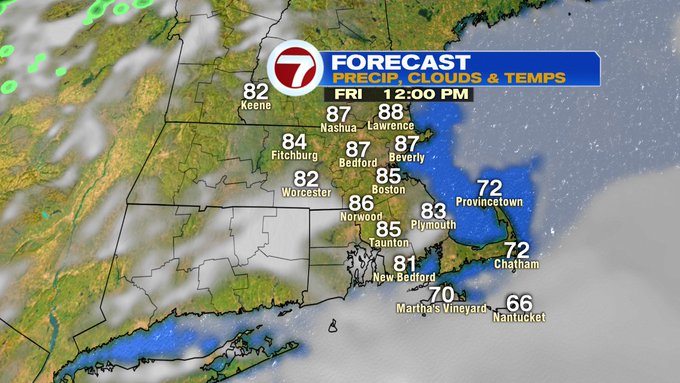
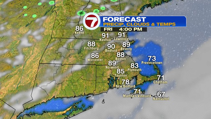

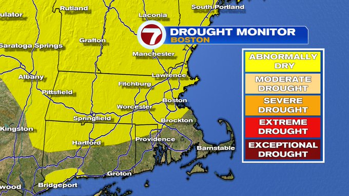
We’ll see a mix of sun and clouds for Friday, making the 8th day in a row that we’ve been dry across Southern New England. As of today, we’re already an inch and a half below normal for the monthly rainfall.

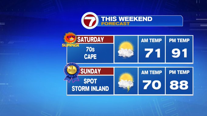
This holiday weekend, we have the Summer Solstice Saturday and Father’s Day on Sunday, and Saturday will certainly FEEL like the first day of summer.

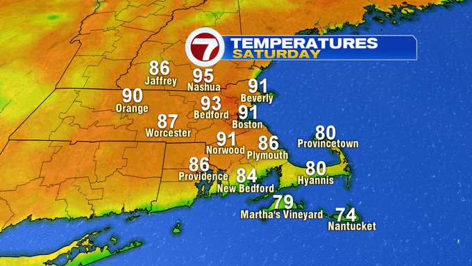
In fact, both weekend days feature near 90 degree heat as well as a mixture of sun and clouds, while Sunday features a chance for a thunderstorm inland in the afternoon (if you’re Sunday plans take you to the coast or the Cape, you’re looking at dry conditions).


The 90s seep into the start of the next week (away from the coast). The next chance for some spotty thunderstorms returns midweek, with scattered storms returning by next Thursday.
