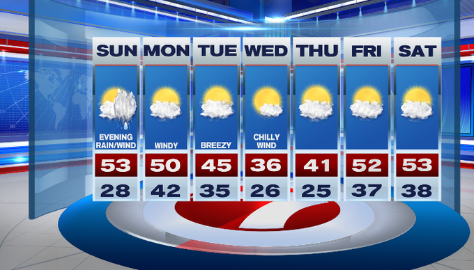
After a clear and cold start to our Sunday, we’ll see increasing cloud cover ahead of rain later tonight. This morning lows dipped into the lower 20s for some, making for a frosty start, but temperatures will warm back up into the upper 40s to low 50s today.

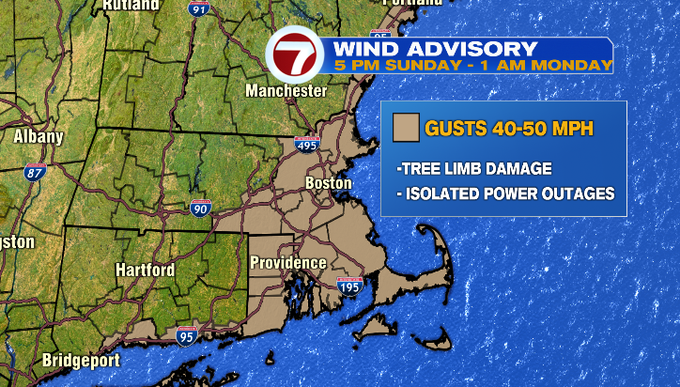
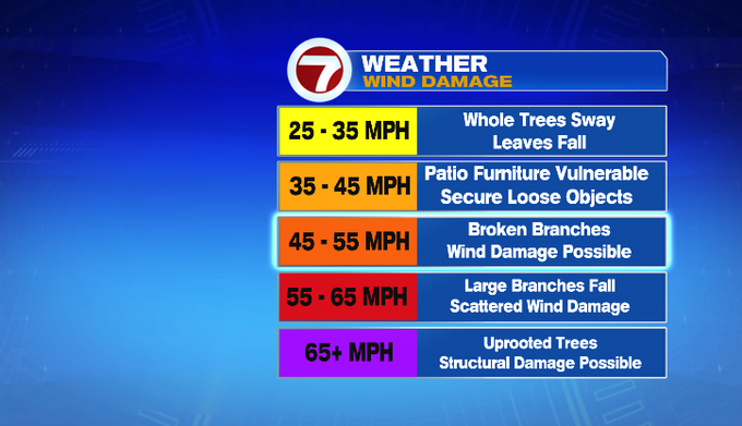
A Wind Advisory has been issued from 5PM Sunday through 1AM Monday for the NH seacoast, southern Worcester Co, eastern and SE MA, and the Cape and Islands due to gusts up to 50 MPH. This could bring down tree limbs and cause some isolated power outages so be sure to charge your phones ahead of time and secure your outdoor patio furniture, trash bins, and decorations too.
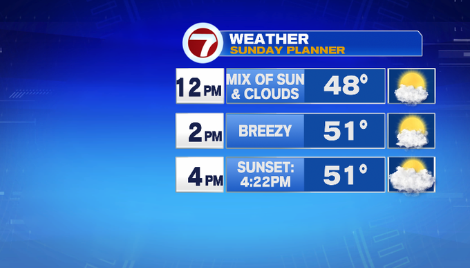
Today is an overall decent day ahead of the heavy rain and gusty winds that move in later this evening. Through sunset, we’re looking at partly to mostly cloudy skies as winds pick up to 10-20 MPH out of the southeast.
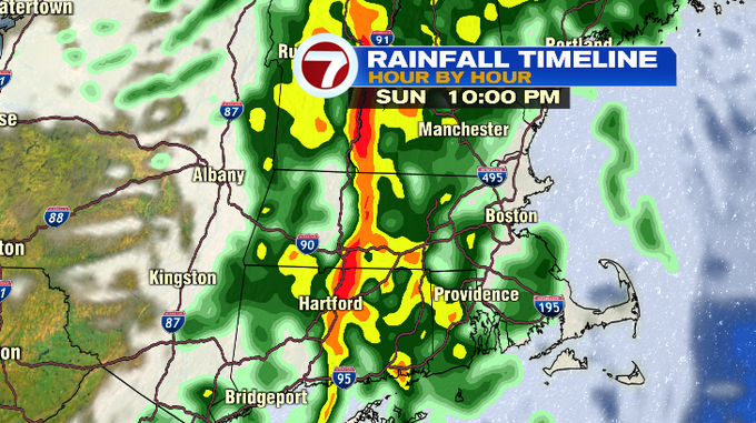
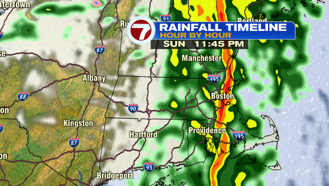
The rain starts to move in as early as 7PM, with the heaviest band of rain (which could include thunder) around 10PM for Worcester Co., 11:30PM for eastern MA and the coast including Boston, 1:30AM for the Cape and Islands. The line of heavy rain will also bring the strongest gusts ahead of it, where 40-50 MPH gusts are expected from 10PM to midnight across much of the viewing area.

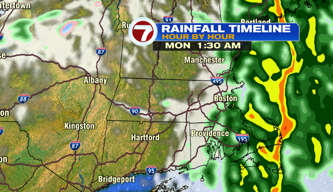

The rain moves out as early as 2AM Monday, with the wind sticking around in the 30 MPH range for Monday morning’s commute.
Colder air moves in midweek with Wednesday’s high into the mid 30s, followed by a warm-up to near normal highs by the end of the week and into next weekend.