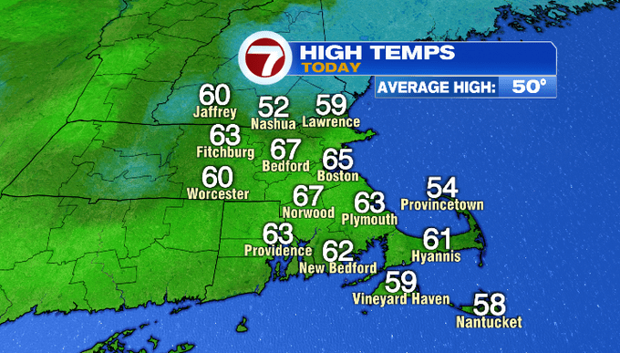
It was a cloudy day, but that didn’t stop temperatures from climbing into the mid to upper 60s for quite a few towns through the afternoon.
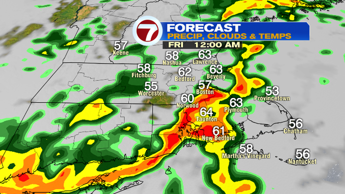
Tonight, temperatures will only slip back into the 40s to low 50s as a cold front approaches, which will allow for showers to spread in with some embedded downpours and an isolated thunderstorm. The heaviest rain moves into Worcester County between 10-11pm, Boston and areas southeast from 11pm – 12am.
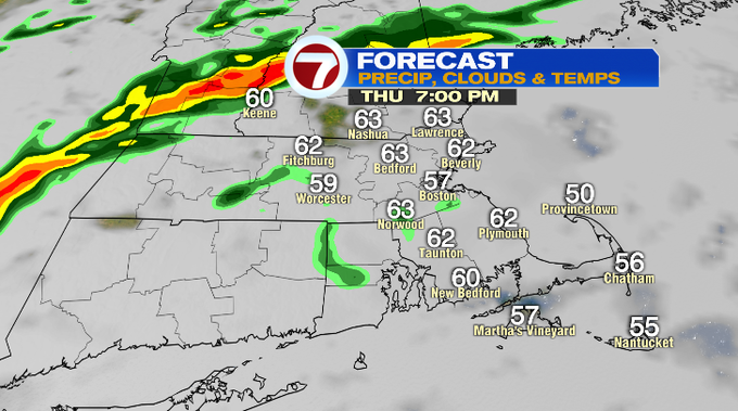
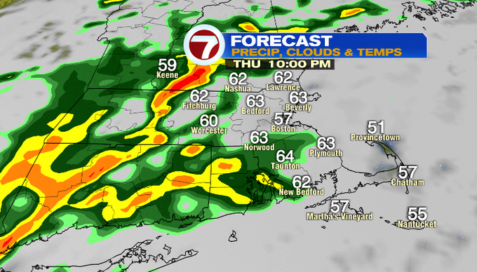
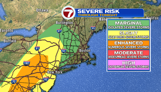
As for the severe potential, that remains west of our area.
The heaviest rain slides out by 2am, with just a few lingering showers through daybreak Friday morning.

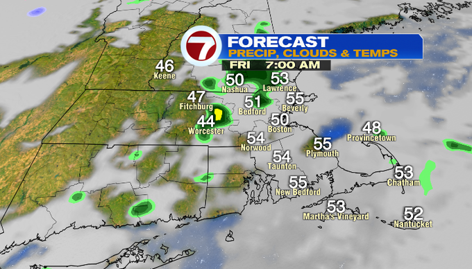
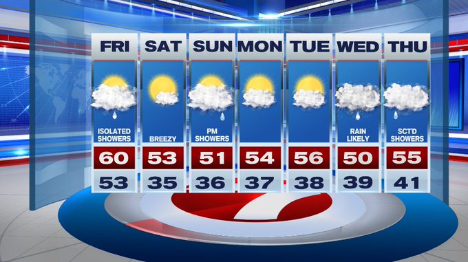
Friday will have isolated showers, but we’re not tracking a washout. Highs top out near 60°.
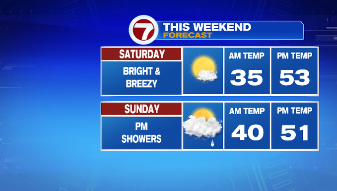
Skies clear out Friday night as winds shift to out of the northwest. It will be a chilly start to Saturday with temperatures in the mid 30s in the morning, which will warm up into the low 50s in the afternoon. Saturday will be the pick of the weekend since it will be mostly sunny. The clouds return Sunday along with afternoon showers.
For the next work week, Monday and Tuesday are dry followed by our next system that brings rain for Wednesday and Thursday.