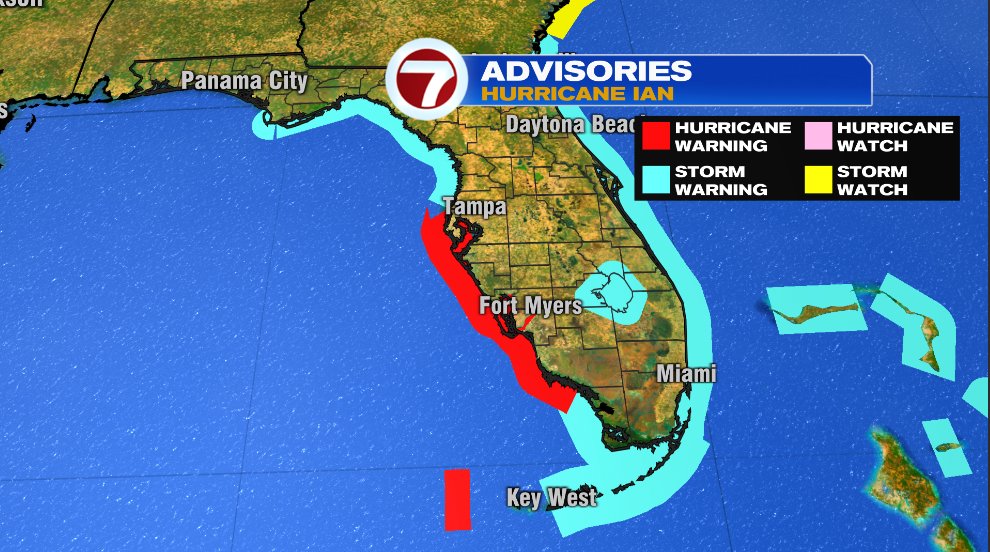
By now you’ve probably heard about Hurricane Ian. It’s a powerful, major hurricane nearing landfall in Southwest Florida tomorrow afternoon/evening. The latest track from the National Hurricane Center has not only a dramatic shift to the southeast but has also sped up to a landfall tomorrow evening. The official track has landfall as a major category 4 hurricane.
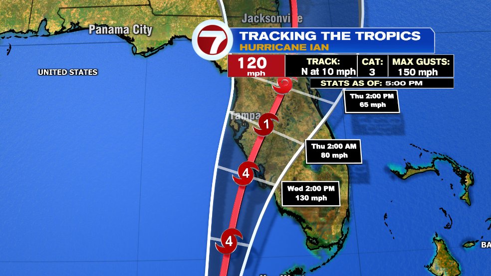
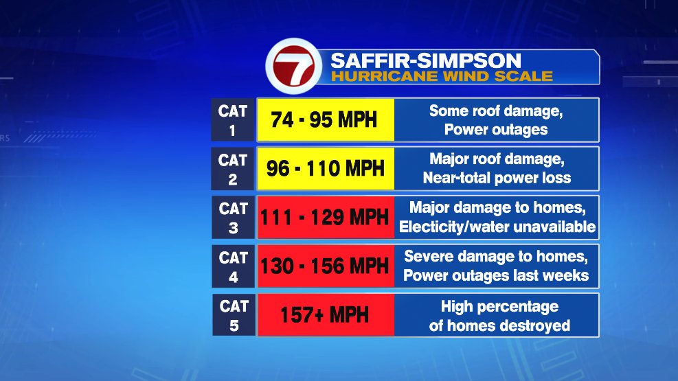
A category 4 hurricane has sustained wind speeds of 130 mph and has the ability to cause significant damage to homes, including power outages that could last weeks. Of course when we think of hurricanes we think of winds. While that is a big threat, it’s not the only threat, and arguably not even the biggest.
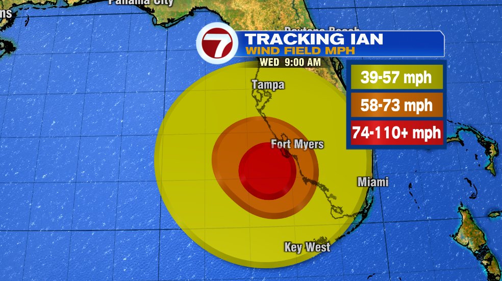
But let’s start briefly with the wind. Hurricane force wind is expected to begin tomorrow morning in Florida. That is just the start of the 74 mph winds (officially becomes a hurricane at 74 mph), remember the forecast is for 130 mph winds. The orange contour is 58 mph winds which, for perspective, is the equivalent of a severe thunderstorm wind gust for us.
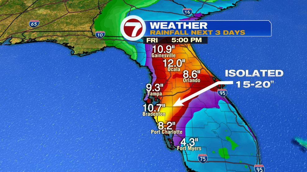
There’s of course a lot of rain. Flooding rains are likely from Tampa to Orlando. Quite a few areas could see 10+ inches of rain with some towns picking up closer to 20 inches.
But the biggest threat with Ian is the storm surge. Storm surge is the actual push of ocean water from the hurricane. The unique way Florida is shaped and the angle at which the storm will hit is a recipe for disaster. Storm surge in spots could be 8-12 FEET. Yes, feet. That’s in addition to any rain that falls with the storm.
