

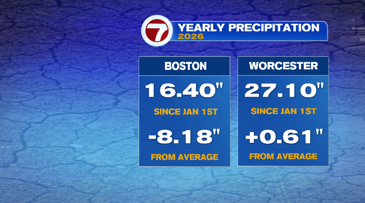
Another dreary day behind us, though today’s rain hasn’t been as robust as what we saw on Wednesday. The silver lining of it all is that this has been a tremendous help when it comes to the precipitation deficit in central and western Massachusetts. In fact, Worcester is back in a precipitation surplus for the first time since January!
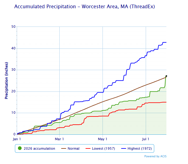
As for Boston? Cities east of 495 still have some work to crack that deficit.. but July has been, overall, an above-average month when it comes to rain.
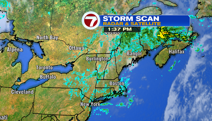
Looking ahead? Rain chances go down significantly for Friday and the end of the week. They’re not zero, but it’s nothing like what we’ve dealt with the last few days.
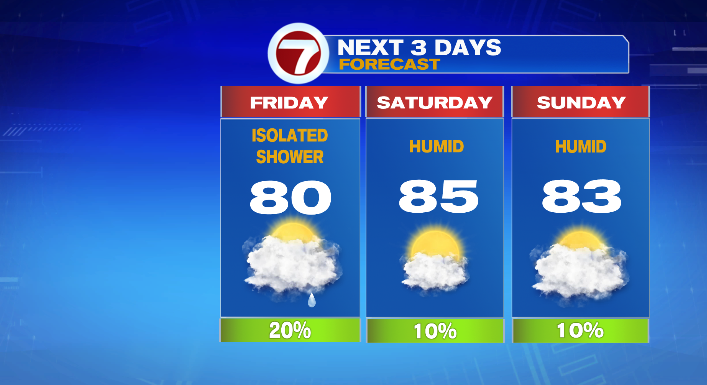
Starting with Friday, we still have a chance for a few pop-up showers and a storm, mainly in the afternoon. Precipitation won’t be widespread, but again, it won’t be perfectly dry. If you absolutely hate the rain, have an umbrella or a rain jacket on hand (especially as any thunderstorms that do set up will likely have downpours). Otherwise, it’ll be a warmer, still muggy day, but with a mix of clouds and sun. Temperatures will be in the upper 70s for most, though the warmest spots will hit the low 80s.
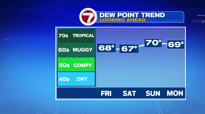
Saturday and Sunday rain chances go down even more. Both weekend days look mainly dry but muggy. Dew point temperatures will be in the 60s and 70s, while air temperatures will be in the 70s for the coast and low 80s inland. We’ll have a mix of sun & clouds on Saturday, and rain chances are limited to a (very) isolated shower. On the flip-side, Sunday’s rain chances look even slimmer, though the day will be cloudier than Saturday will be.
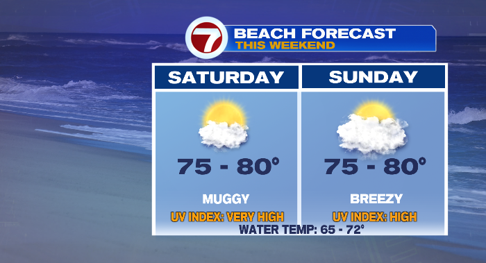
If you’re looking to make it a beach weekend, remember that while the coastline will also be humid, it’ll be sliiiightly cooler than areas inland, and breezy on Sunday.
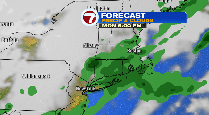
The next chance for more widespread/impactful rain will be Monday as a cold front comes through. This front will spark showers and storms, leading to a soggy day.
However, it could also be the catalyst for a switch-up in the feel outside. Right now we’re looking at one of two scenarios– the first is that the front moves through the region on Monday, leaving us by Tuesday morning. This would give us a drier feel for Tuesday and Wednesday. The second scenario is that the front stalls– should this happen, we’ll be stuck in a muggier stretch including pop-up showers and/or storms until midweek. We’ll keep you posted throughout the next few days!