Yes, we’ve got ANOTHER Nor’easter right on the heels of last week’s storm. But our midweek Nor’easter is a totally different animal than what we saw last week. Before I jump into that forecast, I’m going to first touch on today’s forecast.
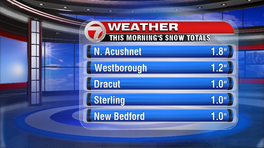
We saw some early morning snow showers that brought a coating-1″ for most of us, with a a few lucky ducks grabbing just about 2″ of snow (mainly across SE Mass.). Some roads may be wet/slushy this morning, so watch out for slick spots!
At this point the snow has mostly wrapped up, but SE Mass. still has the slight chance for an isolated flake through about 9AM.
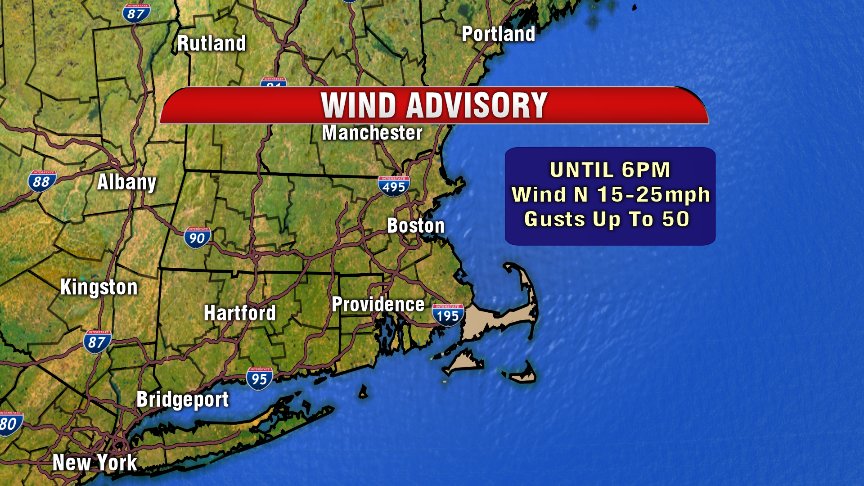
As high pressure build in from our WNW, we’ll kick out our cloud cover, with mostly sunny skies. Although temperatures will be normal for this time of year (in the low-40s in Boston), we stay blustery throughout your Monday forecast. Strong winds out of the north will make for a chilly forecast as we spend much of the day with wind chills in the 20s.
A Wind Advisory is in effect for the Cape & Islands through 6PM tonight, with isolated power outages possible.
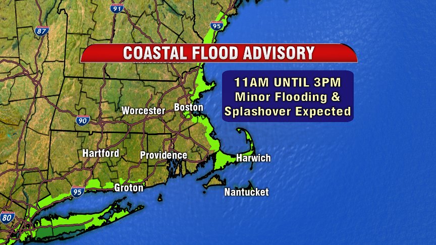
We’re also still dealing with some minor coastal flooding concerns as our last storm is still close enough to bring us storm surge of 1-2 feet at midday high tide.
Alrighty…NOW let’s get to talking about our next Nor’easter! Nearly all of Southern New England is under a Winter Storm Watch Wednesday AM through Thursday AM. The main threat with this storm will be heavy snow, especially NW of I-128 where 6-12″ of snow is possible.
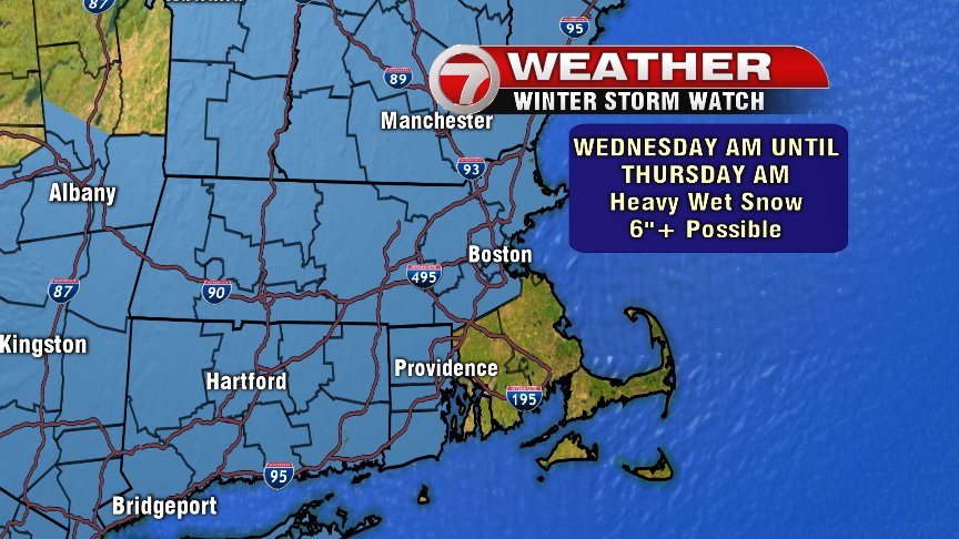
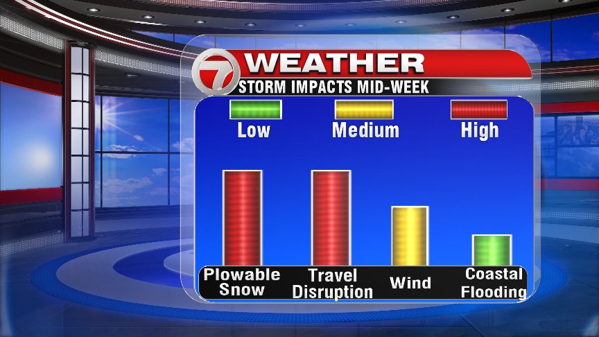
Unlike last week’s storm, the main threat with this Nor’easter looks to be snow. SE Mass. is not part of this watch, because they’re likely to see pretty low snow totals as a rain/snow line sets farther NW of SE Massachusetts (meaning rain and a mix for SE Mass).
There is still uncertainty as to where that rain/snow line sets up, which will have a major impact on snow totals. We’re likely looking at a storm that produces a very steep and narrow cutoff with respect to snow totals.
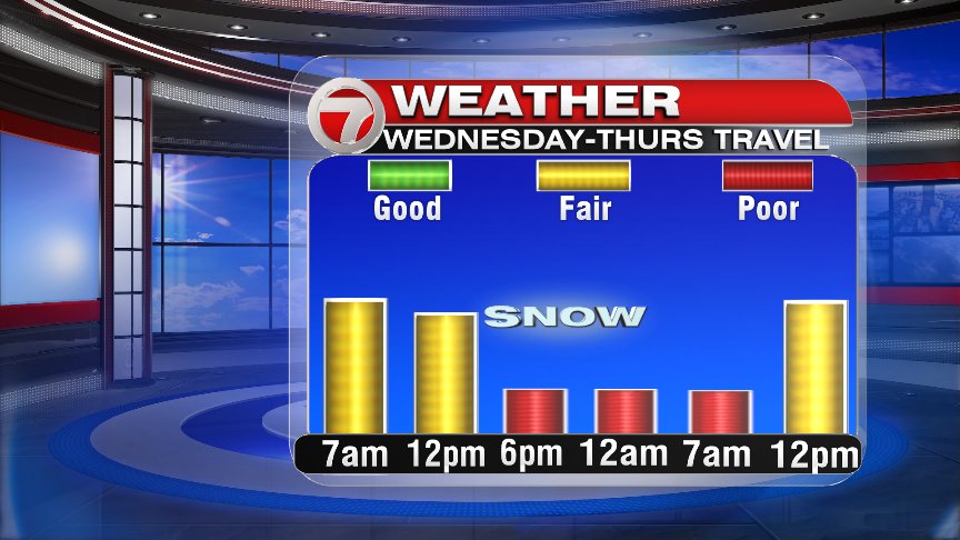
Snow moves in Wednesday morning, and is pretty light at first, intensifying into the afternoon.

The heaviest snow falls Wednesday evening into the overnight hours.
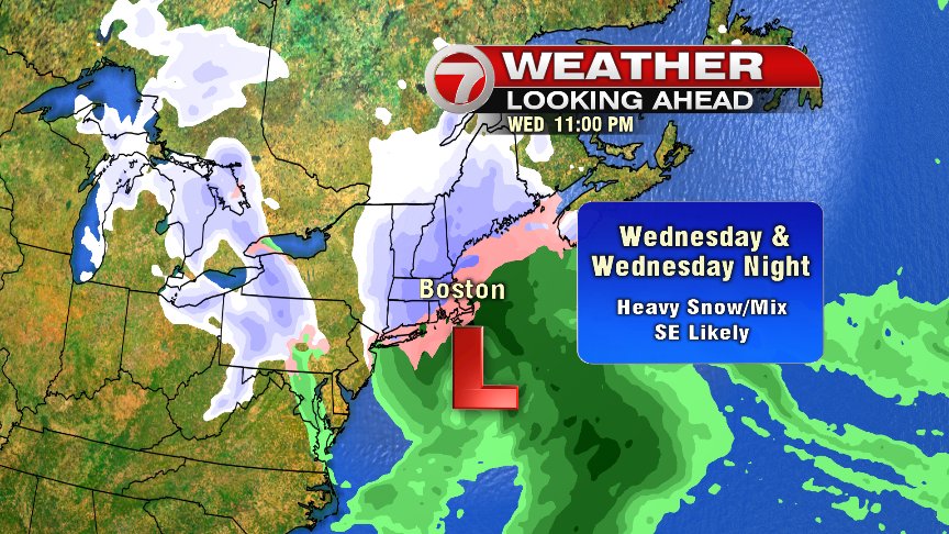
Snow starts tapering even by 7AM Thursday. We keep the chance for a few flakes Thursday morning, with the chance for a few light snow showers and rain showers in the early afternoon.
March madness looks to be firmly in place into next week too….
~Wren