After pockets of downpours and even some thunderstorms rolled through earlier this morning, we’ll continue to notice these pushing off the coast, allowing for drier conditions and eventually some sunshine emerging from south to north through midday.
As of 6am, after the thunderstorms moved off the coast of Plymouth Co., rainfall amounts stretched close to 1.5″ or more. Elsewhere across the region, totals ranged from a tenth of an inch for Boston and the Outer Cape to over an inch for Fitchburg, Worcester and portions of SE MA.
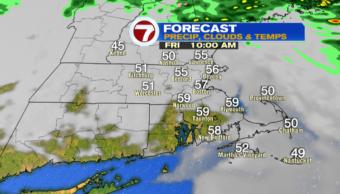
As for the timing of the rain moving out, it will still be wet for much of eastern MA, but these showers will likely be within the 495-corridor and along the coast. By 8am, we should continue to see those showers lift out.

The cloud cover will linger a little longer after the showers move out. By noon, we should break out into some sunshine south of the Mass Pike, and through the afternoon, that clearing will continue to gradually shift northward. The winds will also shift to out of the southwest.

The combination of sunshine and a southwest wind, we’ll see temperatures climb into the mid to upper 60s away from the South Coast, Cape and Islands which will likely stay in the 50s.

The weekend is not completely dry. For Saturday, we’ll have scattered showers, but it will not be a complete washout. You’ll just have to dodge in and out of the showers, mainly in the morning hours. Sunday features just a sprinkle chance, but again, not a washout. Both weekend days will not be nearly as warm as today, but they will both be above normal.

For the start of the work week, the sunshine returns and we’ll see a warm up through the end of the week, especially inland (at the coast, any indication of an onshore breeze off the cooler ocean waters brings those temperatures down a bit — something we always look for with spring forecasting in southern New England).