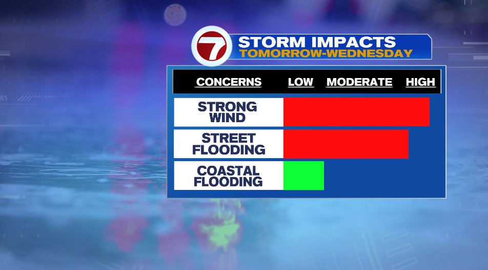
After a gloomy and cool day today, things are really going to pick up tonight and through all the day on Tuesday. Wind, rain, and coastal flooding will all be concerns across the area. We’ll break them down one at a time below.

WIND
Wind will be the biggest concern for many. The wind will get breezy/windy tonight and tomorrow morning but it’ll really take hold tomorrow evening and overnight into Wednesday morning.
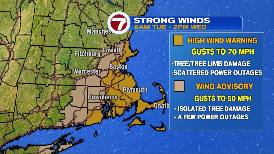
A high wind warning and wind advisory has been issued for the area for the potential of damaging wind gusts that could bring down trees and tree limbs and cause power outages.
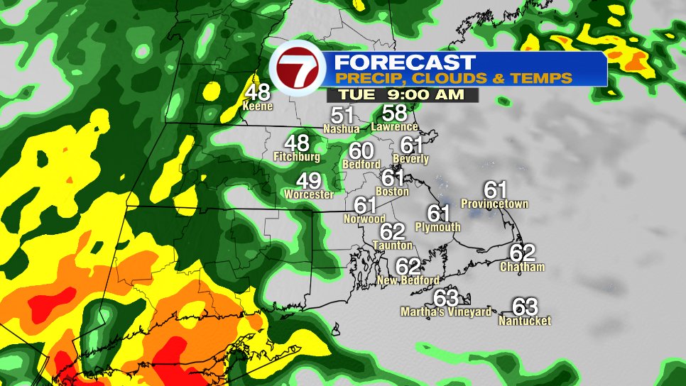
Below is a timeline of the wind gusts, which as you see get breezy by Tuesday morning but really ramp up Tuesday late afternoon and last into Wednesday morning.
Starting tonight at 10PM:
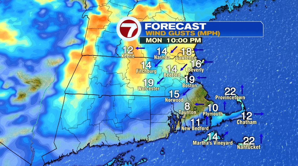
Starting to get breezy for tomorrow morning’s commute, but the winds are not damaging at this point. Tuesday morning at 7am:

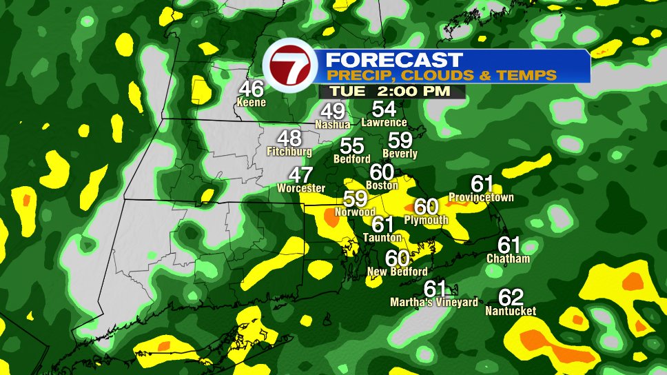
Then things really start to ramp up tomorrow afternoon. Notice wind gusts around 40 mph by 3pm:

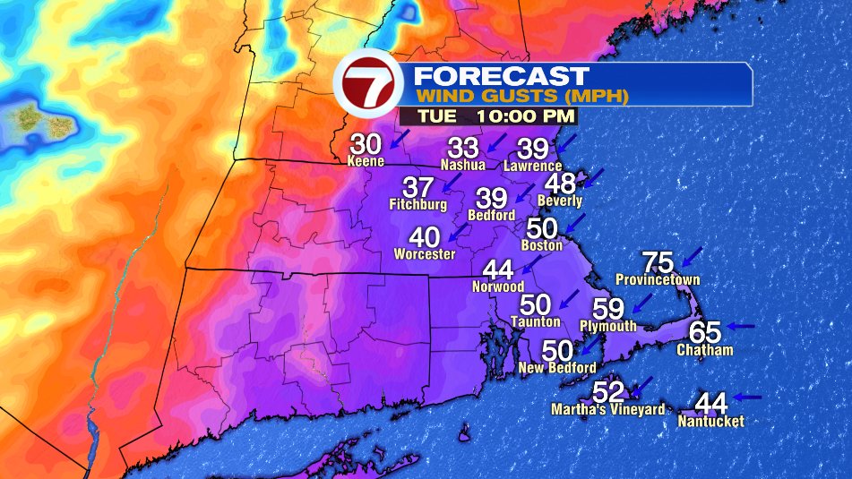
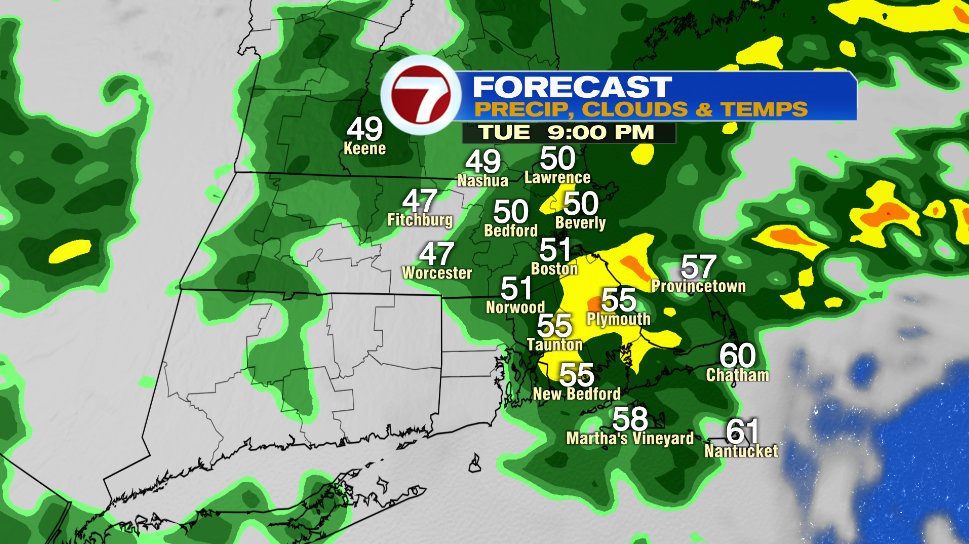
Then tomorrow around sunset and after we get into the peak of the winds. That’s when we could see wind gusts to perhaps 70 mph on the coastline.
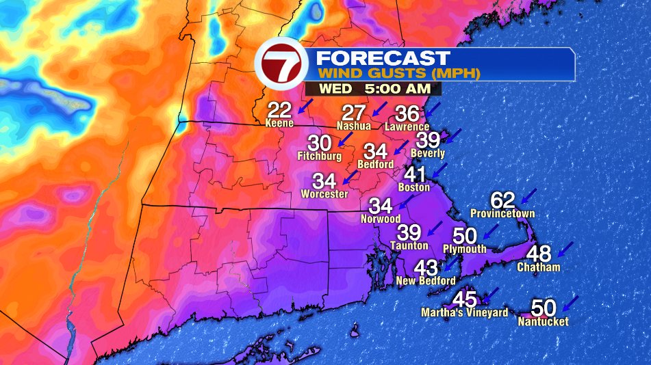
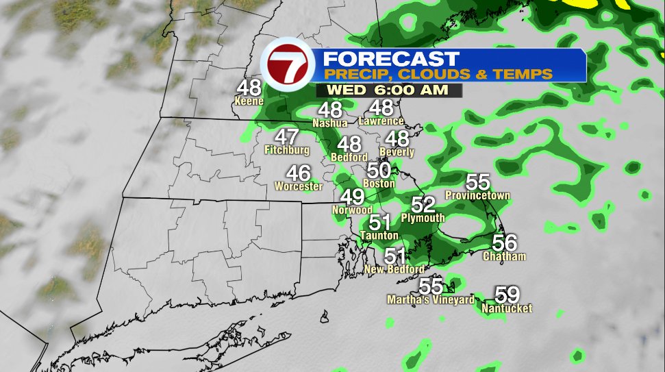
We’ll hold onto the wind early on Wednesday. Here’s 5am:
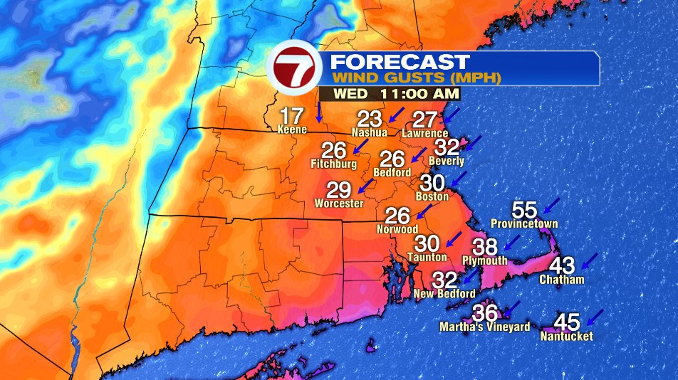
Then the wind will gradually come down during the day on Wednesday. But don’t expect a calm afternoon. Notice by noon Wednesday, we’re still talking about wind gusts up to 40 mph in spots.
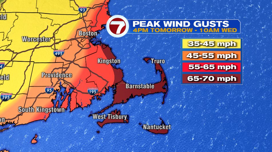
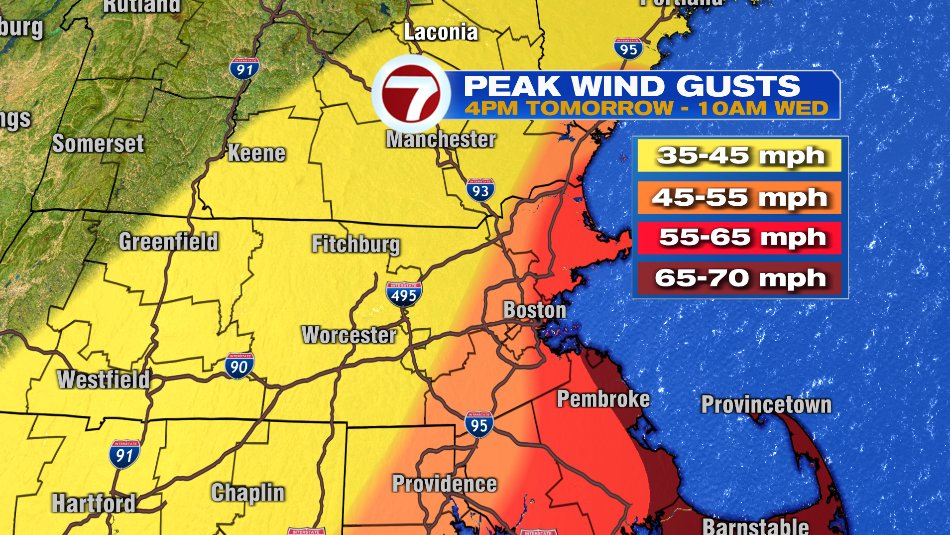
As a quick snap shot at peak wind gusts which will take peak Tuesday Night:
RAIN
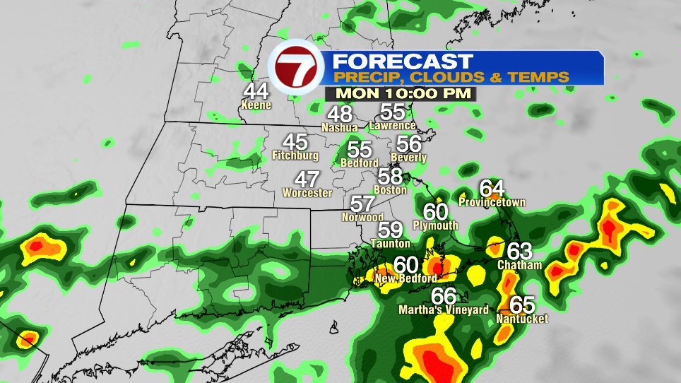
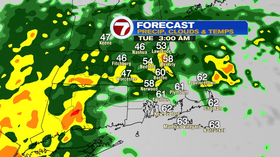
Rain, and a lot of it, is heading our way. The first band of the heavy rain will come in later tonight. But don’t think it’ll pour rain for 36 hours straight. There will be periods where the rain backs down and periods where it totally stops. But rounds and rounds of occasionally heavy rain will be spun in and when all is said in done, many of us will end up with 2-4″ of rain. Some isolated towns may even see 5″.
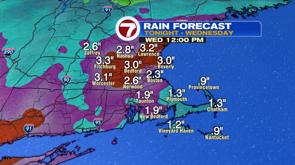
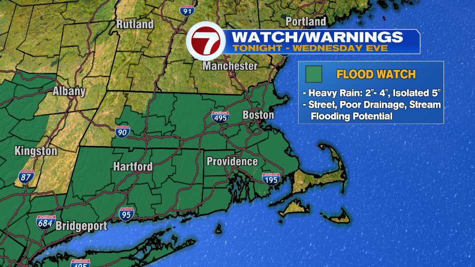
The amount of rain of course is a lot, but what will help is the fact it’s falling over about a day and a half. The concern for flooding primarily lies in the urban areas with poor drainage flooding. If you can tonight, get out and clear the storm drain in front of your house from leaves and debris so that water has the most opportunity to flow away. That said, if your basement is susceptible to flooding, make sure you check that sump pump to make sure it’s working. We have a flood watch in effect for those reasons.
Below is a timeline of the rain. Remember it’s not a full day of heavy rain, you see the lulls and dry spells shown.
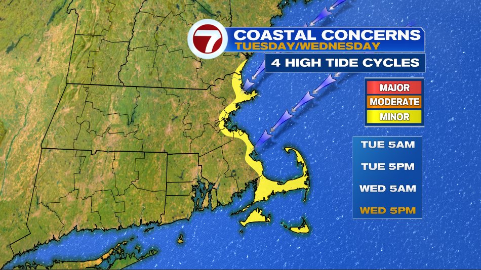
COASTAL FLOODING
Coastal flooding is thankfully a low risk, thanks to the tides being astronomically low as the storm hits. That said, a persistent northeast wind will still lead to splash over during the Tuesday high tides (5am and 5pm) and even some minor coastal flooding during the Wednesday high tides (5am and 5pm) as the water continues to pile up along the coastline.
The 7Weather team will have team coverage on the storm tonight, all day Tuesday, and Wednesday morning. Tune in for updates or check us out on Twitter @jreineron7, @clamberton7, @joshwurster_, @jaisolwx, @jackielayeron7.