After yesterday’s gloom, we are getting a great payoff with sunshine, mild temperatures, and comfortable humidity for the next two days. In fact much of the 7 day forecast is looking really good — a few spot showers here and there with the only wetter day on tap for Friday. But even that doesn’t appear to be a washout.
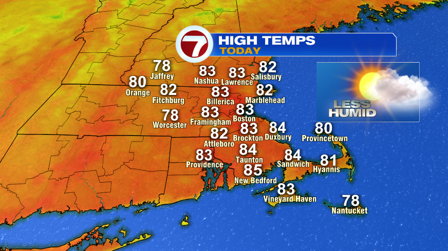
Humidity is falling this morning. That, combined with sunshine, mild temperatures, and a breeze that’s just enough to push out the sea breeze will give us a gorgeous afternoon. High temperatures will climb to the lower 80s today, just a hair above normal. Our average high for today is 79°.

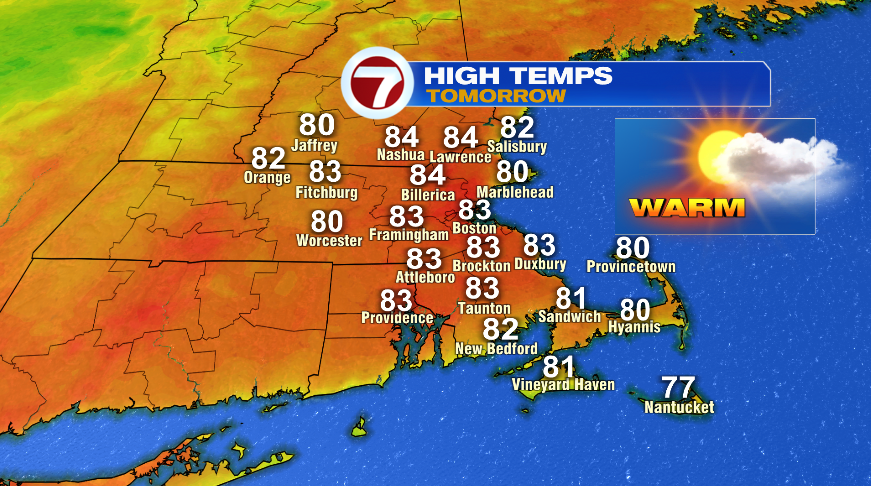
We’ll have an almost repeat day for Thursday. A few clouds will build late in the day ahead of rain that will arrive overnight into Friday morning. There could be a rogue shower closer to sunset Thursday (8:25 pm), but the day is largely dry and most of the rain will hold off until Thursday night.
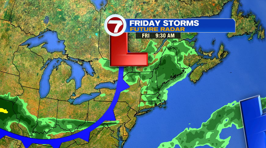
Showers and potentially a few storms will return overnight Thursday into Friday. Scattered showers and storms will close out the week on Friday, but I still don’t think the whole day is a washout. Right now it looks like rain chances will favor the morning. While I don’t think the afternoon is 100% dry, the rain and storm chances will go down pretty significantly from what we’ll see in the morning with more steady rain and showers.
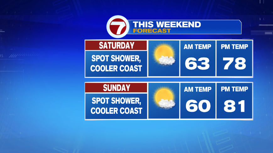
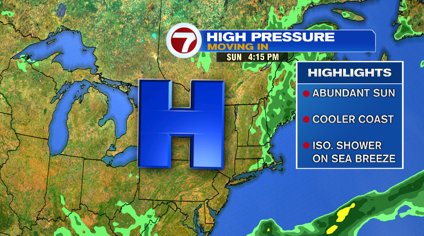
On the backside of the Friday showers and storms, a new area of high pressure will arrive for the weekend and early next week. That area of high pressure will not be in a hurry to go anywhere, which means we have several more nice summer days of weather as long as that high pressure stays with us. So we’ll basically stay in a holding pattern from Saturday through Tuesday of next week. Each day will get about two degrees warmer than the previous with just a touch more humidity each day.
High pressure is known for a few things, and we’ll see those over those four days. The first is just a lot of sun. Expect mostly sunny skies all four days – partly cloudy at worst. While high pressure sits overhead, it essentially shuts the wind off. Without the wind, we don’t fend off the sea breeze so each day will be a bit cooler on the coast than our inland spots. Finally, each day could see a spot shower that fires along the sea breeze boundary. It doesn’t look widespread, something like a 20% shot each day of the four. Most of the day each day will be dry. It’s just your typical summer pop up shower.
So all things considered we have another nice weekend to look forward to weather-wise here in southern New England!