Although we had the gusty breezy today, it was an overall nice Wednesday with highs in the 50s under mainly sunny skies.
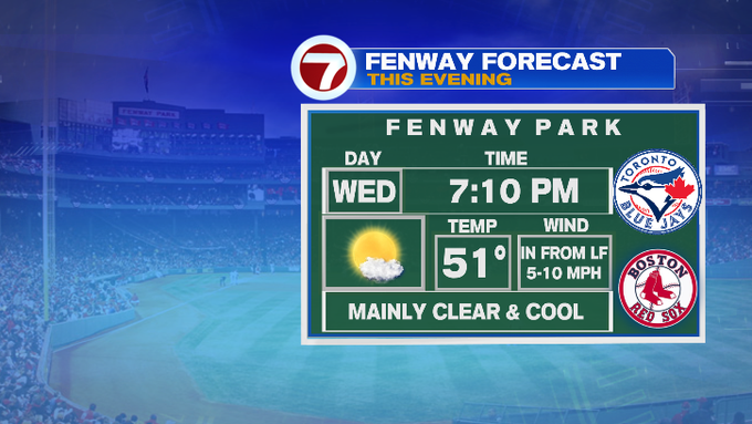
This evening, temperatures will dip after sunset under clear skies as winds continue to weaken. If you’re heading to Fenway to catch the Red Sox Game, be prepared for temperatures to slide through the 40s through the game.
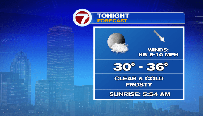
Overnight, temperatures will slip into the 30s, which has resulted in Frost Advisories being issued for the North Shore, South Shore, SE MA and the Cape and Islands. Areas farther inland are not included since the growing season has not started yet. The Frost Advisory goes into effect at 12am and continues through 7am Thursday morning. This means that frost could kill any sensitive plants if they are not protected. You could cover up plants with a blanket or if they are potted plants, just bring them inside to keep them warm.

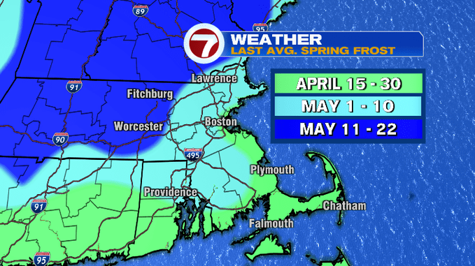
As for our average last spring frost, areas along the immediate coastline average it around the end of April, early May for the 495-corridor, and into mid May for central MA and interior southern NH.
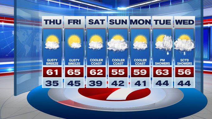
After a cold start, temperatures rebound into the upper 50s to around 60 Thursday afternoon. We’ll also have increasing cloud cover through the afternoon along with a gusty breeze.
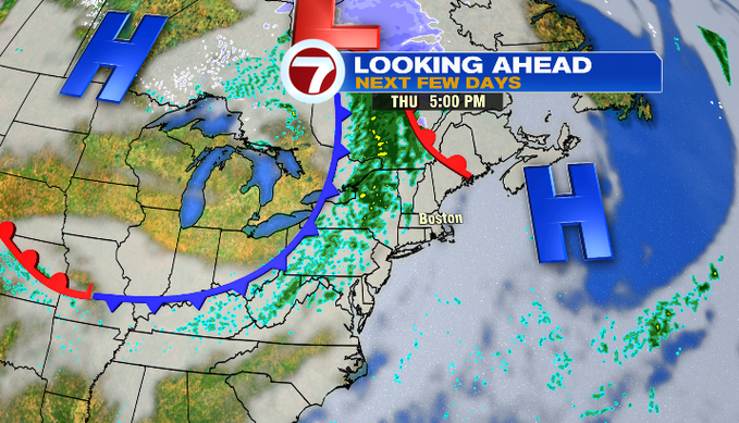
The cloud cover is associated with a front to our west that could bring a few showers our way tomorrow night. Besides that rain chance tomorrow night, dry conditions prevail through the end of the week and into the weekend. Friday will be nice with highs into the mid 60s!
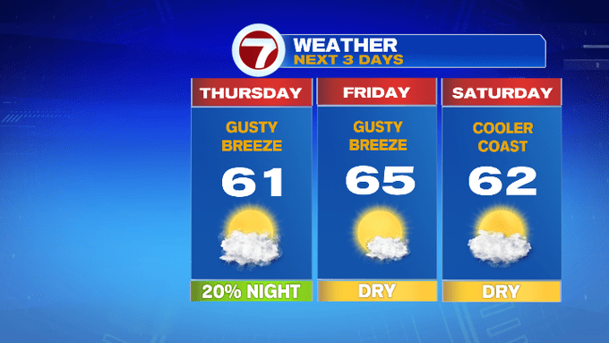
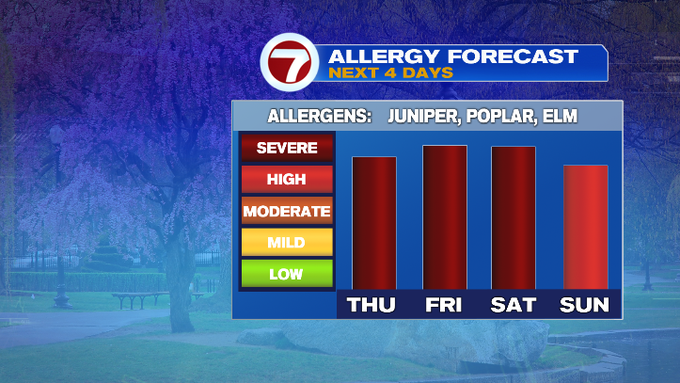
The weekend features an onshore breeze both days making it a touch cooler at the coast both weekend days. Sunday will be the cooler of the two days under mostly cloudy skies. With a mainly dry pattern over the next several days, that just raises the bar for the pollen count. Cue the tissues and scratchy eyes.
Tuesday brings our next best chance for showers and that continues into Wednesday.