High temperatures today stretched into the upper 60s to low 70s, which is our average high at the end of May. It was a nice break from the humidity, too.

Tonight is comfortable under partly cloudy skies and lows into the upper 50s to mid 60s.

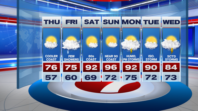
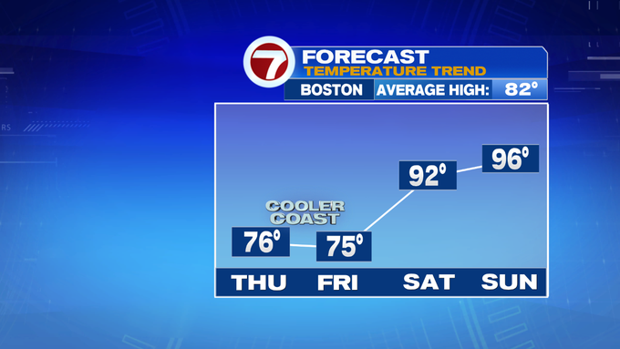
The break from the heat and humidity continues into Thursday with a mix of sun and clouds. Highs stretch into 70s tomorrow with slightly cooler temperatures at the coast due to an onshore breeze through the afternoon.


Speaking of the coast, if you’re heading to the beach, there is a low rip current risk for Thursday with waves between 3-4 ft.

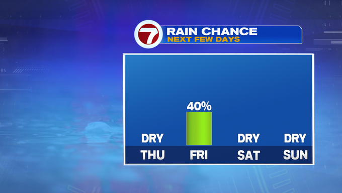
The end of the week turns wet as Friday brings the return to scattered showers and a chance for embedded thunder. Even with the scattered downpours yesterday, since June 1st, we’re still at least an inch below normal for this time of year.

After scattered rain on Friday, the weekend brings mainly sunny skies along with the heat and humidity returning.


Highs will crank into the low 90s Saturday, mid 90s Sunday. Both days could feature heat indices nearing triple digits, so be sure to take plenty of water breaks for your outdoor plans over the weekend.
The heat and the humidity sticks around for the start of the next work week, along with some thunderstorm chances.