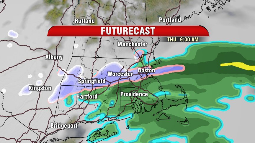
Well…April has kinda been a wet blanket. We’re off to a snowy, rainy, and chilly start to your Thursday forecast. The good new is we get the snow out of the way pretty early today. The bad news is, well, it’s snowing.

Snow stays steadiest NW of I-495, but we’re still contending with some wet flakes here in Boston this morning, mixed in with rain. We do also have the chance for some sleet mixed in at times. Chance for steadier snow dwindles into the mid-morning, with most everyone switching over to rain by late morning.
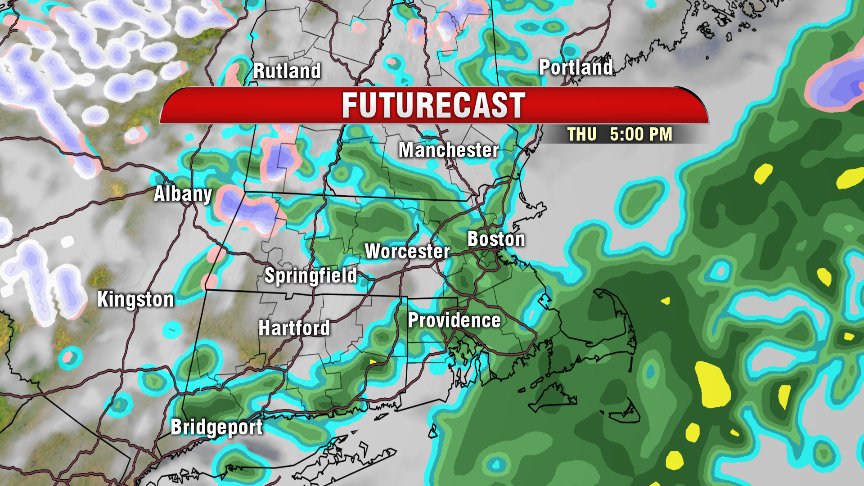
Scattered showers continue through the afternoon & evening commute, but this isn’t the soaking, wind-driven rain like what we saw on Marathon Monday.
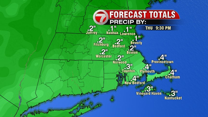
We keep the chance for a few scattered showers through about midnight tonight, with a few sctd. snow showers possible for the Berkshires.
With reports of close to 1″ of snow by 8:15 AM in Sturbride, I have toggled the coating-2″ band farther southward this morning. Still not looking at much in the way of snow totals though. Higher end of this range will be most likely for higher elevations (Berkshires, Worcester Hills).

As today’s storm system peels offshore this afternoon, we start to work in some drier air from the N/NW, which means afternoon rain showers don’t look to bring as much moisture as what it looked like earlier in the week.
Hang in there, the weekend looks great!!!
~Wren