7Weather- Rain showers transition into snow mid-day Tuesday, and then bitter, cold air moves in behind it. Record cold is likely Wednesday.
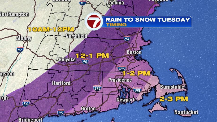
Rain transitions to snow around lunch time for Worcester County and southern NH, and in the early afternoon for Boston.
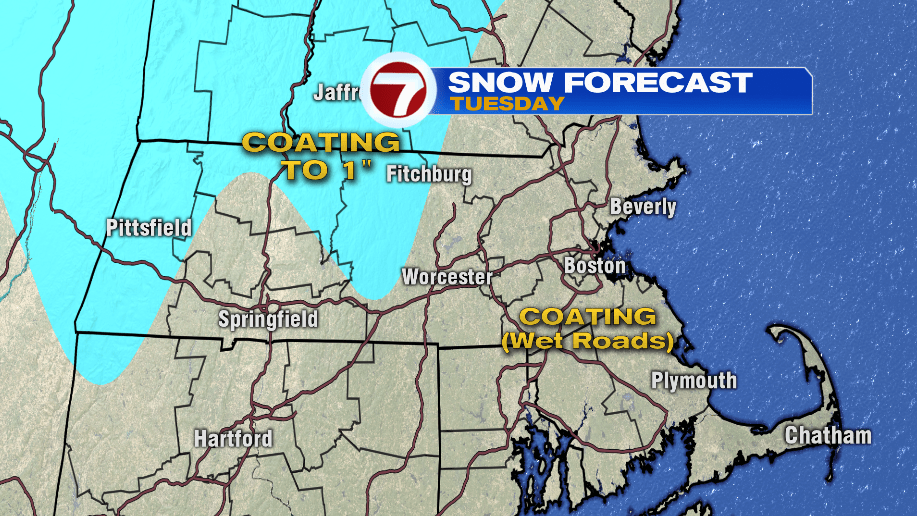
It will snow for about 2-3 hours in most towns, but the ground is too warm for it to stick. The snow won’t stick for the first 1-2 hours, and then a coating is possible in grassy areas.
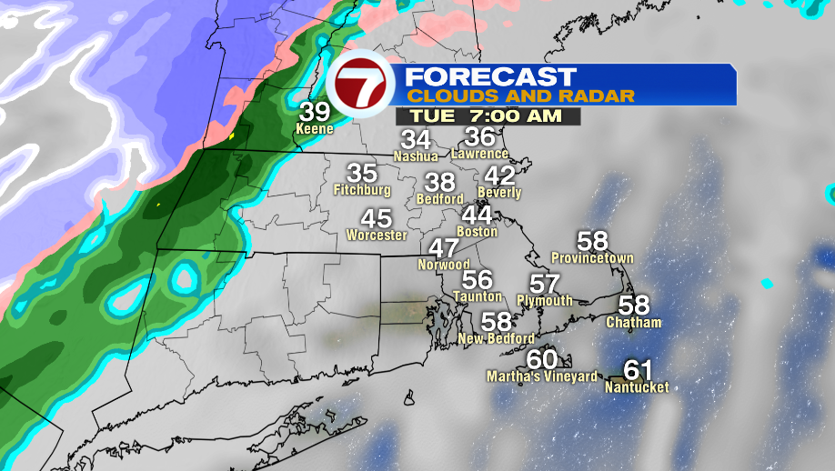
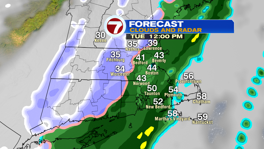
The morning commute is dry with the showers barely moving into western Mass between 7-8 AM. Temperatures will be all over the place. Expect low 30s north, and mid 50s is SE Mass.
Temperatures begin to crash around lunch time for Worcester County and southern New Hampshire.
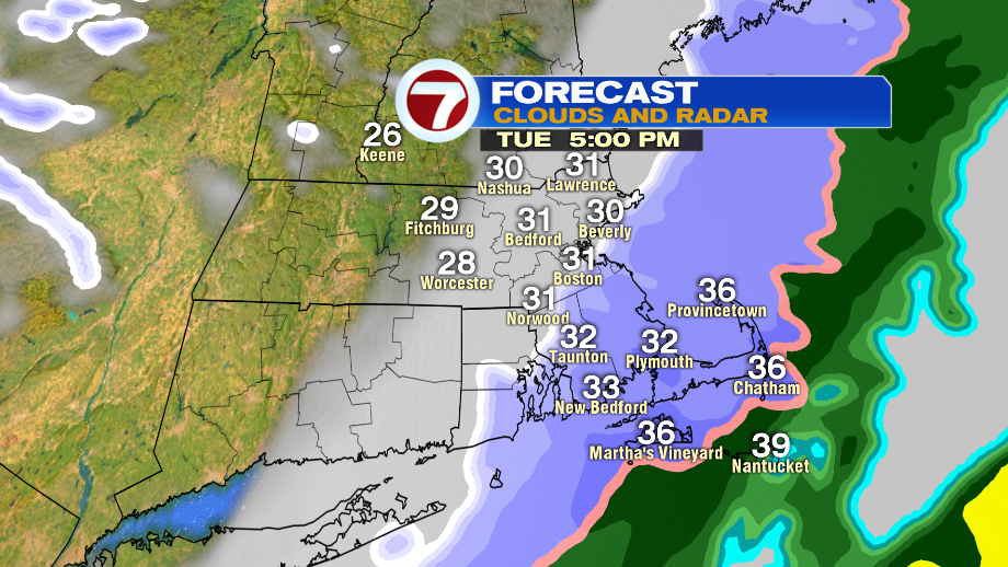
Snow is pushing out by the evening commute. It will mainly be snowing in SE Mass around 5 PM.
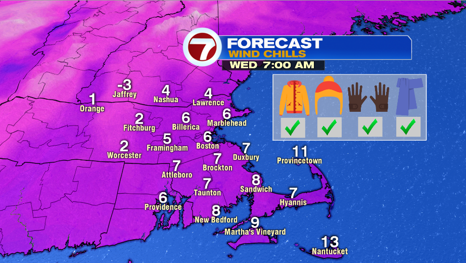
The cold air is officially here Wednesday morning. Bundle up! Wind chill values are in the single digits in the morning, and in the teens in the afternoon.
Worcester likely ties or breaks their record low of 15º set back in 1986. Worcester and Boston likely break the coldest high on record with highs in the low 30s.