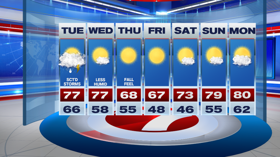
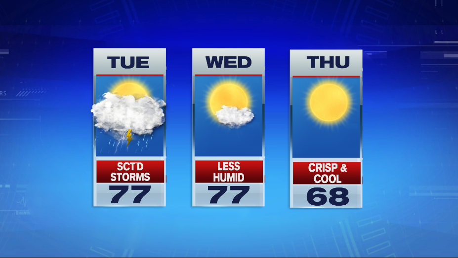
7Weahter- Scattered showers and storms arrive ahead of a cold front tomorrow. That front will bring dry, crisp air to New England by mid-week.
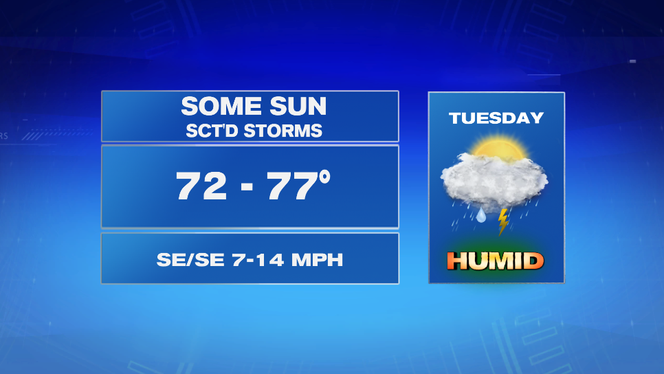
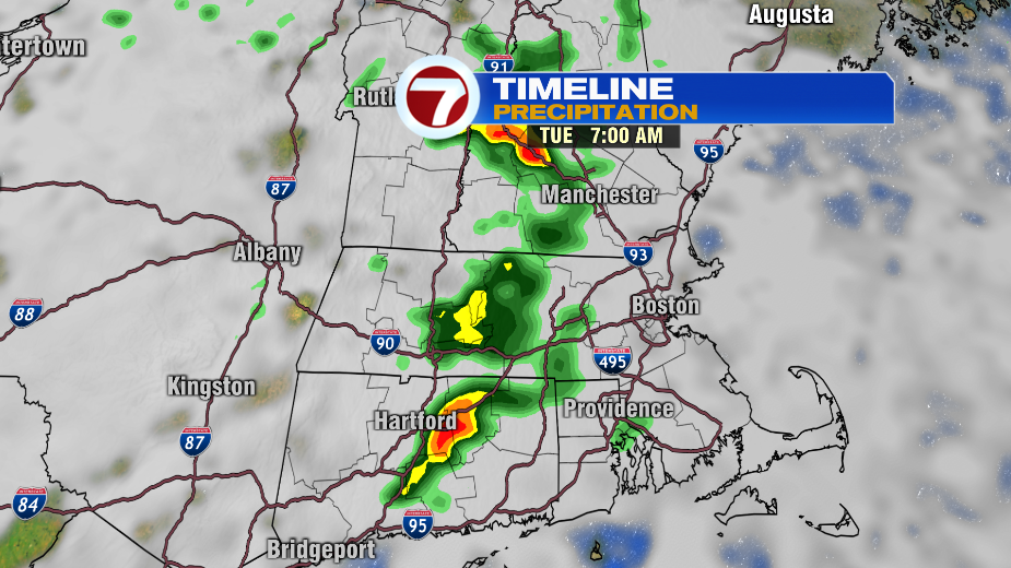
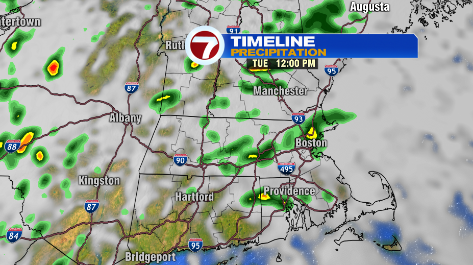
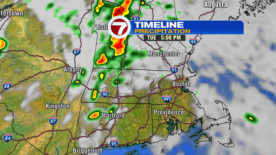
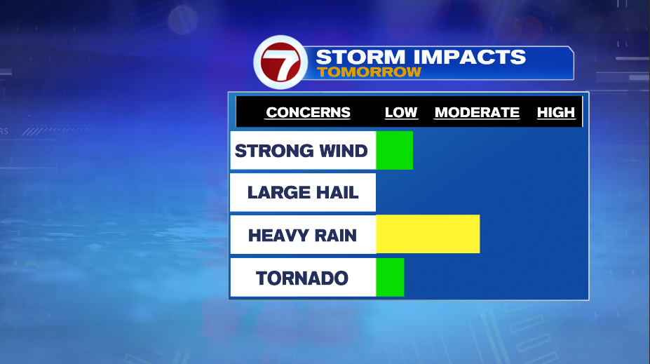
We’ll see a few showers for the Tuesday morning commute with a better chance of storms mid-morning and into the early afternoon. The window to watch for isolated, strong storms will be between 9AM-3PM. The main threat will be strong wind, but we can’t rule out the chance of an isolated tornado across the region.
Highs reach into the mid and upper 70s and it will feel humid!
That cold front clears the area Tuesday night, making for a beautiful Wednesday. It will be less humid with temperatures in the mid and upper 70s. It will feel more like fall by Thursday morning. The day starts in the mid and upper 40s and highs only make it into the mid and upper 60s.
The fantastic weather continues into Friday and the weekend. Highs are cool on Friday and then we slowly warm things up into the weekend with temperatures near 80º by Sunday.