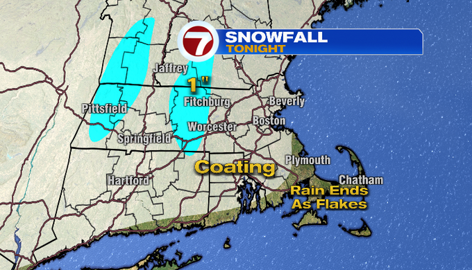
With scattered snow showers tonight, watch for slick spots if you’re traveling overnight. However, this is a quick-moving system, as the snow showers are expected to taper around 3am.
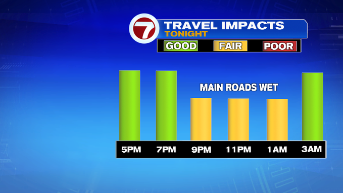
As far as accumulation, we’re looking at a coating for much of the region, with around an inch of snow for the higher elevations into central MA.
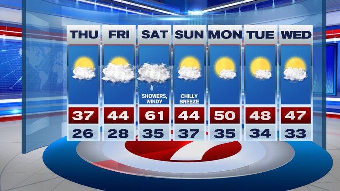
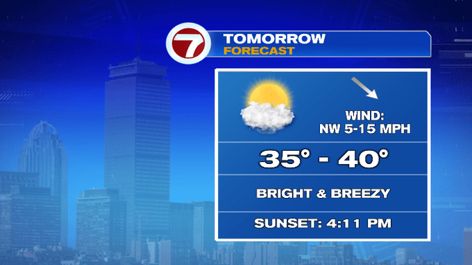
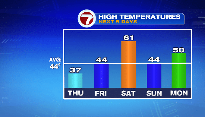
For your Thursday, it will be bright and breezy with highs in the upper 30s.
We see the return to seasonable temperatures Friday with more clouds.

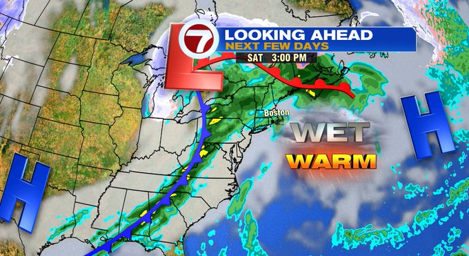
For the weekend, we are forecasting our third 60+ degree day for the month of December.
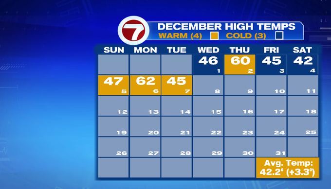
Like the last two 60-degree days we’ve had this month, it is short-lived and is accompanied by wet weather.
It’s back to seasonable temperatures for the second half of the weekend with highs into the 40 with a chilly breeze, but at least we will be drying out after Saturday’s wet weather. The dry pattern continues into the first half of the next work week.